
-
 2459 Hits
-
 74.01% Score
-
 4 Votes
|
|
Route |
|---|---|
|
|
28.97796°N / 13.64047°W |
|
|
Hiking |
|
|
Spring, Summer, Fall, Winter |
|
|
Less than two hours |
|
|
Hike |
|
|
Overview
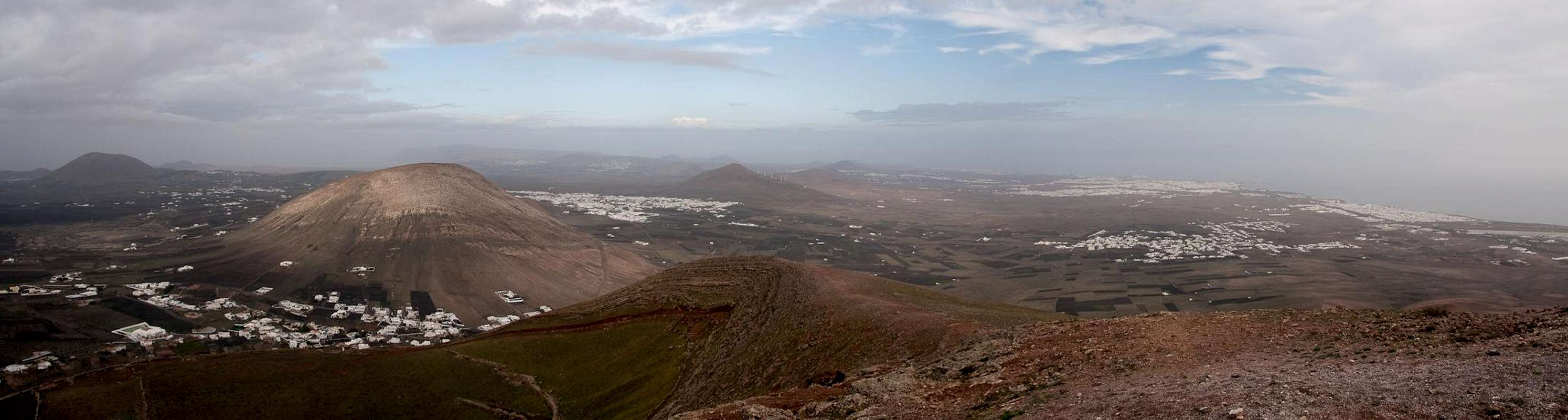
 Montaña Blanca with its small crater Montaña Blanca with its small crater |
The normal route to Montaña Blanca is a short but very steep hike across the eastern slopes of the volcano. Its first part runs along a dirt road but soon ends in a mule trail. The trail has deep ruts and is very steep. Also, the southern and eastern exposure of the slopes suggests climbing the mountain in the late afternoon, especially on hot summer days.
The crater of the mountain shows traces of having been used for farming (a cabin and field walls). There are two routes from the crater to the summit, one along the south rim of the crater which is somewhat steep and exposed. The other - normal one crosses the crater to cut through the east face of the summit cone towards the northern crater rim, which it follows back to the summit.
Getting There
Follow the instructions on the main page. The best starting point is at LZ35, slightly to the west of the roundabout with the C. Manrique wind chime.Route Description
 Montaña Blanca as seen from the trailhead
- Start altitude: 300m
- Summit altitude: 595m
- Prevailing exposure: East
- Type: Hike
- Protection: None
From the small improvised parking lot beside LZ35 follow the dirt road which runs directly in direction of Montaña Blanca. It passes a shed before reaching the base of the volcano. HHere it gradually rises until - after two switchbacks - it reaches a small power station. The road ends here but a wide path heads on, climbing the east slopes of the mountain directly. In several sections, especially as you close in on the crater, the path is deeply rutted and the hike turns into a steep scramble. Finally you reach the plateau-like crater.
 Monte Guatisea seen during the ascent
The normal route now runs right through the barely disstinguishable crater to the base of the summit cone. Look out for a line cutting from the bottom left to the top right of the cone: your ascent path. Again, the route is very steep, at least until you reach the northern rim or summit ridge. Turn back on the ridge and head for the summit.
  |
Alternatively, you can climb the southern rim of the crater. However, the first part of the climb is a serious scramble along loose rocks, where orientation also turns into an issue. There is a cross on the eastern fore-summit, for which you should head. Once there the remainder of the climb is easy, though a little exposed. Simply follow the ridge towards the summit which gradually gets steeper until you reach the top.