Toggle navigation
Mountains
Routes
Images
Trip Reports
Forum
What's New
People
Areas & Ranges
Articles
Trailheads
Canyons
Huts & Campgrounds
Albums
Logistical Centers
Fact Sheets
Lists
Custom Objects
Gear
Plans & Partners
WELCOME TO SUMMITPOST
SIGN IN
REGISTER
Grays Peak (Idaho)
Additional Parents
Image
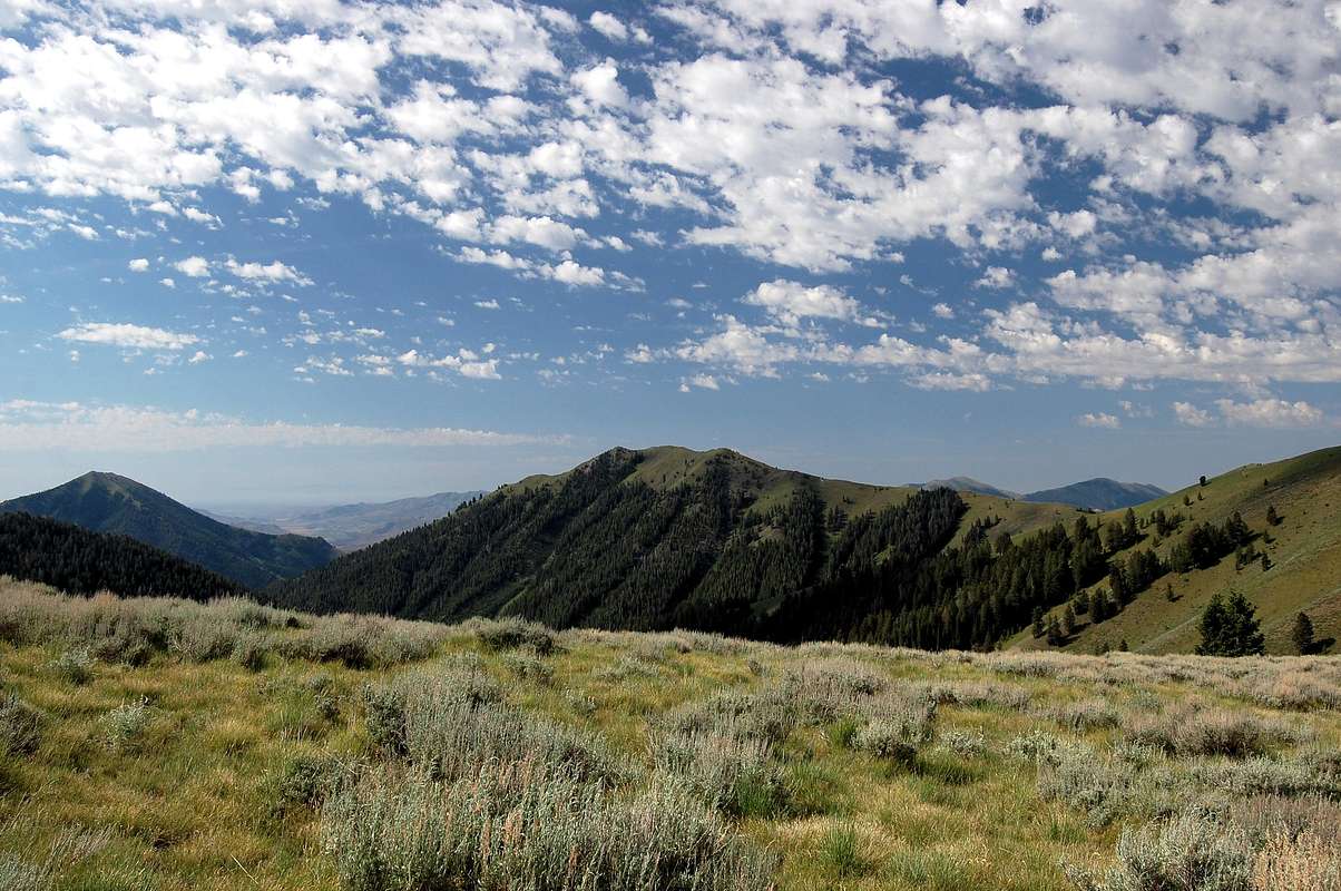
End of the trail
View High-Resolution Image
End of the trail
This is where on-trail travel ends. The Federal Gulch trail continues over the saddle directly in front of this view, while Gray's Peak rises to the left.
« PREV
NEXT »
BeDrinkable
on
Jul 23, 2014 6:53 pm
Comments & voting
Other parents
Lat/Lon:
43.63633°N / 114.13383°W
Image Type(s):
Hiking
,
Scenery
Image ID:
906002
1109 Hits
71.06
% Score
1
Votes
Log in to vote
Comments
No comments posted yet.
to post!
Don't have an account?
Grays Peak (Idaho)
(Mountain/Rock)
You are at
the First
Image
Viewing
#1 of 1
GALLERY
You are at
the Last
Image
BeDrinkable's Image Gallery
« PREV
Viewing
#222 of 250
GALLERY
NEXT »
×
You need to login in order to vote!
User Name
Password
Remember me
Forgot your password?
Log me out when I close my browser.
Keep me logged in all the time.
sign in as a user
Don't have an account?
Register now for FREE
Rating available
Suggested routes for you
People who climb the same things as you
Comments Available
Create Albums
Register Here


