
|
|
Route |
|---|---|
|
|
37.20879°N / 113.66014°W |
|
|
Scrambling |
|
|
Spring, Fall, Winter |
|
|
Half a day |
|
|
Easy |
|
|
Class 3 |
|
|
Overview
The Escalator is the northern route to the summit of Pictograph Mountain in Snow Canyon State Park. It is a fun, easy jaunt to the summit of this superlative peak. It is a slightly easier route than the Tuacahn Chimney route. However, utilizing one route as an ascent and the other as a descent makes a fine loop of the mountain that takes the climber through a wide variety of terrain.
Getting There
See main Pictograph Mountain page here.
Route Description
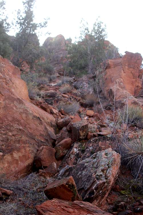
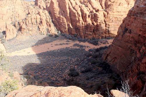
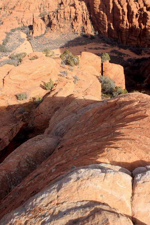
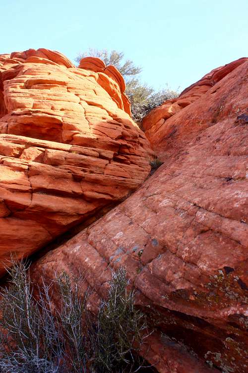
From the West Canyon Parking lot: Walk north for approximately 1.25 miles, until you reach the huge wash that splits Pictograph Mountain from the smaller formation to the north. This is the Three Ponds Trail wash. Head west on interminable sand into the wash, where towering sandstone walls loom over the route. After .5 miles the wash doglegs north. Look for a trail leading to the southwest away from the wash. Follow this towards a low-angled ridge a few hundred feet away. This is the start of the route. Follow the trail which leads right up to the toe of the ridge.
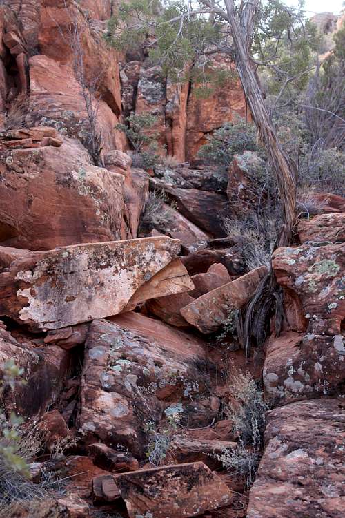
A switchbacking trail leads up a crumbling hillside. Follow this route as it gains elevation quickly. After a few hundred feet, the trail enters a shallow, narrow slot, the "escalator." To your right will be a much deeper slot canyon. Hike and scramble through this section for a few hundred yards. When the narrow slot ends, you will arrive at cool cave/arch feature. The route climbs to the right of this, now ascending ledges. At this point, regular, reliable cairns will appear to help lead the way, but even without the cairns, the route is easy to follow. Just stick to the wall to your left and you will stay on track.
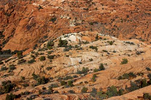
Soon the trail will reach the top of the ledges (and the end of the slot to your right.) Look for cairns leading to the left. Follow these, climbing up a couple of slabs until you pop out at the base of the first rib. Expansive views now greet the mountain traveler. From this point on, the way is fairly simple: climb a series of ribs, all the while maintaining a SE bearing. At the top of each rib there should be cairns to guide you, although sometimes they are few and far between. The route also leads from one cluster of trees to the next. The summit at this point is fairly obvious, it is the high, rounded dome to the southeast. There are most likely numerous variations to this route, but sticking to the main route will soon lead you to a slightly exposed, 3rd class corner/slab. This is the crux (if you can call it that) of the route. Continue climbing, traversing both north and south to link the easiest routes to the summit.
Descent: Either return the way you came or descend the Tuacahn Chimney route or the Tuacahn Saddle route to the west (I will post that route soon.)
The following pictures show the ascent:
 Escalator Route | 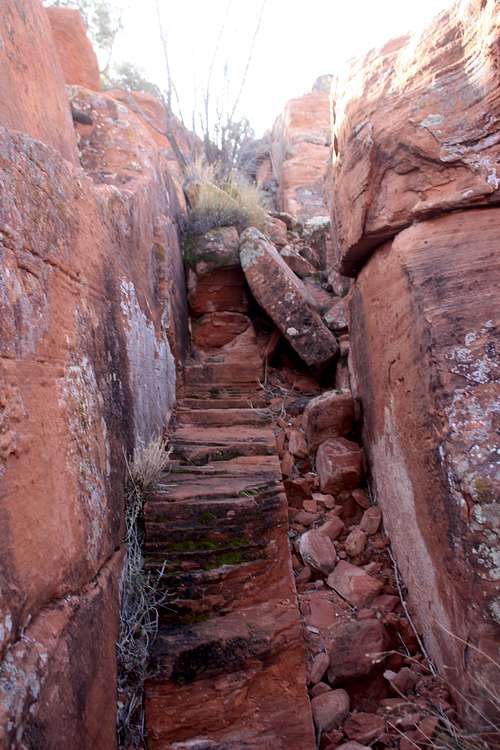 Escalator Route 2 |
 Escalator Route 3 | 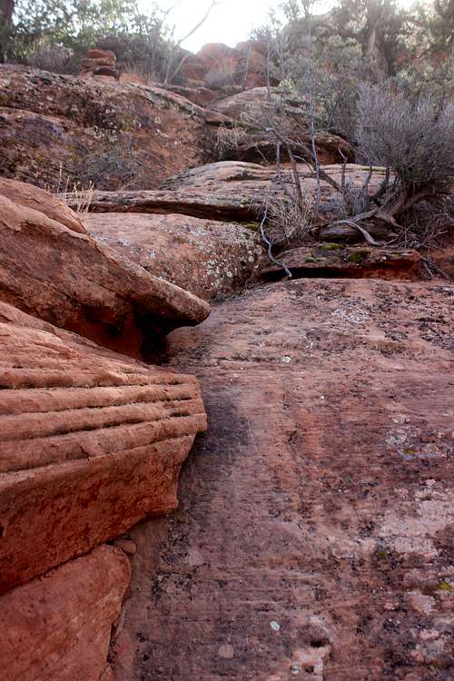 Escalator Route 4 |
 Escalator Route 5 | 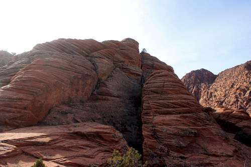 Escalator Route 6 |
 Escalator Route 7 | 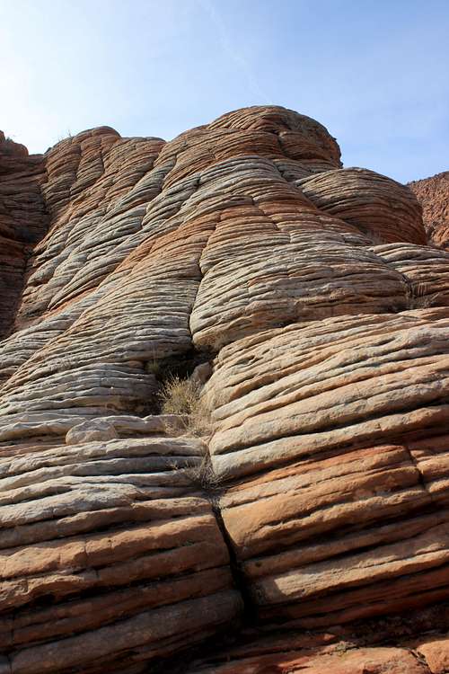 Escalator Route 8 |
 Escalator Route 9 | 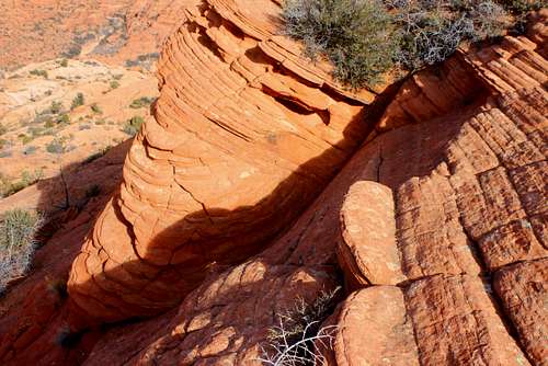 Escalator Route 10 |
 Escalator Route 11 | 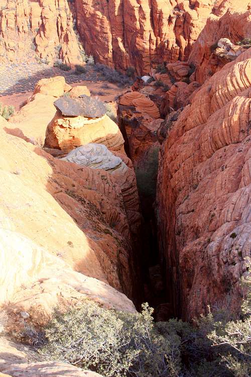 Escalator Route 12 |
Essential Gear
Hiking shoes, water and a camera
External Links
Ivins, Utah weather