
-
 4708 Hits
-
 72.08% Score
-
 2 Votes
|
|
Route |
|---|---|
|
|
28.10976°N / 17.24838°W |
|
|
Hiking |
|
|
Spring, Summer, Fall, Winter |
|
|
Half a day |
|
|
Hike |
|
|
Overview
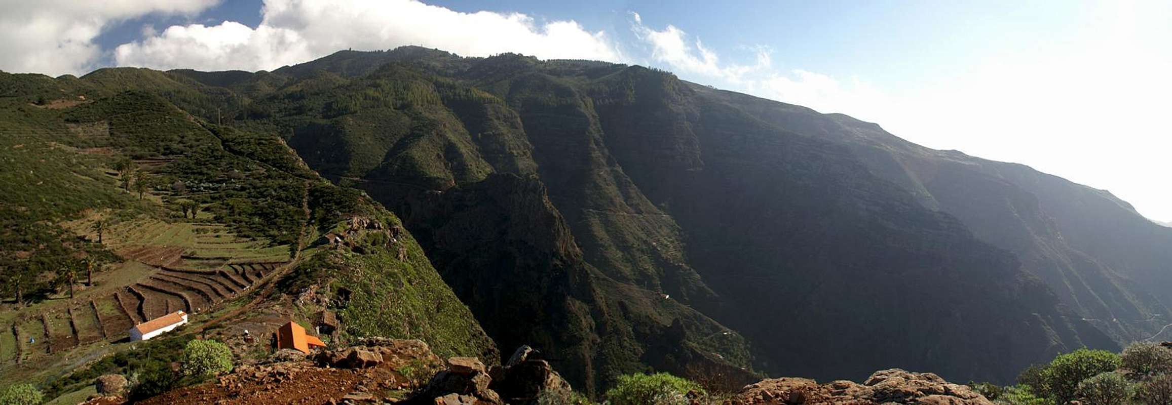
 La Fortaleza above Barranco del Erque La Fortaleza above Barranco del Erque |
There are quite many routes to Garajonay, which is - without a doubt - one of the most popular places on the island of La Gomera. Most routes are very short, just leading from the Carretera del Centro along a forest road to the summit. There is, however, a much better way to climb the mountain, a traverse which connects the village of Chipude with its trademark mountain, La Fortaleza with Garajonay. If you refrain from climbing La Fortaleza (UIAA I) the hike is easy though it follows the steep drops of Barranco del Erque for two thirds of its way.
The last third is a scramble through a pine forrest. You attain a ridge with beautiful views towards the south and west of the island before dropping into the dense and dark laurisilva, which surrounds Garajonay. In the end you join the regular ascent route along a forest road, leading to the Garajonay summit with its Guanche sanctaury.
Getting There
 Roque de Agando
The main page gives you the instructions of how to reach the village of Chipude. Though there are two closer parking lots along the route, Chipude is the best trailhead since a second route leads to Garajonay from there so that you combine both into a loop.
Route Description
  |
- Start altitude: 1080m
- Summit altitude: 1487m
- Prevailing exposure: S
- Type: 3-4h depending on whether you climb Fortaleza or not
- Protection: None
From Chipude (church) follow the road for 150m before a marked path (GR131) turns off to the left. It passes a part of the village on the outside before descending back to the road again. Here you can cross the road, then a Barranco but I would suggest to follow the u-turn of the road for some 500m instead of using the very overgrown shortcut. Where the shortcut meets the road a cobblestone road heads east and up to a saddle right underneath the Fortaleza north face. Climbing and exploring Fortaleza will take up to an hour and will be described in a separate route.
Instead of (or after) climbing Fortaleza turn left in the saddle and follow a wide ridge which leads back to the road to Igualero. Right befor the intersection a path turns off to traverse the end of Barranco del Erque, high above the canyon floor. The path climbs steadily and offers perfect views of the impressive Fortaleza east face. After turning the whole canyon the path suddenly reaches a lookout spot, the mirador de Igualero, from which it sharply turns northward, heading directly for Garajonay.
It meets the Igualero road east of the village, crosses it and plunges into a pine forest. Here turn westward to climb steeply amidst the Canarian pines to reach a rocky and overgrown ridge, again offering good views of Fortaleza. Turn north-east onto the ridge and bushwhack your way along it. After some 700m you'll reach a forest dirt road which you'll have to follow to the left (there is a narrow path heading straight upwards from this road but this leads you to Alto de Igualero, the foresummit of Garajonay which sports a radio antenna).
The road circles the mountain on its western side and joins the regular route once you have reached the north-west of the mountain. A sharp turn southwards will lput you on the road to the antenna station, which you have to leave in the saddle between Garajonay and its forsummit. The remainder is a stroll to the summit, which - depending on the weather - can be very crowded.