Toggle navigation
Mountains
Routes
Images
Trip Reports
Forum
What's New
People
Areas & Ranges
Articles
Trailheads
Canyons
Huts & Campgrounds
Albums
Logistical Centers
Fact Sheets
Lists
Custom Objects
Gear
Plans & Partners
WELCOME TO SUMMITPOST
SIGN IN
REGISTER
Mount Princeton
Additional Parents
Maxwell Gulch
Image
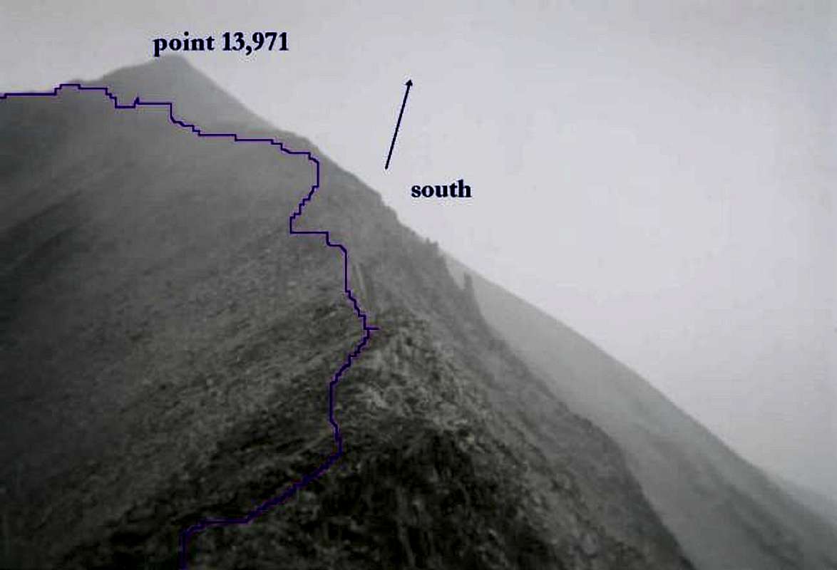
from the top of the scramble...
View High-Resolution Image
from the top of the scramble...
from the top of the scramble turn south and climb up to just below point 13,971, turn east and continue on the main summit ridge to princeton's main summit, about 1 hour's climb from this vantage point.
« PREV
NEXT »
steve simmons
on
Dec 10, 2002 4:40 pm
Comments & voting
Other parents
Lat/Lon:
38.74940°N / 106.2419°W
Image ID:
14759
3621 Hits
70.94
% Score
2
Votes
Log in to vote
Comments
No comments posted yet.
to post!
Don't have an account?
Mount Princeton
(Mountain/Rock)
You are at
the First
Image
Viewing
#1 of 1
GALLERY
You are at
the Last
Image
steve simmons's Image Gallery
« PREV
Viewing
#20 of 36
GALLERY
NEXT »
Maxwell Gulch
(Route)
Loading....
×
You need to login in order to vote!
User Name
Password
Remember me
Forgot your password?
Log me out when I close my browser.
Keep me logged in all the time.
sign in as a user
Don't have an account?
Register now for FREE
Rating available
Suggested routes for you
People who climb the same things as you
Comments Available
Create Albums
Register Here


