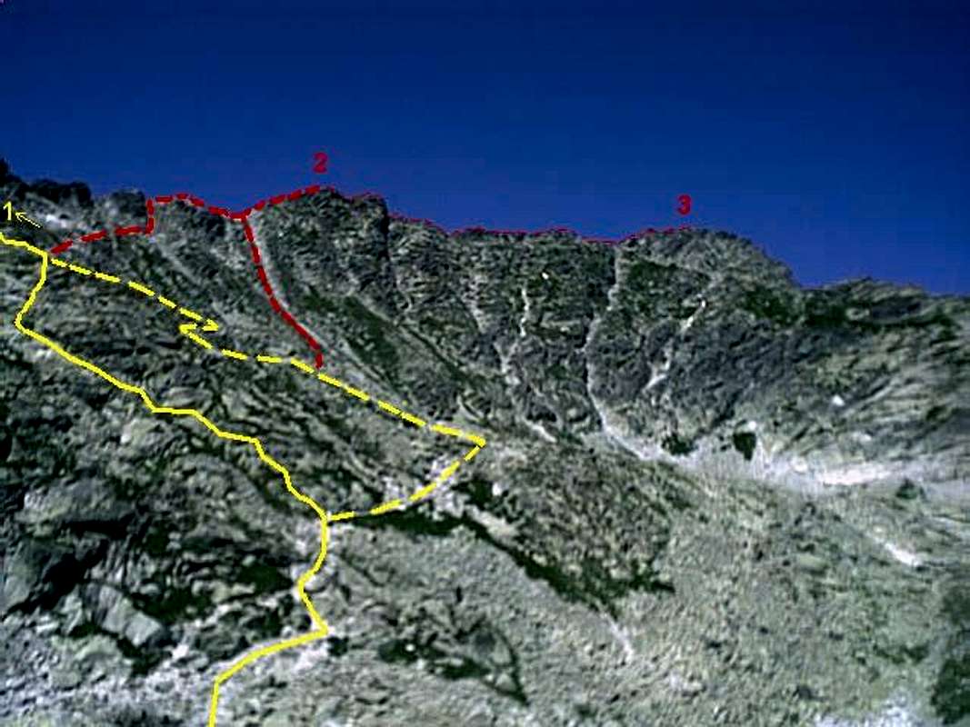
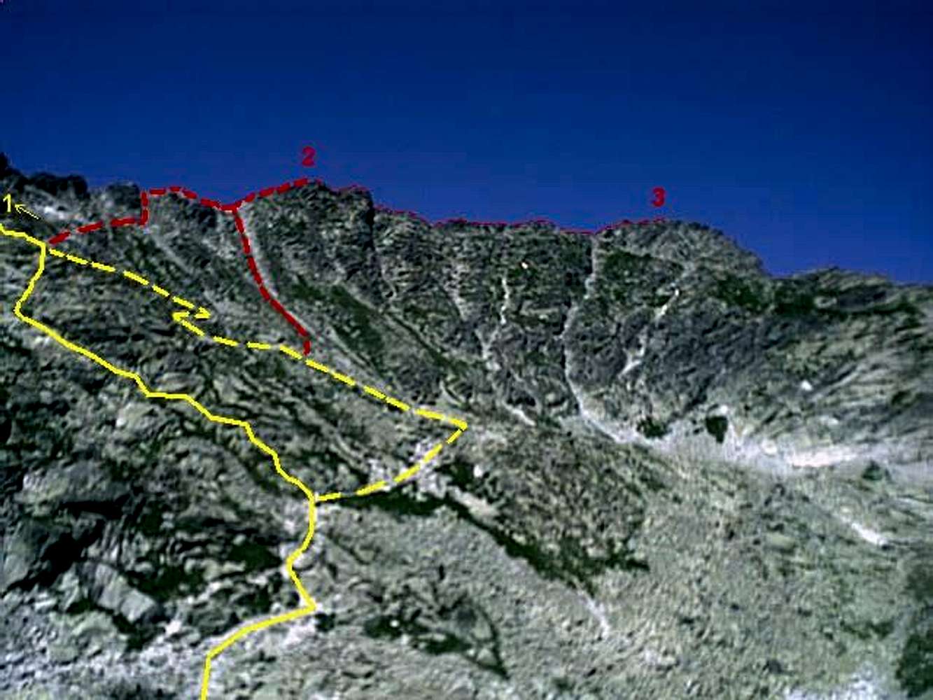
The view over the peaks
Furkotsky stit (2405 m) (2) and
Hruby vrch (2431 m) (3) from the bank of the lake
Capie pleso (2075 m) in the end of the valley Mlynicka dolina.
1 - saddle
Bystre sedlo (2314 m), some 50 meters away
2 -
Furkotsky stit (2405 m)
3 -
Hruby vrch (2431 m)
The yellow solid line represents the marked hiking trail to the saddle Bystre saddle in its present form. The yellow dashed line represents former leading of the trail. Look carefully for the trail's yellow signs especially in the junctions with former trail.
The broader red dashed line represents the two variants of unmarked trails from the Mlynicka valley to the summit of Furkotsky stit (2405 m) (2).
The thiner red dashed line follows the ridge unmarked trail from the Furkotsky stit to Hruby vrch (3) and back.
Photo by Ladislav Ruttkay; 2nd august 2001 by his first digital camera with the resolution of only 70 000 pixels.


