
-
 23152 Hits
-
 83.69% Score
-
 17 Votes
|
|
Area/Range |
|---|---|
|
|
38.50000°N / 79°W |
|
|
Hiking |
|
|
5729 ft / 1746 m |
|
|
Information
The Geroge Washington National Forest was first extablished in 1918 as the Shanandoah National Forest but was renamed after the first president. Then the Jefferson National Forrest was established in 1936.The George Washington National Forest is located in west central Virginia; while Jefferson National Forest is located in southwest Virginia. These two national forests were administratively combined in 1995 to form the George Washington and Jefferson National Forests. All together, they contain approximately 1.8 million (7,300 km2) acres. About 1 million of the acres (4,000 km2) of the forest are isolated and undeveloped and about 139,461 acres (564 km2) have been designated as wilderness areas. This is one of the largest areas of public land in the eastern United States. The forests include 1,664,110 acres in Virginia, 123,629 acres in West Virginia, and 961 acres in Kentucky. The George Washington and Jefferson National Forests headquarters is the Forest Supervisor’s Office in Roanoke, Virginia. The forests also include the Mount Rogers National Recreation Area and seven other Ranger Districts. For George Washington: there are local ranger district offices located in Bridgewater,Covington, Edinburg, Hot Springs, and Staunton. For Jefferson: there are local ranger district offices located in Blacksburg, Marion, Natural Bridge, New Castle, and Wise.
Activities
George Washington and Jefferson National Forest is managed for multiple uses besides hiking; a variety of services and products are offered. The forests are populr for hiking, mountain biking, horseback riding, cross-country skiing, swimming, and hunting. Trail running is also popular in this region and there are several 100 milers (ultra marathons). This forest also contains Nature Camp for youth since 1953. It is within two hours of 10 million people and has many visitors. Developed recreation opportunities are offered at over 200 sites on the forests, which inncludes campgrounds, picnic areas and boat launches. There are also approximately 2,200 miles of trails, and 1,700 miles of open roads. The elevations in this national forest range from 5,729 feet at Mount Rogers, which is the state highpoint, to 515 feet along the South Fork of the Shenandoah River. The Highlights include:• 325 miles of the Appalachian National Scenic Trail
• 12 National Recreation Trails totaling 143 miles
• the 140,000 acre Mount Rogers National Recreation Area
• 3 National Scenic Areas
• 3 National Forest Scenic Byways
• nearly 3 million annual recreation visits
• 23 Wildernesses
• 700,000 acres of lands actively managed for the production of timber and wood products
• Elliott Knob which is one of the last remaining fire lookout towers
• Crabtree Falls which is amazing waterfall over 1,000 ft.
 George Washington and Jefferson National Forests Map
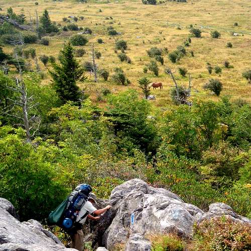
Flora and Fauna
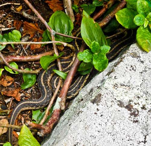
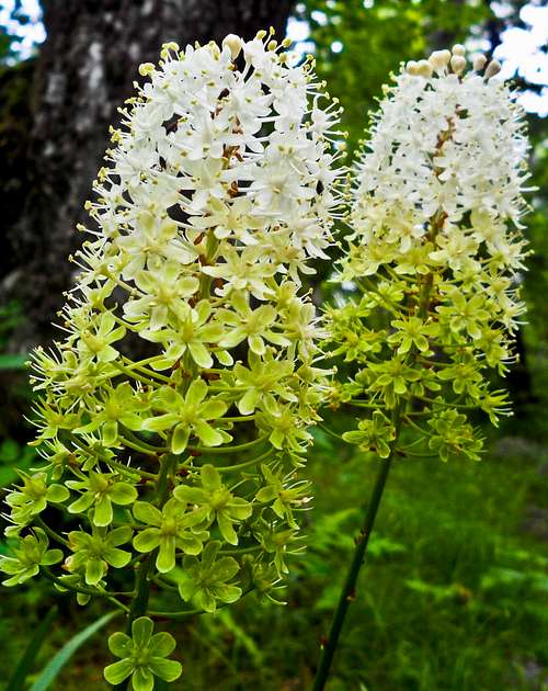
The forests are predominantly consist of Appalachian hardwood and mixed pine-hardwood forest types located within the Blue Ridge, Central Ridge and Valley, Allegheny, and Cumberland Plateau provinces. The Forests contain some 230,000 acres (930 km2) of old growth forests. An old growth forest is a forest that is of great age and had been without significant disturbance. Therefore, these forests exhibits unique ecological features and can be named as climax communities. Locations of old growth include Peters Mountain, Mount Pleasant National Scenic Area, Rich Hole Wilderness, Flannery Ridge, Pick Breeches Ridge, and Laurel Fork Gorge, Pickem Mountain, and Mount Rogers National Recreation Area, the Ramsey's Draft and Wildernesses. There us also an abundant array of wildlife. White-tailed deer, bobcats, bald eagles, weasels, otters, and martens, and black bears, naming a few, are known to inhabit the forests.. The forests are home to:
• 50 species of trees,
• 2,000 species of shrubs and herbaceous plants,
• 78 species of amphibians and reptiles,
• 200 species of birds,
• 60 species of mammals,
• 2,340 miles of perennial streams,
• 100 species of freshwater fishes and mussels,
• 53 federally-listed Threatened or Endangered animal and plant species.


Getting There
This forest is of such a large expanse that there is no specific place to enter it. However, there is access from Highway 64 and 81 in Virginia, as well as along the Blue Ridge Parkway.The map says it better...
View Larger Map>MAP
 George Washington and Jefferson National Forests Map
Camping
Campground Camping AreasBark Camp Recreation Area
Cane Patch Campground
Cave Springs Recreation Area
High Knob Recreation Area
Eastern Divide Ranger District
Steel Bridge Campground
The Pines Campground
Walnut Flats Campground
White Rocks Campground
Glenwood-Pedlar Ranger District
Cave Mountain Lake Recreation Area
North Creek Campground
Sherando Lake Recreation Area
James River Ranger District
Morris Hill Campgrounds
Lee Ranger District
Camp Roosevelt Recreation Area
Elizabeth Furnace Recreation Area
Hawk Recreation Area
Little Fort Campground
Trout Pond Recreation Area
Wolf Gap Recreation Area
Mount Rogers National Recreation Area
Beartree Recreation Area
Comers Rock Recreation Area
Fox Creek Horse Campground
Grindstone Recreation Area
Hurricane Campground
Raccoon Branch Campground
Raven Cliff Recreation Area
Stony Fork Campground
North River Ranger District
Brandywine Recreation Area
Camp Run Campground
Hone Quarry Campground
North River Campground
Shaws Fork Equestrian Campground
Todd Lake Recreation Area
Warm Springs Ranger District
Blowing Springs Campground
Bolar Mountain Recreation Area
Greenwood Point Campground
Hidden Valley Recreation Area
McClintic Point Campgrounds
 Camping site close to Mount Rogers
Addresses
SUPERVISOR ADDRESS5162 Valleypointe Pkwy.
Roanoke, Virginia 24019-3050
540-265-5100
RANGER DISTRICT ADDRESSES
North River
401 Oakwood Dr.
Harrisonburg, Virginia 22801
866-904-0240
James River
810-A Madison Ave.
Covington, Virginia 24426
540-362-2214
Lee
95 Railroad Av
Edinburg, Virginia 22824
540-984-4101
Glenwood/Pedlar
27 Ranger Lane
Natural Bridge Station, Virginia 24579
540-291-2188
Warm Springs
422 Forestry Rd
Hot Springs, Virginia 24445
540-839-2521
Sources
USDAWikipedia
GORP
hgrapid - Jun 28, 2012 6:46 pm - Hasn't voted
Wrong Hemisphere79.00000°E is wrong. Should be -79.00000
Wiktoria Plawska - Jun 29, 2012 8:54 am - Hasn't voted
Re: Wrong HemisphereGot it, thanks!