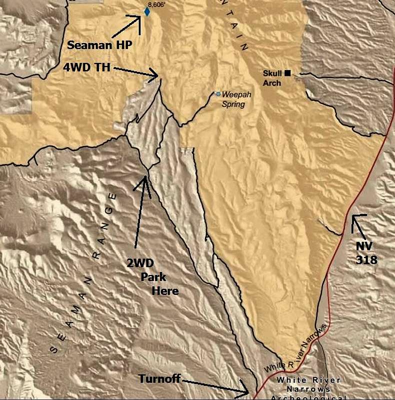
taken from the BLM Brochure for Weepah Springs Wilderness. Turnoff, 2WD, and 4WD parking spots are labelled. The road is very good gravel until you get to the southern tip of the diamond/lollipop shaped junction as seen on the map. From there if you have high clearance you can take either the left or right fork to arrive at the same spot south of the peak. As of late April 2013, the right fork is very rocky, whereas the left fork is very rutted. If you get your way to the northern tip of the diamond (10-12 miles from the highway), where there is ample parking, a very rough and rocky road proceeds for less than a mile to a signed BLM trailhead and camp spot.


