Intro/Stats
Gladstone Peak (13913')
Via Bilk Basin/NE face
12 miles RT, 4650' gain
May 29, 2010
Participants: Mike Rodenak, Jamie Princo, & Kevin Baker
Slideshow
Gladstone has been on my list of remaining centennials for a long time. I had some partners lined up for a pack in to Bilk Basin, but they unfortunately had to bail at the last minute. I found out that Mike and Jamie were going to try it as a day hike, so I jumped on their climb! I failed on nabbing Gladstone when I did the Wilson group because of bad weather, so hopefully it would be kinder to us this time.
We all rolled in fairly late Friday evening to Aaron Ihinger's nice pad near Telluride and got about 2-3 hours of sleep. That would later come back to bite me as I felt sluggish the whole day. We left Aaron's place a bit after 2am, hoping to get on the northeast face before the snow softened up. Little did we know the adventure that was in store for us!
Mike drove us up the Sunshine Mesa road and we were stopped by a downed aspen over the road. Luckily the log was not too heavy to lift and Jaimie and I hoisted it up just enough for Mike to slide his car underneath! We thought we were studs for saving over a mile of hiking each way, but less than a minute later and there was another one! This was a show stopper as it was too heavy, so we were forced to start 1.1 mile from the TH at 9340'.
Will We Ever Get to Treeline?
We set out under a full moon and a temp of 49 degrees at 3am. Hopefully it would be much colder higher up. We cruised up the road to the Sunshine Mesa TH, at which point the road swings west and then south into Bilk Basin. Our next obstacles would be downed trees as we weaved our way up, over, and around. There obviously had been some avalanche activity over the road this winter.
As we headed south closer to Bilk Creek, it sounded like we had a nasty surprise in store for us. We could tell that it was raging and when we got down to it the bridge at around 10120' was swept away! The "creek" was raging and our options were limited. We finally found a log that spanned the raging abyss at a narrow spot, but I wasn't going to set foot on it. Jamie was about to give it a shot and I asked him if he was sure he wanted to do it. A fall in that raging torrent would be very bad news, so we decided to see how far we could go before getting cliffed out.
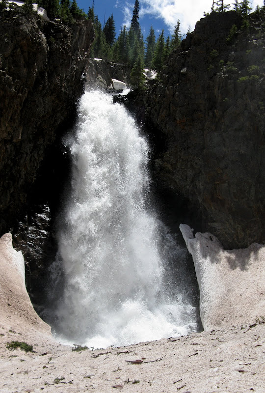
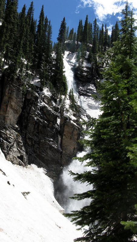
There were no options, so we thrashed and postholed our way up in the dark for about 1/2 mile over talus, willows, and deadfall to a waterfall. Well, what do you know, a huge snowbridge saves the day!
Snowbridge below the waterfall on the descent:
Video of waterfall & snowbridge on descent
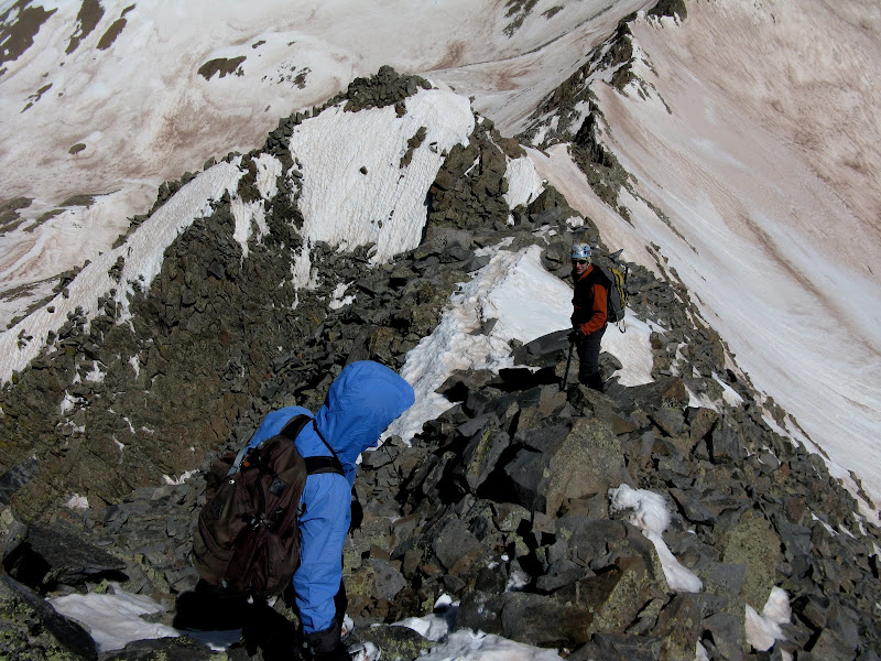
We bashed our way uphill on the other side and found the trail! Our success was short lived though as the trail soon was swallowed up in deep drifts on a steep headwall. We tried to sidehill for a while, but ended up biting the bullet and heading straight up. Luckily the postholing wasn't too bad and we got by sans snowshoes. We finally got to the top of the headwall and needed a break after that ordeal. Only 2900 vertical from here, guys! We were wishing we would have just gone up the standard Navajo Basin approach at this point.
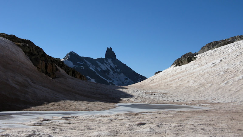
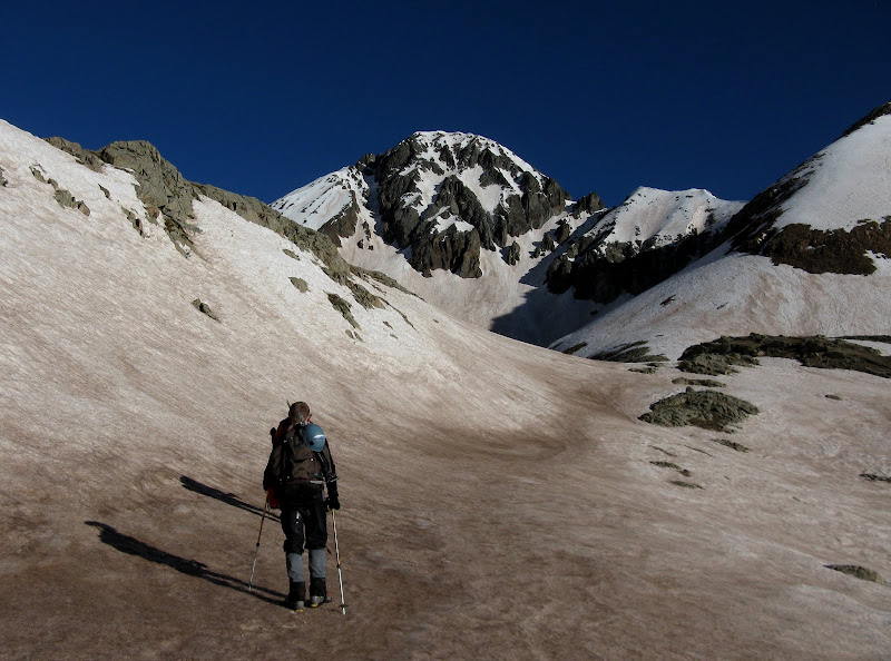
The next section of the climb was enjoyable as we headed up the now mellow drainage, angling n.w. to a small tarn at around 12K. I initially was going to pack in to this tarn with my original partners. That would have been BRUTAL! Lizard Head popped out and gave us some nice eye candy for awhile.
The Northeast Face & North Ridge Descent
As we climbed higher, we were treated with some nice views of the seldom seen s.e. face of Wilson Peak, which looked like a mini-Rainier!
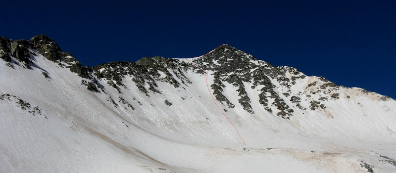
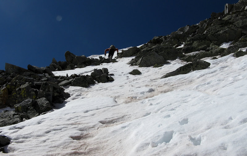
We finally got to the base of our snowclimb on the northeast face of Gladstone. It look real steep from afar, but it turned out to be a pretty mellow line until the top. The red line is our route:
There was evidence of some small point release slides on the face, but it was still pretty early and the wind was keeping the snow pretty firm. We made quick work of the face, trading off leads with Mike doing much of the work.
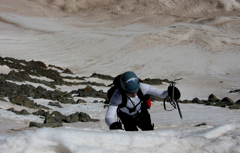
The last hundred feet or so we had to weave through a rock band as the snow started to thin out a bit.
Mike cuts a line through the rock:
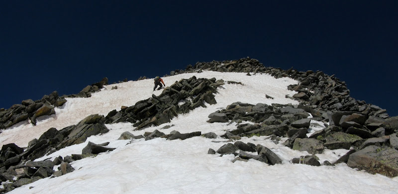
The last 10 feet or so to the east ridge steepened to around 50 degrees, but for the most part the line we took never exceeded a slope angle of 42 degrees. A dagger belay felt secure here.
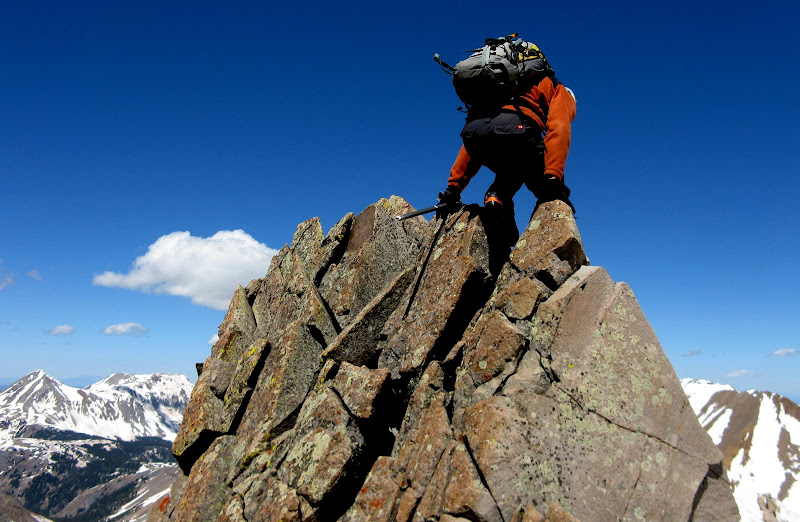
Jamie tops out:
Once on the ridge, it got a lot colder as the winds greeted us from the opposite side. We were now only about 300 horizontal feet from the summit, but it took some time as we were all gassed. Mike and Jamie headed up some steep snow to the left and I took an easier line closer to the ridge crest as I was tired of being on soft snow.
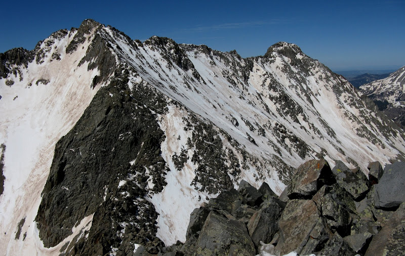
We finally topped out at 10:15am and took a long break to refuel from a 7 hr 15 min push. It was 38 degrees on the summit, a far cry from the warm temps down in Telluride! Mt Wilson and El Diente provided some nice views from the summit.
It was now time for the dreaded descent of the north ridge. This ridge goes at class 3 when dry, but with snow on both sides, our options were limited. Both sides are pretty exposed in spots and it is magnified by the loose rock and soft snow. The rock actually wasn't as bad as I feared, perhaps still frozen in place. We slowly and methodically made our way down, testing holds where we were putting significant weight on them.
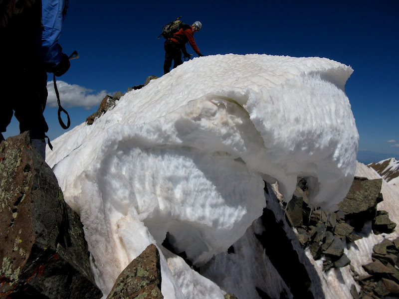
One of the cruxes was getting around a good sized cornice that looked primed to fall. No, Mike is not standing on it, but it sure looks like it!
Jamie decides to bail off the ridge after the east facing slope to the right relents a bit. I follow Mike for a bit longer and the reward for staying on this ridge is going over this bad boy!
Better not show this to mommy, Mike!
I was getting mentally exhausted at this point even though we had only descended 400 feet or so, so I glissaded at a safe runout while Mike plunge stepped down. We were hopefully out of the woods now, although the steep headwall descent loomed. Postholathon commenced as it was futile trying to wear snowshoes down this slip-n-slide. We finally made it down to the high waterfall and got a nice view of the commotion. This is probably one of the highest waterfalls I've seen in CO.
Video of the raging torrent
The long haul down the road seemed to never end as the heat of the day set in, but luckily there was a nice breeze. We thought we heard a chain saw cutting down the aspen in the road, but it was just motorcycles. We made it down a bit after 4, happy to make it up Gladstone with all of the obstacles we had to overcome!


Comments
Post a Comment