South and west of the main Cairngorms plateau lie many miles of green and grey moorland populated with rounded mountains.
On the face of it, the main distinguishing attraction for many of these mountains is that their summits breach the magic 3000-foot height which classifies them as “Munros” and consequently, in the UK, this makes them interesting.
Many mountain writers have described them as “dull”, “drab” and even “tedious”. I have always found this attitude to be surprising, especially as it comes from people who claim to love the mountains and mountain environment of the UK. The mountains lying immediately to both the east and west of the Drumochter pass and the Monadhliath mountains further northeast of these, have all been described this way.
However, other “aficionados” have likened them favourably to the mountains of Scandinavia.
It occurs to me that even the most ordinary looking mountain can provide an enjoyable and even exciting day, given the right circumstances and the individuals to appreciate them… seems like there may be a moral there!
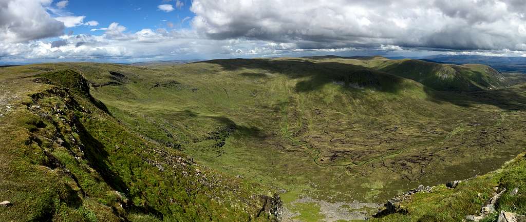
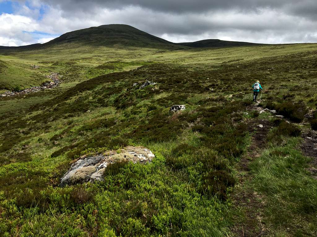
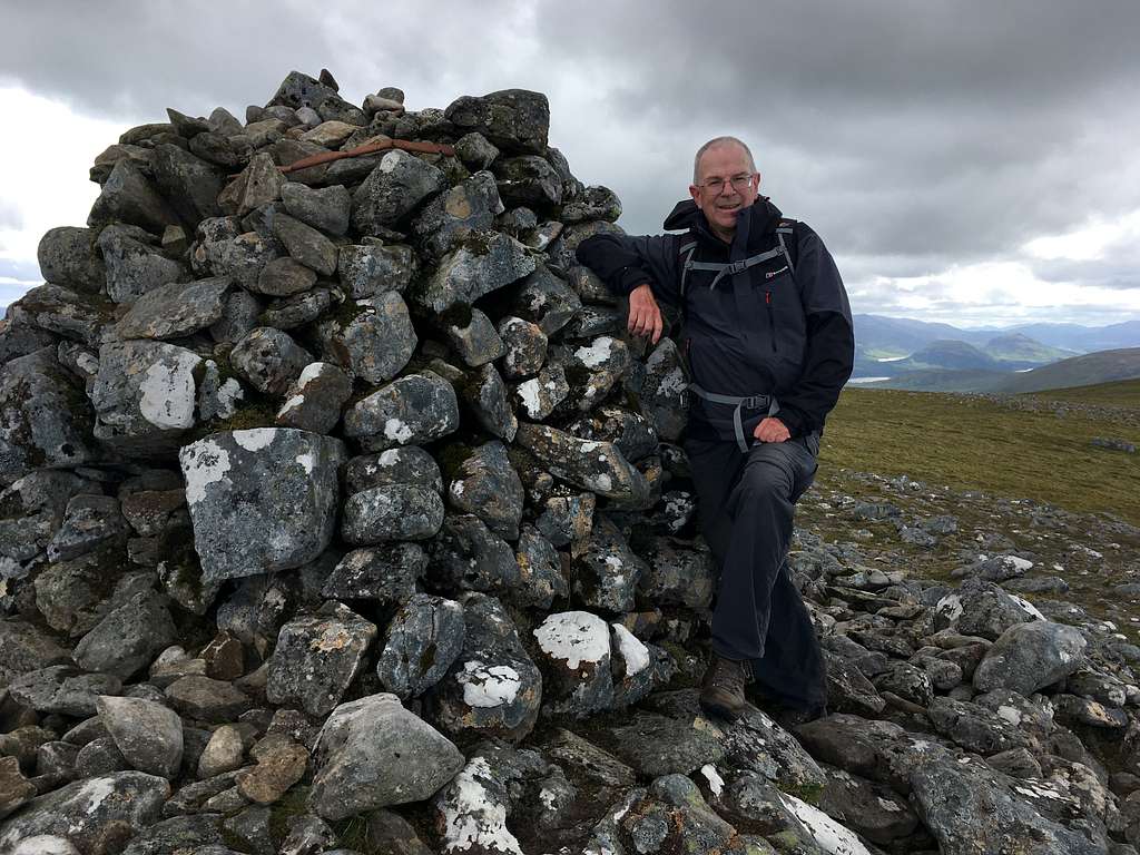
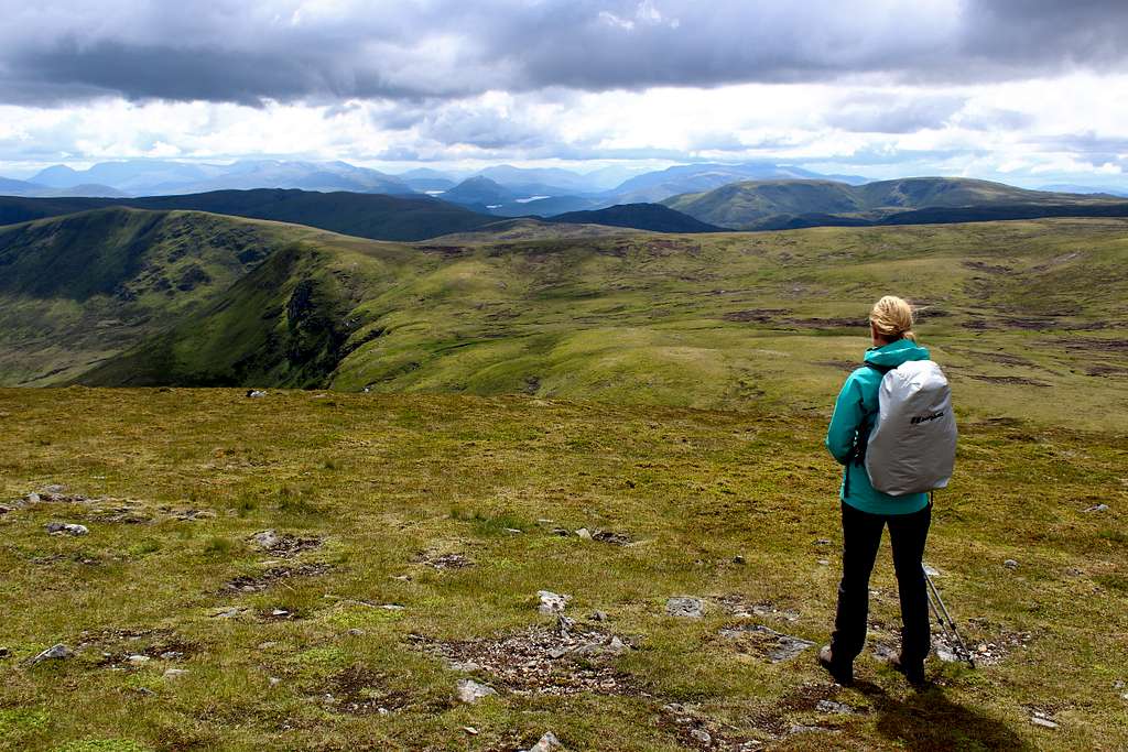
Geal-charn and A’Mharconaich, West Drumochter pass.
We pulled into the car park near the Balsporran cottages on the A9 in Scotland. I had worried that it might be popular and parking would be difficult but there were few cars already there at 9.30 am, even though the day was bright and sunny.
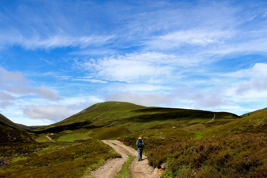
We walked down the track past the cottages and crossed the main railway line to continue on the other side, on the ATV track which ran parallel to the Allt Coire Fhar. Our objectives for the day both looked attractive - green hills under a bright, blue sky and not too steep.
Geal-charn (917m), Drumochter pass, Scotland.
The ATV track forked right twice in quick succession, we made sure we took the second fork up the hill. The going was quite easy and we make good time as the track dwindled to a path and then only a feint impression in the grass as we rose higher. The wind blowing across the hillside from the south was cool but not too bad.
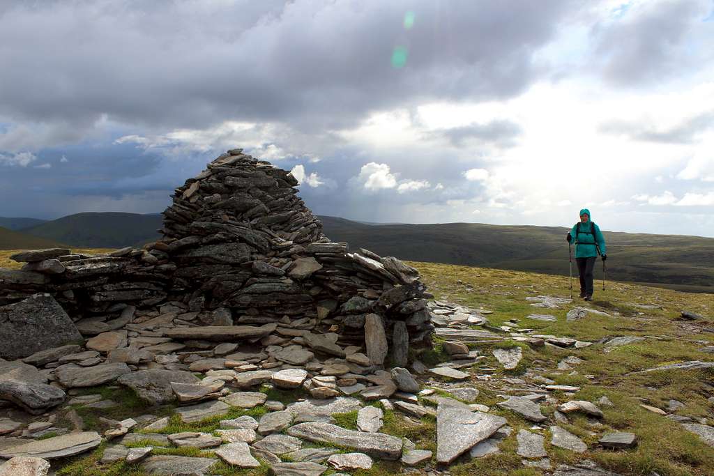
After an hour, the angle lessened and the grass underfoot gave way to an area of rocks and stones, Marie stopped at a large cairn.
“This can’t be the top already?” She asked hopefully.
“No, that’s further up.” I replied. “I thought there were supposed to be a few of these cairns but this is the only one.” I looked around in case I had missed them but to no avail.
We drank some tea and had a biscuit in the sunshine. The views north towards the Cairngorms looked good and I tried to identify the mountains I could. The A9 road cut through the scene sounding strangely quiet from so far away.
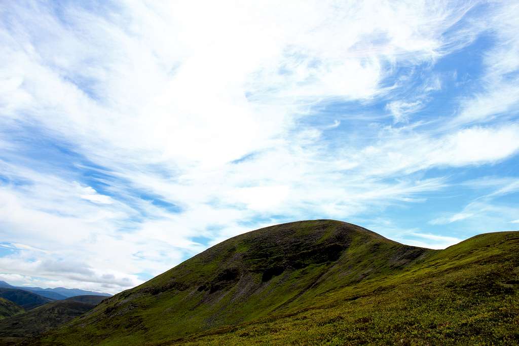
We continued southwest up the easy sloped hill behind our tea break spot towards another cairn around 1km away. The summit itself was a little further on from that, a rather large, untidy cairn in the rock-strewn landscape.
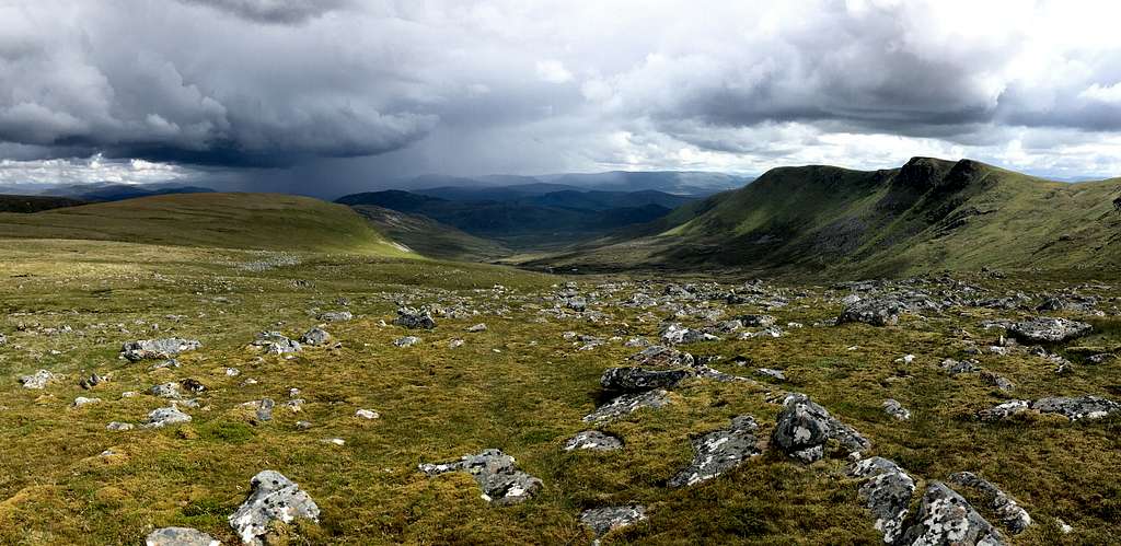
We reached this at 11.10 am and continued down the broad south ridge. As we did so, the fantastic views to the west and south opened up in front of us.
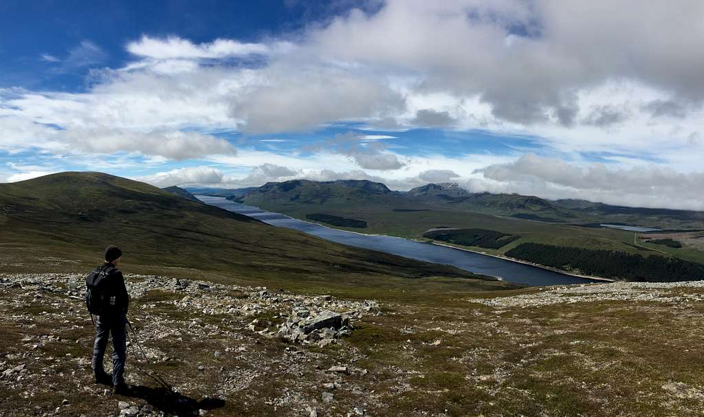
I had read about the Ben Alder Forest before but this was the first time I had been to this area to actually see it. The view westwards across Loch Ericht into the wilderness was pretty amazing and captured my attention as we descended towards the bealach at 739m. The array of mountains on the far side of the loch set me dreaming of a future visit.
Geal-charn (917m), Drumochter pass, Scotland
The Ben Alder estate has no public roads crossing it so is accessible only on foot or by bike. The large Lodge building (complete with helicopter pad) dominates the west shore of Loch Ericht.
We descended the rocky ground to meet the ATV track rising up from Coire Fhar on our left and walked along it for a few minutes. We approached the grassy west flank of A’Mharconaich and took a feint path heading straight up the slope in front of us.
It didn’t take long to reach the top of the slope and we found ourselves on a wide, almost flat plateau-like ridge. The summit cairn was to our left but we paused to take in the scenery before us.
“That is Beinn Udlamain up there.” I pointed to the right. “And Sgairneach Mhor,” in front of us.
We knew it was customary to do all four mountains in one trip and we discussed this. In the end, we decided to stick with the two for today and headed northeast to the cairn at the end of the ridge.
We reached the summit around 12.50 pm. The ridge ended here and dropped away steeply into a coire overlooking the Drumochter pass and the Cairngorm mountains further north.
We descended the northeast ridge above the coire. It was steep and rocky at first but soon the angle lessened and became a broad, grassy ridge. We found a sheltered niche amongst the grass and heather to eat some lunch. It was still sunny but more clouds had gathered as the afternoon progressed.
A' Mharconaich (975m), Drumochter pass, Scotland.
A man descended near us; he jogged down the ridge past us. We had seen a couple in the distance earlier and those three were the only people we had seen all day.
We continued down the ridge on a good path that took us around the few boggy areas – it had been a dry period for Scotland!
We crossed the Allt Coire Dhomhain on exposed rocks and got to the car at 3.00 pm.
A relaxing day in good weather and with fabulous views into a remote area we had never seen before.
Geal Charn, Monadhliath mountains.
Geal Charn (926m) Monadhliath Mountains, Scotland
Once again, the forecast was not great. Cloud, showers and strong winds. Once again, we headed south towards the Drumochter pass, it was very windy and once again we met a wall of cloud.
“The Cairngorms will be a nightmare in this weather.” I proclaimed. “We could always have a look at Geal Charn in the Monadhliath mountains.”
“Will the weather be better there? Marie asked.
“Probably not but I’m not sure exactly how to get to it so the drive would at least solve that problem for the future.”
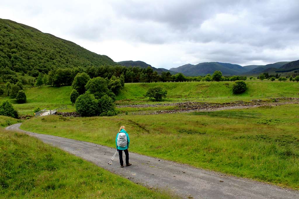
We set off back up the A9. I took a wrong turn westward on a narrow road but eventually, we reached Laggan Bridge on the A86. From here, we headed further west on a small dead-end road into the Spey valley. We passed through lonely farms, passed the Spey dam and its reservoir, a place called Glenshero lodge and finally the farm at Garvamore. A couple of minutes later, we rounded a bend and the road ended at an area where a handful of cars were parked in front of Garva Bridge. The track of General Wade’s road headed west into the wilderness but this was as far as we could, or needed, to drive.
It was nearly midday by now so we sat and ate lunch in the car as a shower passed down the glen.
“I don’t want to have to drive that road again…except to go back today.” I said.
“I know what you mean.” Marie replied. “Shall we go?”
We put our waterproofs on, I left my camera in the car and with no food to carry, the rucksacks were really light.
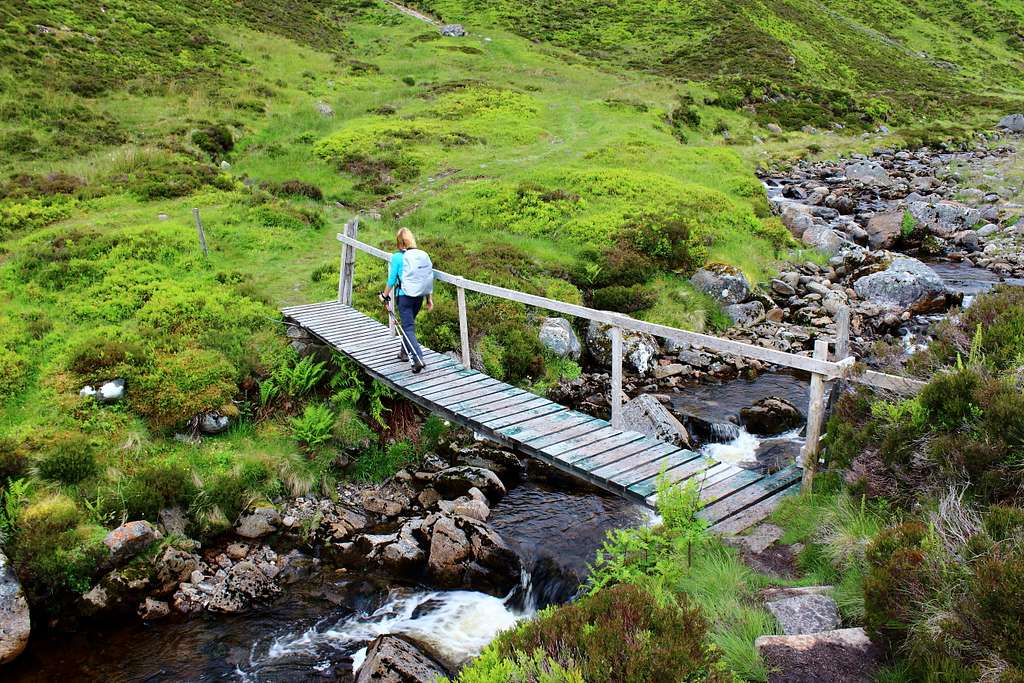
We crossed the bridge at 12.15 pm and headed north up the farm track on the other side. It was a grey and very blustery afternoon but not raining anymore. The track crossed back over the river on a large bridge and we followed its east bank.
I thought this was going to be a difficult route to navigate but there was a feint path running parallel to the riverside and it was not as boggy underfoot as I had feared.
We followed the river, the Feith Talagain up the heather clad hillside. As we started to get higher, the wind got stronger. Luckily, it was from the southwest, so behind us.
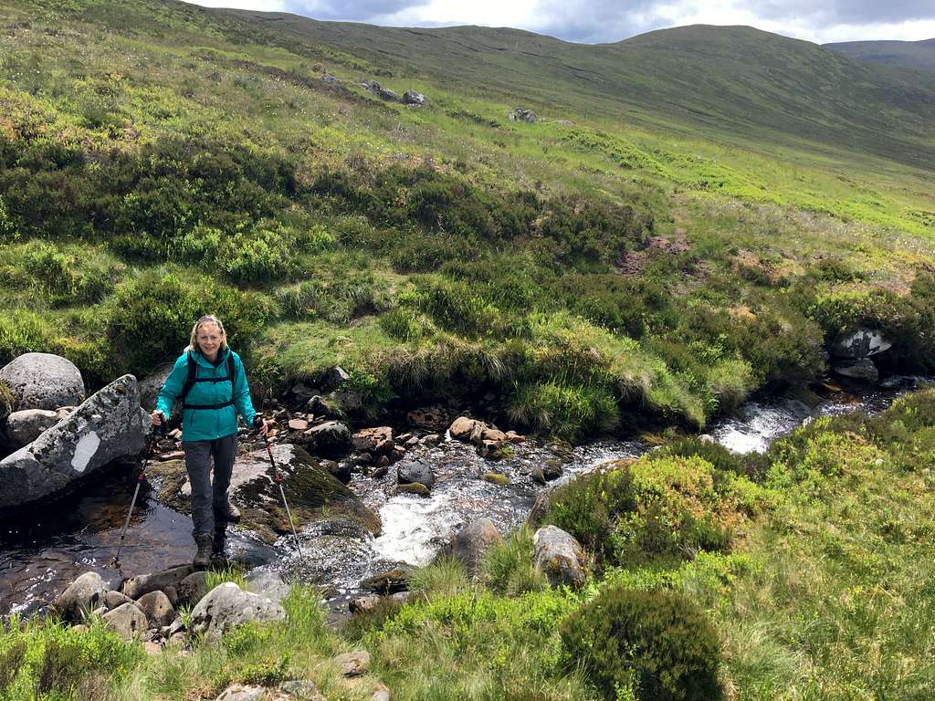
We came to a tributary joining the main river, the Allt Coire nan Dearcag and followed this upwards.
“We need to cross this at some point.” I said to Marie.
It didn’t look like it would be difficult, I just wanted to find the best place.
Eventually, I selected a spot and we hopped across as the sun came out for a few minutes.
Allt Coire nan Dearcag , Monadhliath Mountains, Scotland
We headed up the grassy southwest ridge of Geal Charn and got battered by the wind as we went. It was supposed to be gusting around 35 mph and we staggered as each gust hit us.
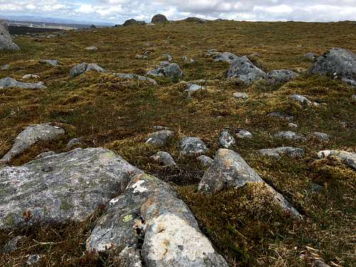
As the ridge started to level out, Marie was a little in front of me. I was staring at the ground in front of me being careful not to turn my ankle on the rock-strewn surface.
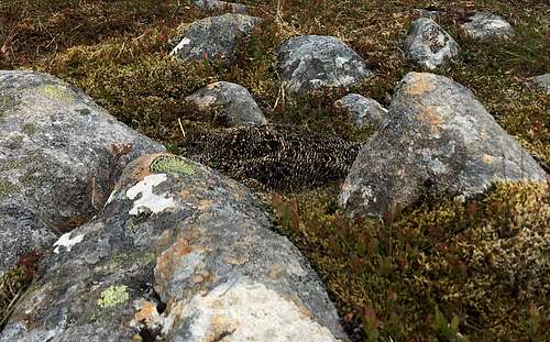
Suddenly, I was aware of feathers and a little face looking up at me!
I stopped and right in front of me was a bird nestled in between the rocks, out of the wind.
I shouted to Marie. After a few attempts, she heard me and started back, I had to stop her in case she trod on the bird, it took several seconds for her to realise what I was pointing at.
Spot the Birdie! Geal Charn, Monadhliath Mountains, Scotland
“I didn’t see that on the way up!” She gasped above the wind.
“You must have nearly trodden on it.” I replied.
We looked at it for a while. It looked back at us quite calmy, as if to say….
“I don’t care how big you are, I’m not moving!”
I wasn’t sure if it was a Ptarmigan or a Grouse but in my past experience, they usually either run or fly away before I get too close. Was she sitting on a nest amongst the rocks and protecting eggs or young?
I took some pictures with my phone and we continued on across the gently sloping plateau to the large summit cairn, arriving at 2.20 pm.
We ducked out of the wind behind the cairn but soon left to re-trace our steps down.
Another couple passed us on their way up and we wondered if our bird was ok. We soon reached her, still stoically nestled amongst the rocks.
Isn’t nature amazing? In the vastness of the landscape, we would never have seen her if I hadn’t nearly trodden on her!
We descended into the wind, which was colder now, forcing us to stop and put gloves on. I think we more or less returned the same way although it didn’t really matter.
We got back to the car at 4.15pm and before any heavy showers arrived. On the drive back down the glen, we talked about how sometimes, we don’t need a perfect weather day and spectacular views to have a memorable day!
(A few days later we visited the RSPB centre at Loch Garten. We showed them my photo of the bird and they pronounced it as a female Ptarmigan.)
Carn Dearg, Carn Sgulain, A’ Chailleach. Monadhliath Mountains.
Carn Dearg (945m), Monadhliath Mountains.
“Another day, another wall of cloud over the Drumochter pass!”
We looked out of the car window, the forecast was for scattered showers but these were far from scattered.
We drove back north, intending to do a low-level walk in Glen Feshie and hope we didn’t get too wet. Somehow, I took the wrong exit off the A9 and we ended up in the town of Newtonmore. In a moment rife with déjà vu, we decided to find the road that would take us out of the town and down Glen Banchor and to see the start point for the routes into the Monadhliath mountains.
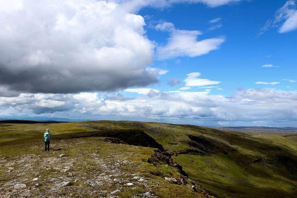
The Monadhliath is an enormous area of high-level moorland extending from the Spey valley west to Loch Ness. Mostly, it is undulating moorland but it has four Munro summits along its south eastern edge. We had already climbed Geal Charn and the remaining three Munros could be all traversed in a long day. By all accounts, this area could be featureless and difficult to navigate under poor conditions.
A short drive took us to the end of the public road and a small parking area. The hills around us were all clear although they still sat under a higher layer of grey cloud. It wasn’t raining but didn’t look great.
Glen Banchor, Monadhliath Mountains, Scotland.
Marie spoke. “If I’m going to get wet, I might as well be climbing a mountain rather than walking through the valley.”
We set off at 11.05 am… another late start but we didn’t need to be back early for anything.
We headed west along the track towards Glenballoch, a couple passed us walking in the opposite direction and ahead an older couple were exploring the ruined farm buildings on the far side of the Allt Fionndrigh.
“We don’t cross the river.” I said. “We turn right and follow the river upwards.”
We waved to the couple on the opposite bank. We didn’t know it then but we would see no one else for the rest of the day.
We headed northwest up the ATV track into the hills. It was a well-made track and we made good time. Somewhere along the way a thought trickled through my brain.
We left at 11.05 am, how long was this route? Somewhere in my head, I had a thought it was 10 hours long, that would mean we wouldn’t finish until at least 9.00 pm!
I decided we were going well and would finish by 8.00pm, still quite late but it would be light.
My more worrying problem was, how long should I leave it before I told Marie this information? How would she react?
I decided to tell her.
“Oh well, it won’t be dark until 10.00pm… as we used to say in Ireland.” Was her reply.
Phew!
By 12.20pm we had come to the place where we left the ATV track and crossed the river on an old footbridge. We headed up a small path on the other side to the bealach between the hills of Creag Liath and Meall na Ceardaich where the path ended on a wet, marshy hillside.
Allt Fionndrigh, Monadhliath Mountains, Scotland.
So far, the route finding had been easy but now it got harder. We followed the impression left by an ATV northward until it vanished and we had to continue where we could, avoiding the worst of the bogs.
We found another ATV track and followed it in the direction we needed. It ended abruptly and we followed some relatively new boot prints along a path which vanished in a carpet of sodden moss. I read the route description and consulted the map.
“I think we should be down there.” I pointed down to a path in a grassy ramp about 100m in height beneath us and on the other side of the valley.
“We don’t want to lose all that height.” Marie said.
Somehow, we had come too far up the east side of Meall na Ceardaich, we needed to traverse westwards under Carn Ban to get to Carn Dearg. This was easier said than done and almost inevitably, we had to climb higher and ended up within sight of the summit cairn of Carn Ban.
We then had to descend southwards and then climb again to get to the first summit we wanted. Up to this point, I had been saying to myself…”thank goodness it’s clear, we can see where we’re going and it’s not raining.”
As we headed south, we could see a shower heading towards us, our first of the day. The rain started as we reached the path we should have been on in the first place, lying in a small ravine.
We decided to shelter there and have some lunch at 2.20pm.
We had earlier discussed just climbing Carn Dearg and returning the same way.
“I’m not just going back that way.” I said. “Not after all this effort.”
Marie agreed, we would continue the traverse, we thought we must have done the hardest bit.
The shower ended quickly and we packed up and headed for the summit arriving at around 2.55pm in sunshine!
Carn Dearg (945m), Monadhliath Mountains.
The moors to the north were flat and featureless apart from some wind turbines in the distance, an area rarely travelled in the crowded British Isles. We could see for miles and there were no other people visible in any direction. It was a wonderful form of loneliness and felt dramatic and exciting.
I took a compass bearing from the summit of Carn Dearg and we headed towards the top of Carn Ban. When we arrived, I was delighted to see a line of ancient fence posts – an old administrative boundary – heading across the moorland hill tops and marking out our route for us.
We passed Lochan Uisge, a useful route-finding feature and reached Carn Ballach, the next top. I looked back towards Carn Dearg and photographed it in the sunshine. Unfortunately, I saw another shower heading towards us.
We quickened our pace heading northwest and hoping the shower would miss us. Instead, it caught up and cut across in front of us. Then, I head a distinct rumble.
“Was that thunder?” Marie asked.
“I think so, that’s all we need.” I replied.
We were wandering across the highest ground for miles around with no chance to descend and in the middle of a thunderstorm, a recipe for possible disaster.
The rain started, we descended a few meters into a tiny, dried up lochan – the lowest ground we could find - put our walking poles down and sat on a nearby rock.
The cloud swept over us, it rained for about 10-15 minutes before it began to subside. Thankfully, we heard no more thunder.
The storm headed north towards the higher Cairngorms and the sky brightened behind us. I looked at my watch, it was 4.00pm and I remembered the weather forecast.
“The weather should be clearing after 4.00 pm.” I said. “That will the last of the rain.”
We returned to our line of fence posts and headed across the moors. Our target, Carn Sgulain, was further away than we had realised and involved a crossing of a boggy swamp before we reached its two cairns at 5.30 pm in breezy sunshine.
We then had to retrace our steps westwards to find a path to A’ Chailleach our third target. I saw a shortcut path and took it; this was a mistake. The path soon vanished in another carpet of wet moss and dropped into a small river valley that needed to be descended, crossed and reascended.
Eventually, we re-found the correct path and made it to the summit at about 6.10 pm.
A' Chailleach (930m), Monadhliath Mountains
We sat and finished off our tea. I knew I had climbed this mountain in 1998 but I couldn’t remember it, the vagaries of memory!
Our pleasant, sunshine evening was vanishing as a load of cloud approached from the southwest – so much for the weather forecast.
We descended southwards on a vague path though the boggy carpets of moss. The rain started and didn’t stop.
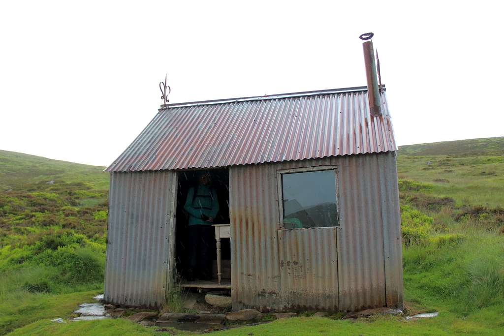
As we descended, we passed an old, corrugated iron hut – I did remember this from my past visit – Marie ducked inside to get out of the rain for a while. I stayed outside in the wetter – but cleaner – rain.
Corrugated iron hut, Aâ Chailleach. Monadhliath mountains
We continued down to the river and managed to cross on stones to the track on the far side. As we descended further, the rain stopped. We had about 20 minutes of walking in the dry before we reached the car at 7.50pm.
8 hours 45 mins to traverse 24.5 km (15.25 miles) over three Munros and some of the most featureless, loneliest and in its own way, dramatic land in the country.
We didn’t get our evening meal until 10.15pm but it was worth it.
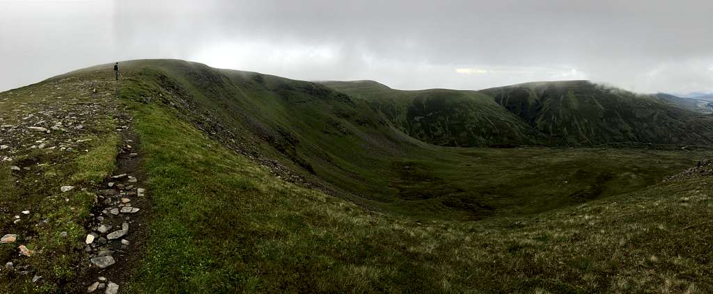
Sgairneach Mhor and Beinn Udlamain West Drumochter pass
Coire Dhomhain, Drumochter pass, Scotland
The weather forecasts for the day were consistent in one aspect…rain was coming in from the west. The difference between them was the time it was arriving. It was either at 11.00 am, 1.00 pm or 3.00pm! The evening before was clear so we decided on an early start.
By the time we reached the Drumochter pass at 7.30 am, it was already grey with low cloud drifting across the summits – it had been clear when we got up – I was starting to expect the rain at 11.00am!
We started our route up Coire Dhomhain but immediately found a discrepancy between our route description and the map. Eventually, I decided to follow the evidence in front of me and the route description (it was the OS map that was out of date!).
We followed a feint, boggy path up to “Pt 758” on the map and on to the east ridge of Sgairneach Mhor. I noticed a bird on a rock… a Golden Plover. Not something we had seen before but not unusual here.
We carried on reaching the summit at 9.30am. A large cairn which was easy to find, even in the light mist.
We left quickly and headed southwest, then northwest and finally east following the feint path through the boggy ground to reach the bealach between the mountains.
We ascended the south ridge of Beinn Udlamain following the line of old fenceposts that formed the local district boundary – by now we were really getting used to following fenceposts!
Through the mist we got the odd view west over to the Ben Alder Forest but it wasn’t as dramatic as we had hoped. We reached the large summit cairn at around 10.45 am and decided to have an early lunch before it started raining.
As we sat there, it started to get warmer and our views improved.
We descended the northeast ridge in quite good weather and enjoyed what we could see of the Ben Alder Forest and the mountains we had traversed earlier in our trip.
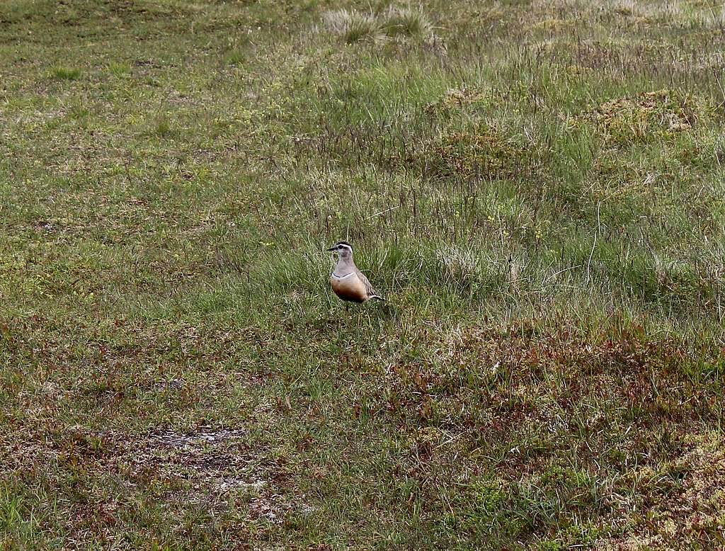
Suddenly, Marie stopped in front of me.
“Look!” She pointed at the ground right in front of her.
I walked slowly to up her to see a bird just in front of us. It didn’t look worried at all and it just walked back and forth, pecking in the grass.
Dotterel (Charadrius morinellus)
We later realised it was a Dotterel – our book described it as “Trusting”- it certainly was that! We had never seen one before and it would be rare in out part of the country but they are often seen in Scotland. A treat for us.
At the bealach for A’ Mharconaitch, we descended into Coire Dhomhain following a vague ridge into the valley and the end of the ATV track we had started out on.
We reached the car at 1.35pm. Not only was it not raining but there were patches of blue sky, I was not happy! It was a good route and I was pleased we had completed it in the dry but the vagaries of the weather forecasting was getting to me.
With hindsight, we both felt we should have traversed all four of the west Drumochter pass Munros in one go. It would have made for a more satisfying day and would not have been too long.
We headed back north towards Aviemore. By 3.30pm it had started raining and it poured all evening. The forecasters had redeemed themselves!
Postcript
Monadhliath Mountains.
All in all, we had some great experiences on these mountains. We would not have enjoyed these if we had'nt decided to ignore the views we had read and decided to make up our own minds!
"It occurs to me that even the most ordinary looking mountain can provide an enjoyable and even exciting day, given the right circumstances and the individuals to appreciate them" - well put.
Please keep on writing here!
Jacek
I think not. Great photos and writing. I hear the same thing about our western sagebrush and desert lands, yet I find the isolation and serenity to be the same as any mountain top I've been on.
Hi Bob,
Many thanks for your comments, its great to hear what people think.
I have had the chance to visit some of the desert national parks in the USA (Grand Canyon, Arches, Capitol Reef) they are very interesting places and I loved the solitude. Its good these type of places still exist. Scotland is a lot wetter but beautiful!
Cheers,
Mike
Parents refers to a larger category under which an object falls. For example, theAconcagua mountain page has the 'Aconcagua Group' and the 'Seven Summits' asparents and is a parent itself to many routes, photos, and Trip Reports.


Comments
Post a Comment