
-
 3030 Hits
-
 74.01% Score
-
 4 Votes
|
|
Route |
|---|---|
|
|
47.17128°N / 11.56689°E |
|
|
Hiking |
|
|
Spring, Summer, Fall |
|
|
Half a day |
|
|
Hike |
|
|
Overview
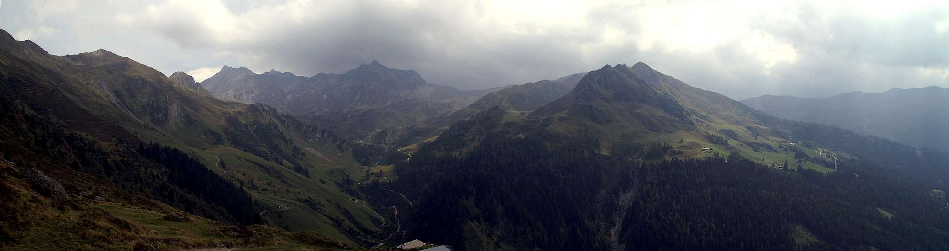
Most of the route across Grafmartalm follows mountain dirt roads which serve the three Alms along the way. From the uppermost one, Grafmartalm, the path turns into a narrow trail which climbs the sides of a weathered cirque and which reaches the Naviser Jöchl Saddle. From there a very rocky path leads up the remaining 200m through a wide couloir and along large blocks towards the Naviser Sonnenspitze summits. All along the route you have developing views of the tallest mountain of the Tux Alps, Lizumer Reckner.Getting There
Follow the instructions on the main page (Getting There). Remember that the summit as well as the upper part of the route is located on the boundary of the military training area “Truppenübungsplatz Wattener Lizum”. In principle you are only allowed to climb it when there is no military manoeuvre. I’m not sure what happens if there is one.Route Description
  |
- Start altitude: 1485m
- Summit altitude: 2610m
- Prevailing exposure: S
- Type: 4h
- Protection: None
Depending on which of the two parking lots in Navis you have parked the start of the climb is different. From the upper lot just follow the signs to Naviser Jöchl. The trail follows a road to Peeralm. From the lower parking lot head out (also along a dirt road) along the Klammbach Creek on its southern side. After a while the road ends and a wooden bridge leads across the creek to its northern side. Here a sign Peeralm leads up a very steep meadow and through a pine forest. It joins the road from the upper parking lot 200m west of Peeralm.
Shortly after the Alm the road splits. Take the upper one which leads in switchbacks up the mountain towards a second Alm. There is a second intersection on which you also have to take the upper road. The road itself turns into little more than a wide path and finally leads to Grafmartalm. Again there is an intersection, this time one of two narrow footpaths. The eastern one leads to Mölsjoch Saddle to the east of Sonnenspitze, while the western one leads to Naviser Jöchl. It follows a wide and weathered cirque on its western side, steadily climbing the slopes. Finally it reaches the elevation of the saddle but not the saddle itself. A short slope traverse finally leads to Naviser Jöchl.
Enjoy the views towards the Karwendel Range in the north, you won’t see it any more until you reachthe summit blocks of Sonnenspitze. Now a rocky climb across large boulders leads through a wide and somewhat shallow couloir to the western ridge of Sonnenspitze. The first spire-like summit is reached and little later the main one.