The way in.
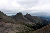
![Elk at first morning camp]() Elk at First Morning
Elk at First Morning
_______
It all began with cabin fever last March, in the long,
freeze-thaw-ice-mud, ...nonexistent Colorado "spring."
My friend Drew and I had cabin fever and so we got out
the maps and dreamed up this six day trip.
_______
Our first rendezvous was at my mom's house near the town of Hesperus. We had already prepared and portioned out everything for our trip, and that night we did the final inventory and stuffed the packs. Then in the middle of the night we woke up to a downpour- which was especially loud on the propanel roof. It lasted all night and my heart sank. I could only imagine what it was doing up in the mountains. Oh well, though, this was to be expected. We were going to enter the Weminuche Wilderness during the middle of monsoon season.
The next morning we loaded the packs into my truck. The La Plata mountains were entirely shrouded in clouds, and in Durango not even the top of Missionary Ridge was visible. We drove onward over Coal Bank and Molas Pass in a light, constant drizzle. Once in Silverton the weather seemed to lighten up. Sometimes the weather comes in low and backs up on the perimeter of the San Juans, and it doesn't quite have the energy to push into the heart of the range. I hoped this was the case.
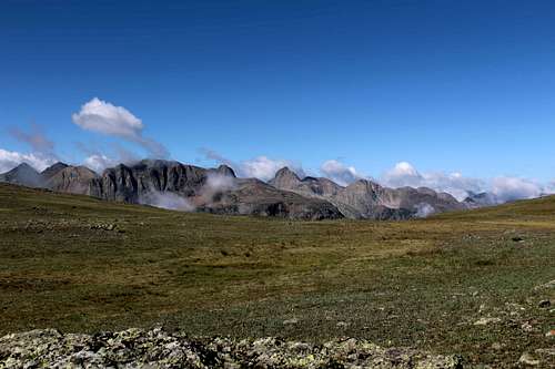
![Grenadier Range from the CDT]() Grenadier Range from the CDT
Grenadier Range from the CDT
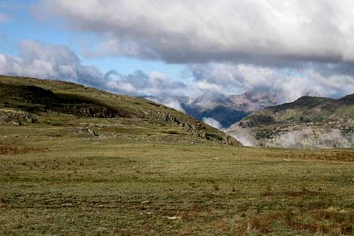
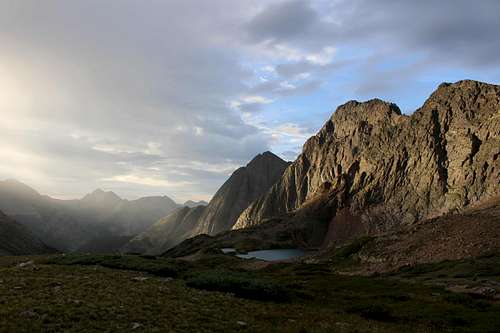
We parked at the Cunningham Gulch trailhead, and as if by request, the sky cleared and the rain stopped. What grand luck! Our first task was to immediately gain 1,700' to the Continental Divide Trail. This is a typical San Juans trailead, with an abrupt slog uphill to overcome this range's compact topography. For the next four miles the trail elevation averaged 12,500'. We meant to camp at Kite Lake that night, but sun turned to fog, then to drizzle, and then to a cold, soaking rain. It was unusual weather actually, in that it was far too cold for lightning. In a low saddle near a pond, we decided it was cold enough and set up camp. We could see our breath in the air and we were glad to shake off our ponchos and get warm inside.
At dawn, a dense fog lifted to brilliant sunlight. While eating our breakfast, we heard the chatter of Elk making their way on a distant hillside. I envied them being able to just live up here on the divide with no pack or gear.
We continued to Kite Lake, watching the Grenadier Range draw closer. I had chosen this trailhead because I knew the northeastern San Juans tend to have a lot of high, rolling plateaus. The views over to the Creede area were amazing, as were the views to the southwest. From Kite Lake we continued over Hunchback Pass and into upper Vallecito Creek. Shortly below the trail to Mt. Nebo we found a wonderful campsite. We decided to stay here rather than the site I had been thinking of at Rock Creek... because some of our gear was still soggy, the weather was sunny, and we were feeling lazy. Why not!
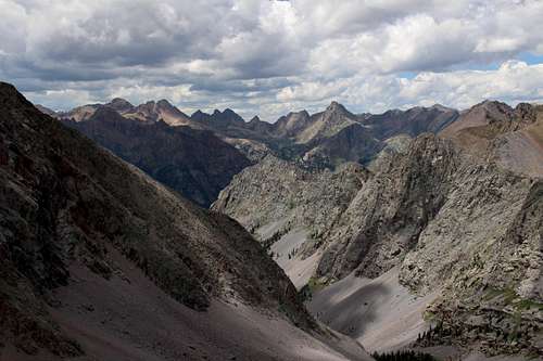
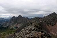
On the third day we left our base camp below the Mt. Nebo trail and headed out light and fast to Mt. Oso. The Rock Creek valley is one of my favorites: beautiful, post-card picturesque, but somehow in a unique way that does not compare to your standard Animas canyon tributary. It's also truly remote. This was my third visit to the pass between Rock Lake and Half Moon Lake, and on none of those visits have I ever seen anyone in this valley. I did not summit the mountain on this trip. Although the weather was ideal, the east side of Mt. Oso was still too formidable to my friend, and so I chose to remain with him.
![Needle Mountains from Mt. Oso]() Needle Mountains from Mt. Oso
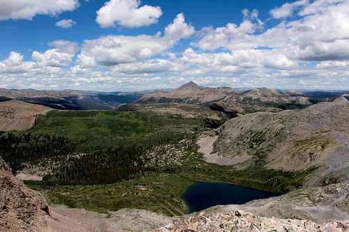
Needle Mountains from Mt. Oso![Rock Lake and the upper Rio Grande area]() Rock Lake and the upper Rio Grande area
Rock Lake and the upper Rio Grande areaThe traverse.
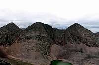
![Above Trinity Lake]() Morning Camp at Trinity Lake
Morning Camp at Trinity Lake
Our fourth day was devoted to exploring Stormy Gulch, aka Trinity Creek. There is simply no written information on this area, although I knew for sure from verbal accounts that it is (seldom) traveled by climbers who look for routes on Storm King's north face. It can also be used to make the pass into Vestal Basin. Trinity Creek was also the last area in the Grenadier Range that I had not yet explored, and this had been a personal goal for some time.
The immediate difficulty was finding the confluence of Trinity Creek and Vallecito Creek. From Vallecito Creek there were two side trails that might have been climber's trails. The first proved to be nothing but a game trail, and the second just a path to a nice campsite. With some ado, we crossed Vallecito Creek just beyond this campsite, and contoured into the woods northwest of Vallecito Creek until we found the confluence. From here we began to follow the left bank of Trinity Creek, which rose high above the water. Soon thereafter, a faint trail appeared through the undergrowth. This trail was about as faint as the Ruby Creek trail, but far easier to ascend. We followed this into one of the most beautiful hanging valleys I have ever seen... and which the reader will have to see in person to believe ;)
Farther up this valley was an incredible concentration of wildlife. Below timberline we saw a brown bear. Then at camp a herd of deer actually came up the hill to see us. Later after dark and after we had put everything away, I had to shoo away a huge, pesky goat... twice! I have seen many goats that seemed fearless, but it really struck me how...curious and tame the deer were. They are normally quite skiddish. I hope these animals were not being fed by the traffic in the adjacent Vestal Basin....
The fifth day we devoted solely to the pass into Vestal Basin. Our run of good weather slid out with some low clouds. Not really thunderstorm material, but dreary and misty all the same. We made an early push for the ridge separating Trinity Creek from Vestal Creek. On the south side of this ridge was an obvious route...you guessed it, a scree march up a steep gulley. We chose instead the solid talus just southeast of Peak Three. It took some coaxing to get my friend to scramble up the talus, but as we are both weightlifters, this proved to be more of a mental endurance test and we scaled the mountain like mules. We summitted Peak Three with full packs, turned south to follow the ridge, and I looked for the descent route I had observed in Vestal Basin some years earlier. We downclimbed a fairly solid third class route, fussed around on the talus piles immediately below this, and then were released into upper Vestal Basin.
We descended to the lower camping area below Vestal and Arrow Peaks, and that night it poured. The morning of our sixth day brought us nice sun, but sogginess was everywhere. We had hoped for lighter packs with so little food, but everything was damp. We packed up and descended to Elk Park to catch the train.
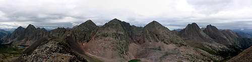
The big highlights for this trip were the pass above Trinity Lake, my second lengthwise traverse of the Grenadiers, and our sustained elevation. Except for the Elk Park trailhead, the lowest elevation we experienced during the six days was 10,140' at the confluence of Vallecito Creek and Rock Creek. Our four campsites were at 12,500' (CDT,) 11,100' (Nebo Creek,) 12,170' (Trinity Lake,) and 11,400' (Vestal Basin.) It was a good trip to get our fix in the highcountry :)
![Grenadier Range East to West]() Grenadier Range East to West
Grenadier Range East to West
Although the panorama perspective looks odd, it is quite accurate. The photo above is from the summit of Peak Three, at the northernmost part of the giant arc that forms the Grenadier Range. ...I can't seem to get the high-res photo to display on this page, even though I'm uploading an 8 mb file. Does anyone have any suggestions?
Happy summer and thanks for visiting the trip report!


Comments
Post a Comment