
-
 6228 Hits
-
 82.48% Score
-
 15 Votes
|
|
Mountain/Rock |
|---|---|
|
|
46.85822°N / 10.59489°E |
|
|
Hiking, Scrambling |
|
|
Summer, Fall, Winter |
|
|
9846 ft / 3001 m |
|
|
Overview
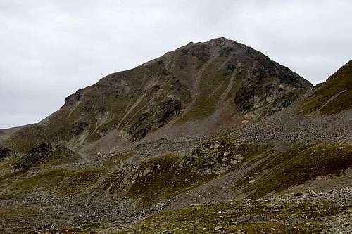 Großer Schafkopf as seen from the south-east Großer Schafkopf as seen from the south-east |
On the main ridge of the Nauderer Berge Subgroup of the Ötztal Alps there is a trio of hiking summits, very popular among hikers and tour skiers. Thanks to a chair lift, which serves the ski runs of Nauders but also operates in summertime, the three mountains, Mataunkopf / Cima Mataun (2892m), Wölfeleskopf / Cima del Lupo (2894m) and Groer Schafkopf / Cima delle Pecore (3001m) can be climbed in one go, a loop which starts and ends at the chair lift station. Alternatively, each of the summits can be reached from Langtauferer Höhenweg, a panoramic trail to the south of the main ridge, which traverses the slopes of Langtauferer Tal / Vallunga. There are two ancient high passes, Wölfelesjoch (2829m) and Saletztjoch, which have been used for hundreds of years for sheep and goat herding.
Großer Schafkopf / Cima delle Pecccore is the highest of these three mountains. With 3001m it barely makes the 3000m mark, which nevertheless makes it one of the highest peaks in this part of the Ötztal Alps. Generallly it is climbed from Wölfelesjoch, which at 2829m can be reached via steep, rocky paths. The last part of the ascent, along the west ridge of the mountain, runs across big blocks and is rather exposed in several parts of the traverse. However, it covers less than 200m in elevation and thus doesn't require too much courage.
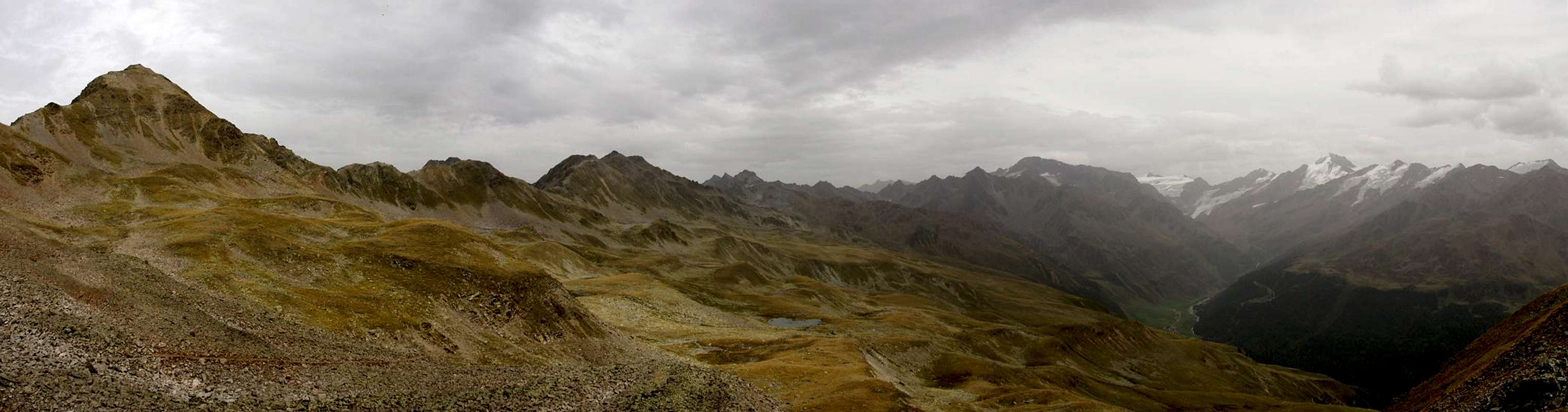  |
The summit of Großer Schafkopf is located a little north of the border between Austria and Italy, while the bulk of the mountain stretches across both sides of the border. In good weather (we had none) it is a good lookout peak. The glaciated peaks of the Weisskugel / Palla Bianca Ridge are just south of Langtauferer Tal while the Ortler Group shines in the far south. Across the Inn River there are the Samnaun and Ferwall Groups while in the north the Lechtal Alps hover in the distance.
 |  |  |
Großer Schafkopf, with its two neighbours, also is a popular ski tour destination in winter.
Getting There
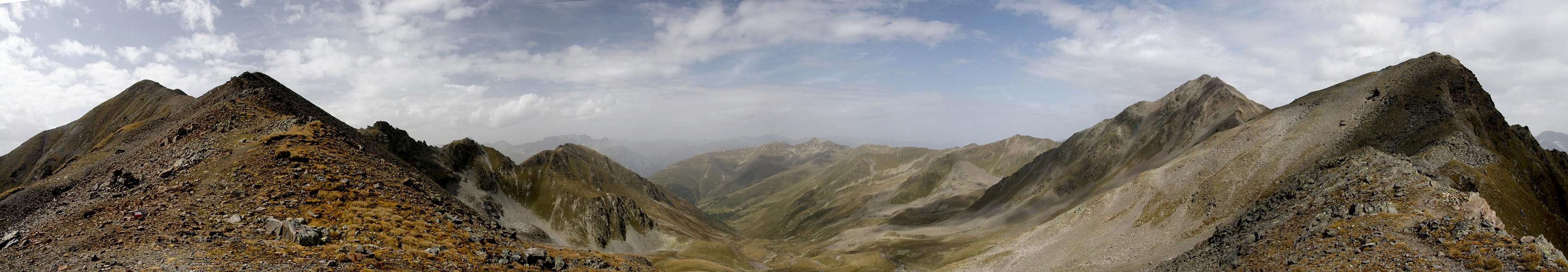 Großer Schafkopf is the second summit from the right. |
Reasonable starting points for a climb of Großer Schafkopf are the town of Nauders in the north-west and the villages within Langtauferer Tal / Vallelunga in the south. Starting from Nauders you can make use of the chairlift, which will take you to an elevation of 2200m. For the southern approach you need to climb at least 1000m. However you could also hike the panoramic Langtauferer Höhenweg, an 9 - 11h affair, and sidestep through Wölfelesjoch (2829m) to Großer Schafkopf summit.
Nauders
The town of Nauders is located several kilometres north of Reschenpass / Passo di Resia. It can be reached by B180 from Landeck in the north or via SS38 / SS40 from the south (Bozen / Bolzano and Meran / Merano). The lifts are about 2km south of the town.
Langtaufers / Vallelunga
The valley's mouth is at Graun / Curon Venosta, directly on the Reschenpas road. The closest trailhead for the Wölfelesjoch Route is at Hotel Alpenfrieden.
Red Tape
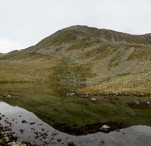 Großer Schafkopf mirrored in oberer Schwemmsee
Großer Schafkopf is a border summit on the Austrian / Italian border. There may be no checks anymore but it is mandatory to carry passport / ID. Apart from this there is no red tape.
Accommodation
- Nauders Accommodation
- Vinschgau / Val Venosta Accommodation
- Reschenpass / Passo di Resia Accommodation
Weather Conditions
Maps & Books
Maps
- Vinschgau / Val Venosta
Kompass Map WK52
1:50000
ISBN: 978-3-85491-058-9
- Ötztaler Alpen, Nauderer Berge
Deutsche Alpenvereinskarte 30/4
1:25000
Art.Nr.: 100031
- Alta Val Venosta / Vinschgauer Oberland
Tabacco Map 43
1:25000
Books
- Ötztaler Alpen
W. Klier
Alpenvereinsführer
Rother Verlag
ISBN: 3-7633-1123-8
- Vinschgau
Rother Wanderführer
Rother Verlag
ISBN: 978-3-7633-4204-1
- Vinschgau / Ortlergruppe
Kompass Wanderbuch 950
Kompass Verlag
ISBN: 3-87051-404-3