
|
|
Mountain/Rock |
|---|---|
|
|
46.27507°N / 122.17365°W |
|
|
Skamania |
|
|
Hiking |
|
|
Spring, Summer, Fall |
|
|
4752 ft / 1448 m |
|
|
Overview
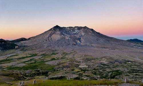 Mount Saint Helens at Sunrise | 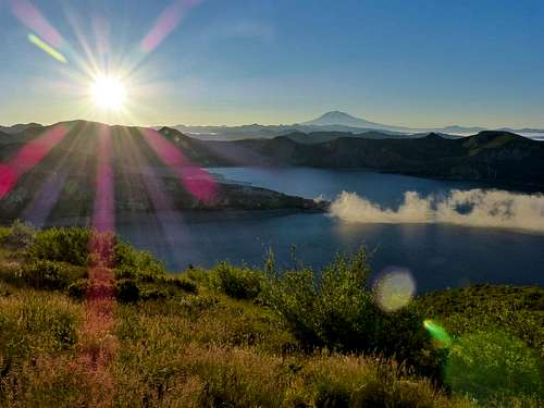 Spirit Lake and Mount Adams |
Today the hike to Harry's Ridge offers excellent views of the blast zone of Mount Saint Helens, Spirit Lake, several surrounding peaks, and three Cascade volcanoes; Mount Saint Helens, Mount Adams, and Mount Hood.
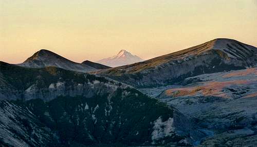
Hood from Harry's Ridge
Getting There
From I-5, drive to the junction of State Road 504 at Castle Rock (Exit 49). Exit the freeway, and turn east onto SR 504 and follow it east. After five miles you will pass the Silver Lake Visitor Center and in another 38 miles you will come to a junction where you will turn right onto SR504 E and follow it another 8 miles to the Johnston Ridge Observatory. On a smart phone you can search for "Johnston Ridge Observatory" and use GPS Navigation to guide you there as well.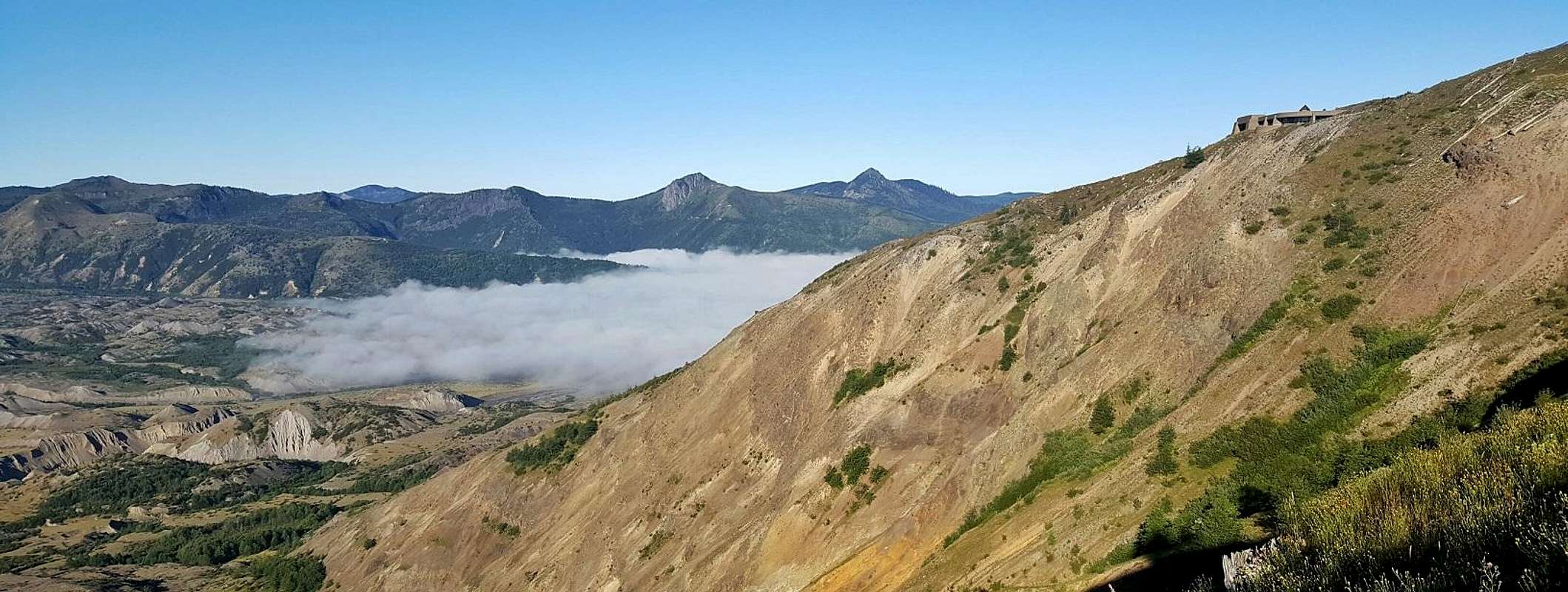
Johnston Ridge Observatory from the Boundary Trail
Route
Take the Boundary Trail starting from the NE corner of the Johnston Ridge Observatory and begin hiking east. Mount Saint Helens will be visible to hiker's right, visability permitting. Hike the boundary trail for 3.5 miles until the turn off to Trail #208 which leads up to Harry's Ridge.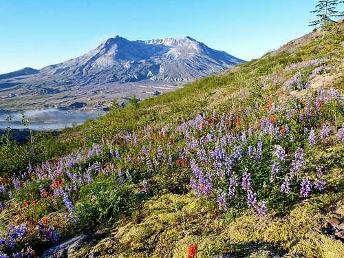 Saint Helens with Summer Flowers | 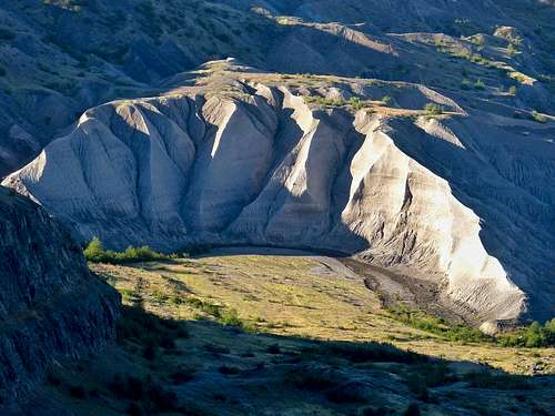 St. Helens Ash Pillows |
Total Distance (round trip) ~8 miles
Total Elevation gain (cumulative) ~800 feet

Harry's Ridge Trail Map
You can continue of past the summit down the other side of the ridge for better views of Spirit Lake. The trail eventually peters out. Please do not preceede any further than the trail to avoid damaging the delicate eco system and incuring a fine for being off trail. This will add distance and elevation gain to your trip. My GPS recorded 8.7 miles 1300 ft elevation gain doing this.
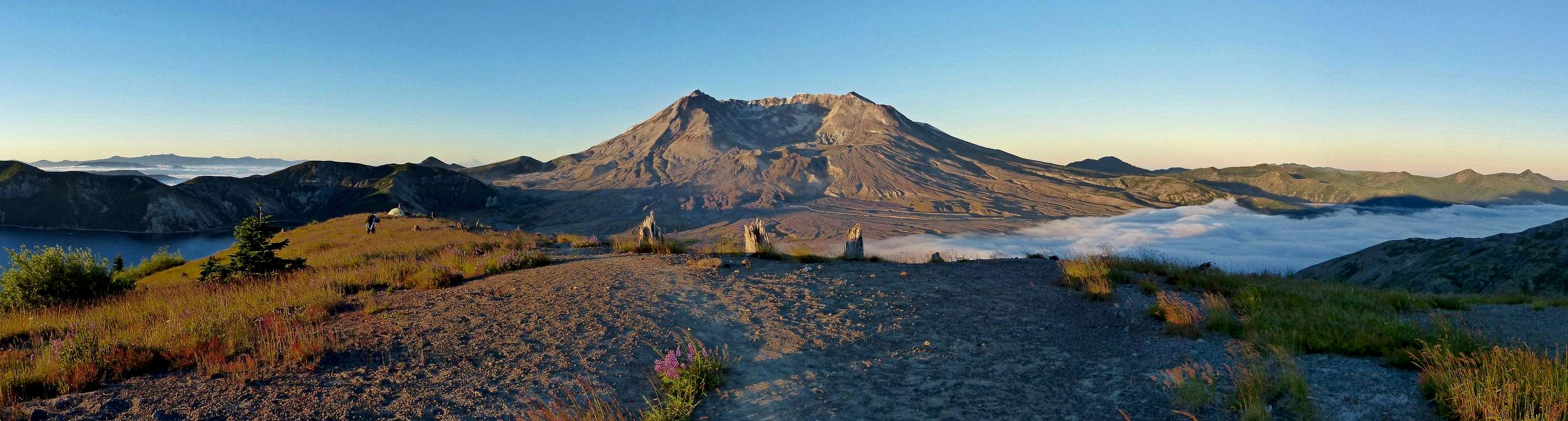
 Harry's Ridge Summit Panorama - SCROLL RIGHT
Red Tape
As of 2016, hiking in the area requires and $8 day use fee per person. Children under 15 are free. A NW forest pass or America the Beautiful pass will suffice in place of the $8 fee. Wrist bands can be obtained at the Johnston Ridge Observatory. More information can be found HERE.When to Climb
This is generally a Spring to Fall hike. The road to the Johnston Ridge Observatory is closed from November until mid-May in most years. Information about the current conditions can be found HERE.July is a fantastic time to visit when the wildflowers are in their peak.
 paintbrush |  wild flowers |  wild flower |
Weather information from the NWS / NOAA can be found HERE.
Camping
I have seen campers on Harry's Ridge, mostly photographers. Sunrise can be quite scenic but the area is also prone to high winds. Camping in the Mount Margaret Backcountry requiers a permit which can be obtained at recreation.gov or by calling 1-877-444-6777.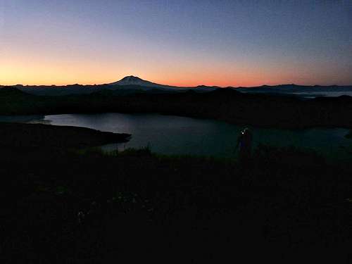 Spirit Lake at Dawn | 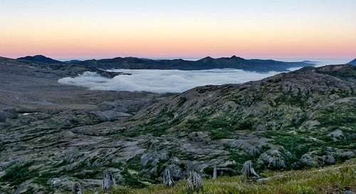 St. Helens Blast Zone Sunrise |
Harry's Ridge at Sunrise - Campers on the Left
External Links
The Washington Trails Association page for Harry's Ridge can be seen HERENWHiker page for the hike can be seen HERE
My trip report - HERE