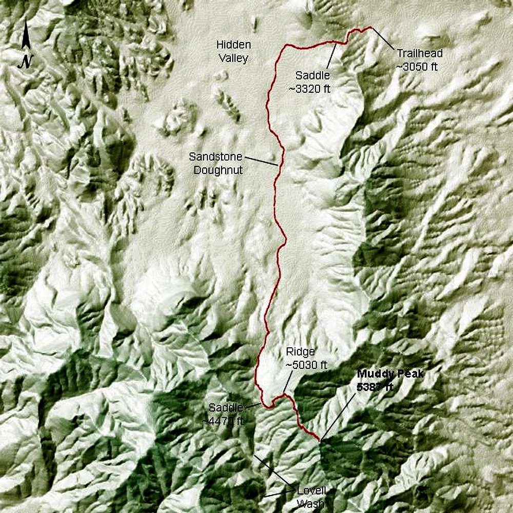
Here is a view of the "Northwest Gully via Hidden Valley" route to Muddy Peak, created with a program I wrote that uses USGS data. Some key landmarks and elevations are shown. The data for the route path are GPS track data from our hike on 05 March 2005. Send me an e-mail if you would like the GPS data for this route. For a photographic explanation of "Sandstone Doughnut,"
click here.


