Overview
I have hiked Bearfence Rocks several times. Bearfence Mountain only once. Bearfence Mountain is not far past the Bearfence Rocks but requires some interesting manuvering up and over boulders. It is one of the most fun hikes in the Shenandoah National Park. Now most people just go up to the Bearfence Rocks, but they should probably take the time to do the whole hike.
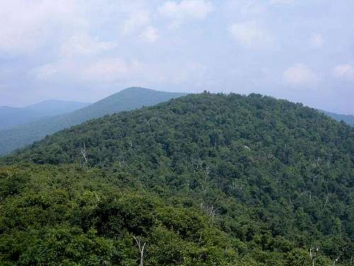
![The true summit of Bearfence...]() Bearfence Mountain behind the Bearfence Rocks
Bearfence Mountain behind the Bearfence RocksThe Hike
On a sunny, summer Sunday afternoon in 2004 I was in Shenandoah National Park, planning on climbing Bearfence Mountain, and doing some other short hikes in the park.
![Bearfence Rocks from Skyline...]() Bearfence Rocks from Skyline Drive
Bearfence Rocks from Skyline Drive
For Bearfence Mountain, I decided to park at Bootens Gap and see how far along the Appalachian Trail I would need to go to get to the climbing areas at Bearfence. I knew I would climb up to near the top of the 3500'+ Bush Mountain first, and then descend to near the start of the Bearfence Trail. It turned out to be about 1.5 miles to this point.
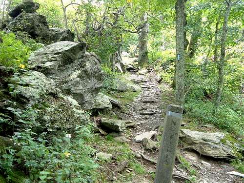
This being my first time up this mountain, I did not realize how rocky the trail was. It started up a steep grade from where the AT meets up with the Bearfence trail. From here it is only 1/2 mile to the summit and about 300 feet of elevation gain but it feels longer and higher due to all the climbing on my hands and feet.
![This is one of the Class 2...]() Up the rocky trail
Up the rocky trail
The first rock view has a nice view from most directions.
![Hazeltop (3812 ) (back left)...]() View to Hazeltop 3812' and Bush Mountain 3527'
View to Hazeltop 3812' and Bush Mountain 3527'
After taking some photos on Bearfence Rocks, I descended and I continued on the trail. I thought it would be a normal trail, but it turned out to be more rock climbing. At one point, there was a large drop, and a tree tilted over near the rocks. I had to grab onto the tree and pull it closer to the rock to pull myself up over the rocks and then back down onto the trail.
Near the top, there was another nice viewpoint. Not as nice as the Bearfence Rocks, but still worth the extra trip. I knew the summit was pretty close. I took a junction trail, which looped around back to the Appalachian Trail.
![This is a pristine AT forest...]() Junction trail leading to the summit
Junction trail leading to the summit
Once it started to descend, I back-tracked and looked for the highest point in the area. I noticed a small trail leading up to some rocks, and realized that had to be it. It was almost covered over in overgrowth, but still noticeable.
![Near the summit, you have to...]() The short side trail to the summit
The short side trail to the summit
The summit itself was nothing to look at. It is just a big rock in the middle of the woods, with no view.
![The true summit. It is just a...]() The true summit is the highest rock
The true summit is the highest rock
After bagging the summit, I descended back to the 360 degree panorama. This meant climbing back up, which was something I was looking forward to.
![Coming down from the summit,...]() Coming back from the summit to the trail back up and over the Bearfence Rocks
Coming back from the summit to the trail back up and over the Bearfence Rocks
Instead of taking the AT back to my car, I decided I would walk down to Skyline Drive, and hike back to my car. At the bottom of the Bearfence trail, I saw a couple looking at a deer sitting in the woods. I saw lots of animals out today. I saw several deer on the road. Another deer on another trail, just sitting and chewing on some food, while I walked in his/her direction. On the way back to Thornton Gap, I even saw a small black bear cross Skyline Drive.
The way back up Skyline Drive was uneventful, however it was certainly an enjoyable trek. About 4 miles of hiking and 650 feet of elevation gain.
Comments
No comments posted yet.