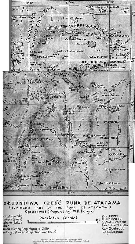
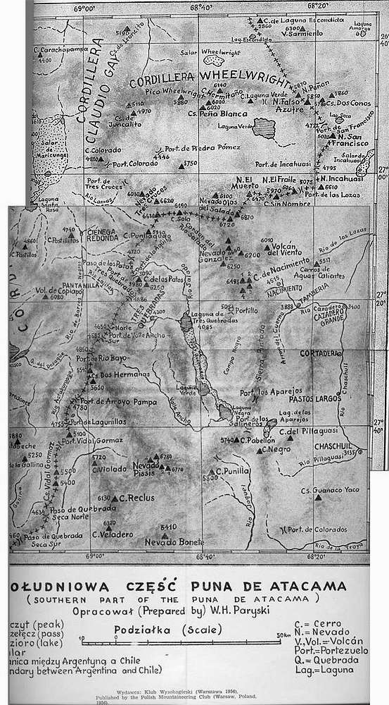
Witold Paryski's map of the Puna from 1956.
As you can see the Volcán del Viento is there and the altitude is given at 6010m (should be 6028m). Medusa isn't on the map, but should be just north of VdV. The name contorversy about the two peaks is basically the Alpenvereinskarte's fault which has mixed them up.
Scanned map provided by Eberhard Jurgalski - 8000ers.com


