I am just experimenting with...
I am just experimenting with route photos here. Will improve.
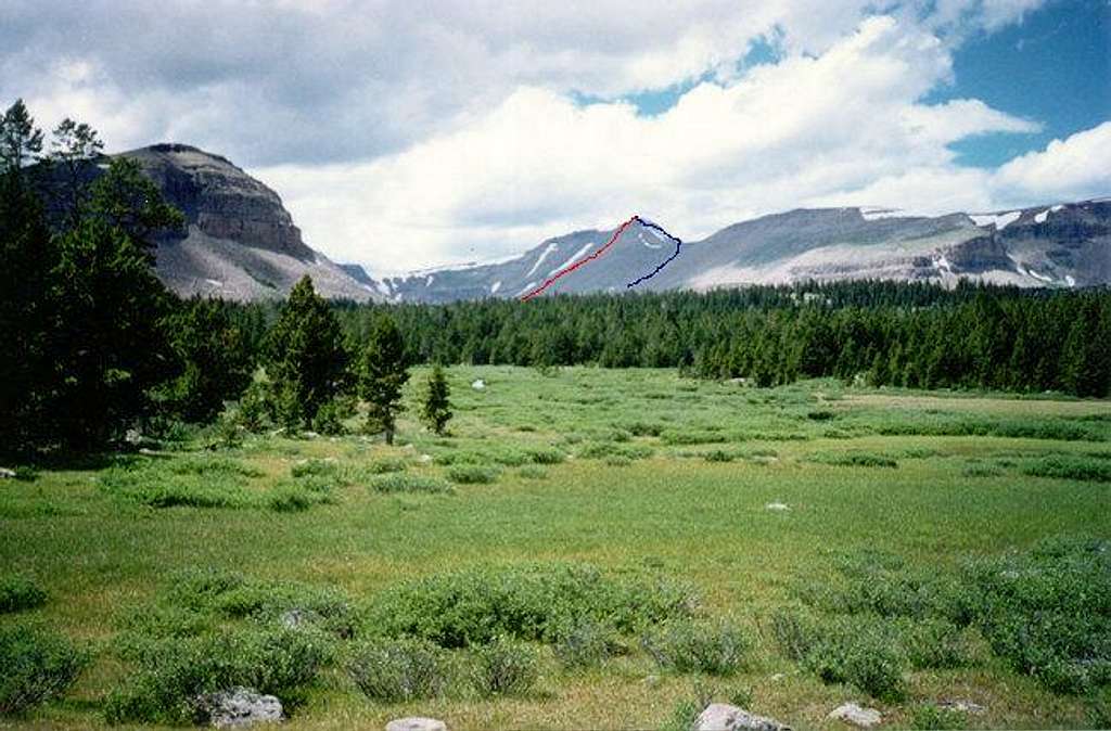
Gilbert Peak (center) from the south and near Milk Lake in the Uinta River drainage. This picture was taken in mid-August 1995. The Gilbert Creek Route goes through the beautiful meadows and along Gilbert to the cirque-basin seen just to the left of Gilbert Peak. The route then climbs the slope just to the right of the long-thin snowfield seen dropping from near the summit (marked in red). Alternately, you can climb to the notch visible to the right of the summit, and ascend the ridge to the top (marked in blue).


Comments
Post a Comment