Ibapah Peak, Pain and Pleasure
And totally worth it!
Departed after work Thursday. The trailhead was 4.5 hours from the Ogden Area. I-15 South to I-80 West out to Wendover with a posted speed limit of 80 mph! I almost think that's way too fast, but it is basically a straight line. Exit 410 in Wendover to top off gas at the Chevron. Turned due South onto US-93A (paved/70 mph) for 20 minutes, then left/East to Ibapah Road South (paved/55 mph) for another 30 minutes.
The previous directions were mostly the same as the main page. However, the following is IMHO a better deviation: Instead of turning left onto the dirt-road to Gold Hill after Mile-Marker 28, continue 13 more miles to Mile-Marker 15 and turn left/East onto what Garmin called the "Gold Hill Cut-off"/Pony Express Road (dirt/35 mph). This new route avoids the unkempt, rocky, rutty roads and town of Gold Hill all together. In June 2014, this newer road was smoothly graded and I could easily maintain 35+ mph for 7 miles until it met back-up with the older portion of the Pony Express Road (dirt/25 mph) right turn/South, as described on the main page.
Once back on the original route, passed Pony Express Historical Marker (15 foot high stone monument). Further on, at the top of the knoll, another Pony Express Historical Site with the stone ruins of Pony Express Station/Cabin. From here, I descended off the perch toward the town Calleo and onto Snake Valley Road for the final approach to Granite Creek Road which ends at the Ibapah Peak Trailhead.
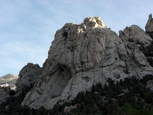
![Granite Creek Cave]() This massive cave opening is along the road to the Ibapah Peak Trailhead above Granite Creek.
This massive cave opening is along the road to the Ibapah Peak Trailhead above Granite Creek.
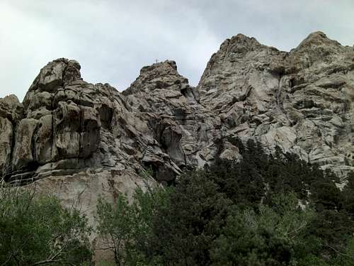
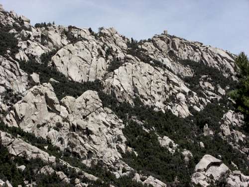
![Granite Creek Formations]() Huge Granite formations line both sides of Granite Creek.
Huge Granite formations line both sides of Granite Creek.
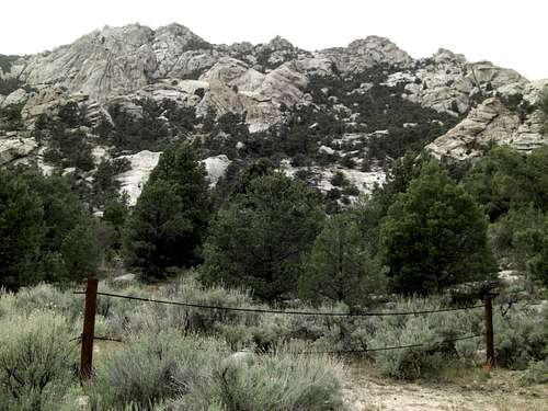
![Granite Creek Formations 3]() Very interesting rock formations above Granite Creek.
Very interesting rock formations above Granite Creek.
![Granite Creek Formations 4]() The Granite formations stand tall next to the road.
The Granite formations stand tall next to the road.
![Granite Creek Rushmore]() This Granite formation might be a good candidate for Mount Rushmore 2: The Next Generation. j/k
This Granite formation might be a good candidate for Mount Rushmore 2: The Next Generation. j/k ![Granite Creek Second Crossing Cables]() Looking South-West above Second Creek Crossing. They've cabled-off numerous trails in-order-for the wilderness to reclaim some of the land.
Looking South-West above Second Creek Crossing. They've cabled-off numerous trails in-order-for the wilderness to reclaim some of the land.
![Granite Creek Second Crossing Turn]() To the right is the Second Creek Crossing hidden by overgrowth of trees and shrubs. They've now cabled-off the false road going straight. So, turn right and power through the foot-deep creek span of 10 feet. If you've chosen to park/camp at/before this crossing, there's log upstream/left you can balance across.
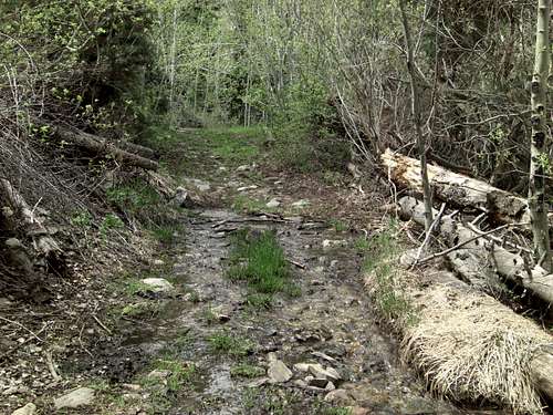
To the right is the Second Creek Crossing hidden by overgrowth of trees and shrubs. They've now cabled-off the false road going straight. So, turn right and power through the foot-deep creek span of 10 feet. If you've chosen to park/camp at/before this crossing, there's log upstream/left you can balance across.The first creek crossing was lengthy at least 30 feet across but shallow. I just kept my momentum and plowed thru. Just prior the second creek crossing, there was large gate and sign that read, "No motor vehicle access 1 November to 31 May". So, hiking during that period will add 0.6 mile each way to your hike. I think a car could make it to here. After the gate, the second creek crossing is 90° right turn hidden behind an overgrowth of trees. The span of this crossing is shorter, 10 feet, but deeper, at least one foot. Again, I kept my smash and drove thru. After the second creek crossing, the dirt road had some deep ruts, which required even my modest SUV to make some creative "S" turns to avoid high-center. Finally at the trailhead, there were more signs/posts stating "No motor vehicles, ANY TIME past this point". I had the entire site to myself, very peaceful, solitary. It was now getting dark with clear starry sky above the Granite cove and evergreens. So I set up camp and zzz'd out.
![Ibapah Trailhead Start Hill]() An SUV/Truck will make it to the Ibapah Trailhead, though with some free "Rocky-mountain Pin-striping" This shows the uphill start of the hiking portion from the Ibapah Trailhead. Arrived here Thursday evening and camped. Then began my hike at first light. It was cold/cool all day, which is preferred. At the top of this first hill, there's super deep rut with large round rocks on both sides that would eat many SUVs for breakfast. Many ATVs seem to make it, as evidenced by fresh tracks.
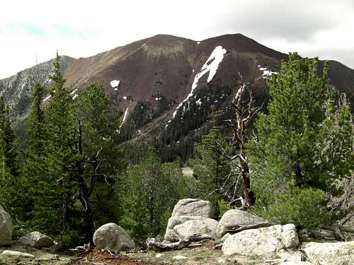
An SUV/Truck will make it to the Ibapah Trailhead, though with some free "Rocky-mountain Pin-striping" This shows the uphill start of the hiking portion from the Ibapah Trailhead. Arrived here Thursday evening and camped. Then began my hike at first light. It was cold/cool all day, which is preferred. At the top of this first hill, there's super deep rut with large round rocks on both sides that would eat many SUVs for breakfast. Many ATVs seem to make it, as evidenced by fresh tracks. ![Granite Creek Slabs]() The Granite slabs in the Deep Creek Mountain Range remind me of Little Cottonwood Canyon.
The Granite slabs in the Deep Creek Mountain Range remind me of Little Cottonwood Canyon.
![Ibapah Trail Creek 1]() One of the many creek crossings along the Ibapah Trail. Some crossings are easier than others.
One of the many creek crossings along the Ibapah Trail. Some crossings are easier than others.
![Ibapah Trail Creek 2]() The creek-crossing just before and marking the end of the ATV Trail. They have the rest of the trail cabled-off just past on the left.
The creek-crossing just before and marking the end of the ATV Trail. They have the rest of the trail cabled-off just past on the left.
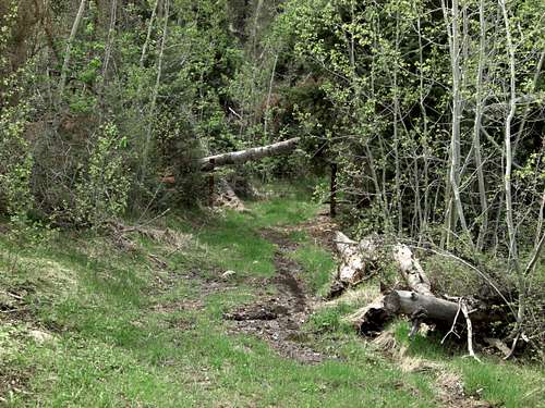
![Ibapah ATV Trail End]() The end of the ATV Trail brought abruptly to stop by very rude cable Oh and they conveniently/purposely didn't clear any of the dead-fall after this point to dissuade even those with bolt-cutters. It was like running hurdles for quarter mile past the cables.
The end of the ATV Trail brought abruptly to stop by very rude cable Oh and they conveniently/purposely didn't clear any of the dead-fall after this point to dissuade even those with bolt-cutters. It was like running hurdles for quarter mile past the cables.
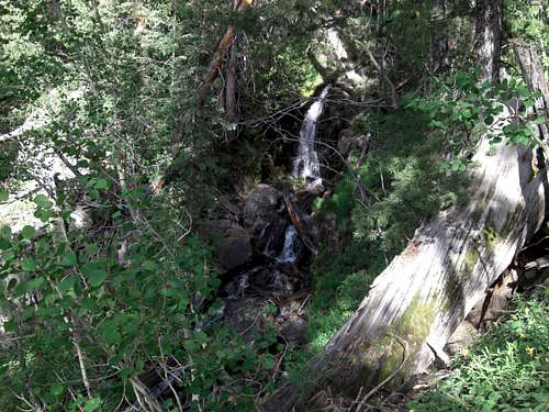
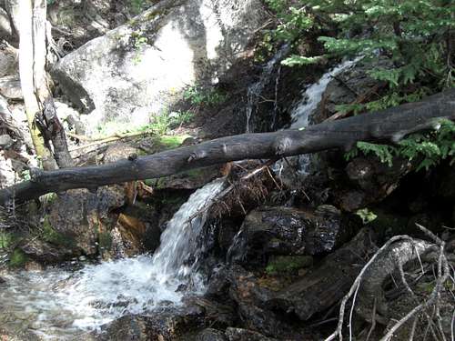
![Ibapah Waterfall 1]() One of the many waterfalls seen from the trail.
One of the many waterfalls seen from the trail.
![Ibapah Waterfall Crossing]() This is approx. the fourth creek crossing and waterfall along the trail. After this Waterfall Crossing, you'll meander through the trees for a bit, then veer East of the rock-band and eventually cross East over the stream. You'll be on the right side of the stream the rest of the way to the High Meadow. This is an easy section to replenish your water. There are many clean catch opportunities, such as mini waterfalls.
This is approx. the fourth creek crossing and waterfall along the trail. After this Waterfall Crossing, you'll meander through the trees for a bit, then veer East of the rock-band and eventually cross East over the stream. You'll be on the right side of the stream the rest of the way to the High Meadow. This is an easy section to replenish your water. There are many clean catch opportunities, such as mini waterfalls.
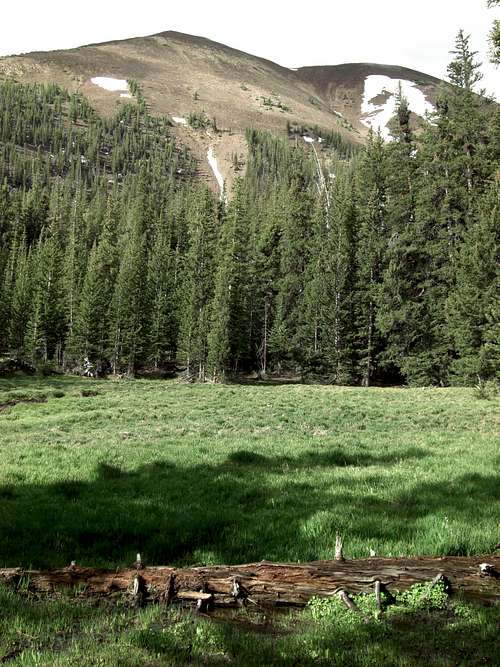
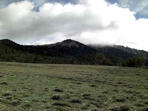
![Red Mountain from Lower Meadow]() Looking West toward Red Mountain from the Lower Meadow.
Looking West toward Red Mountain from the Lower Meadow.
![Ibapah Meadow Approach]() Looking North from the trail just below the High Meadow. You can leave the trail here and hike directly up to the High Meadow.
Looking North from the trail just below the High Meadow. You can leave the trail here and hike directly up to the High Meadow.
![Ibapah Approach to High Meadow]() Looking North from the trail just below the High Meadow. Break-Right now!
Looking North from the trail just below the High Meadow. Break-Right now!
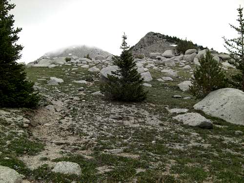
![Ibapah High Meadow Goal!]() My first glimpse of the High Meadow at 10,200 ft.
My first glimpse of the High Meadow at 10,200 ft.
![Ibapah High Meadow West]() Looking West from the High Meadow.
Looking West from the High Meadow.
![Ibapah High Meadow North-West]()
There are even cool Granite formations around the High Meadow! Check the Cracked Monolith at 1 o'clock.
![Ibapah High Meadow Rest Area]() My Rest Area on the High Meadow. Brunch time! (or "Second Breakfast") The rocks made good chairs.
My Rest Area on the High Meadow. Brunch time! (or "Second Breakfast") The rocks made good chairs.
![Ibapah Peak socked-in]() Looking North toward the Sub-peak from the High Meadow. Ibapah Peak is currently occluded by clouds. The ceiling was just above 11,000 ft. Of note: When I got back to SLC, I found out it rained over an inch in Happy Valley. While the clouds over Ibapah stayed closer to a shade of white and dry all day, and cool, especially on the peaks. Thanks be.
Looking North toward the Sub-peak from the High Meadow. Ibapah Peak is currently occluded by clouds. The ceiling was just above 11,000 ft. Of note: When I got back to SLC, I found out it rained over an inch in Happy Valley. While the clouds over Ibapah stayed closer to a shade of white and dry all day, and cool, especially on the peaks. Thanks be.
![Red Mountain from High Meadow.]() Red Mountain from just above the High Meadow.
Red Mountain from just above the High Meadow.
![Ibapah Sub-peak Approach]() Further up the mountain just below the Sub-peak. Ibapah Peak still in-the-clouds. As said, in SLC it rained an inch that day. Ironically, all I was worried about was if the clouds would move off by the time I got up to the peak.
Further up the mountain just below the Sub-peak. Ibapah Peak still in-the-clouds. As said, in SLC it rained an inch that day. Ironically, all I was worried about was if the clouds would move off by the time I got up to the peak.
![Ibapah Sub-sub-peak]() Looking West toward the Sub-sub-peak.
Looking West toward the Sub-sub-peak.
![Ibapah North Valley]() Looking North from the saddle below the Sub-peak.
Looking North from the saddle below the Sub-peak.
![Ibapah North Forest]() Looking North from just below the Sub-peak.
Looking North from just below the Sub-peak.
![Ibapah Sub-peak]() Cresting the Sub-peak.
Cresting the Sub-peak.
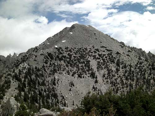
![Ibapah Peak Clear View!]() Tagged the Sub-peak too! (11,400 ft.) Once on the Sub-peak, I look up and lo and behold! Ibapah Peak! The clouds finally cleared out! Thank you, thank you, thank you! It's so much easier climbing mountain when you can see the top!
Tagged the Sub-peak too! (11,400 ft.) Once on the Sub-peak, I look up and lo and behold! Ibapah Peak! The clouds finally cleared out! Thank you, thank you, thank you! It's so much easier climbing mountain when you can see the top!
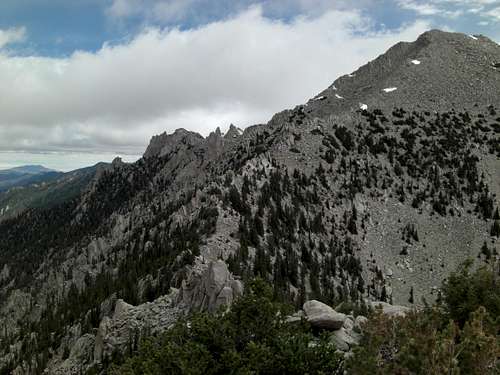
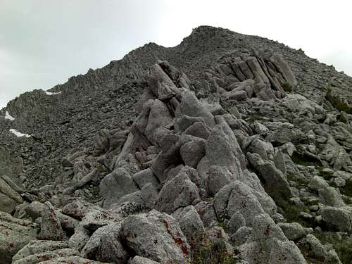
![Ibapah Razor-back]() Long Razor-back you navigate toward the Ibapah Summit Cone.
Long Razor-back you navigate toward the Ibapah Summit Cone.
![Ibapah Saddle North]() Looking North from the saddle into the valley below.
Looking North from the saddle into the valley below.
![Ibapah North Razor-back]() Looking North toward one of the Razor-backs that leads to Ibapah Peak.
Looking North toward one of the Razor-backs that leads to Ibapah Peak.
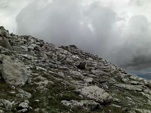
![Ibapah Summit Cone]() Elevating yourself to Ibapah Peak can be a scramble, but if you can find it, there's fine Use-trail that switches-back-and-forth toward the summit cone.
Elevating yourself to Ibapah Peak can be a scramble, but if you can find it, there's fine Use-trail that switches-back-and-forth toward the summit cone.
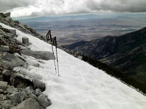
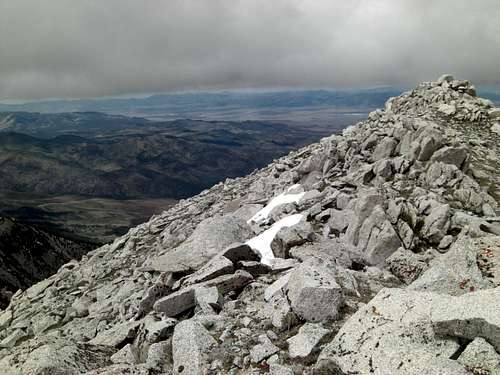
![Ibapah Valley]() Looking West through the valley I hiked up to get to the High Meadow. My Trekkers planted in a persistent snow-bank.
Looking West through the valley I hiked up to get to the High Meadow. My Trekkers planted in a persistent snow-bank.
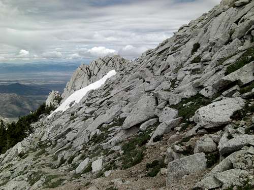
![Ibapah Steeps]() If you look carefully you can see the Use-trail that meanders back-and-forth making its way up the Ibapah Summit Cone.
If you look carefully you can see the Use-trail that meanders back-and-forth making its way up the Ibapah Summit Cone.
![Ibapah Steeps 2]() The Use-trail, sometimes more obvious, sometimes not so. But it can make travel up to Ibapah Peak a little easier than scrambling straight up!
The Use-trail, sometimes more obvious, sometimes not so. But it can make travel up to Ibapah Peak a little easier than scrambling straight up!
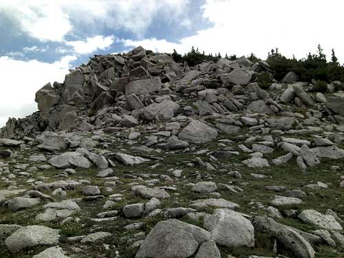
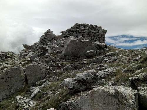
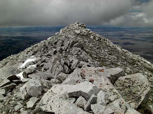
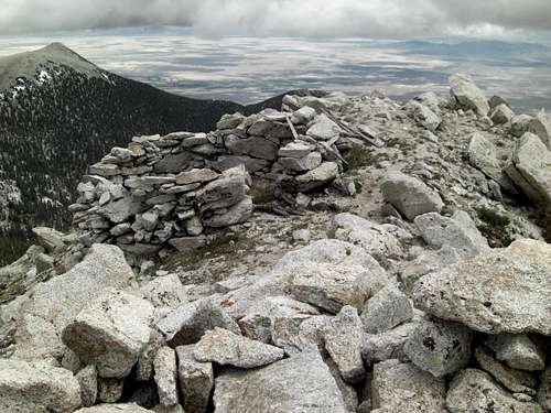
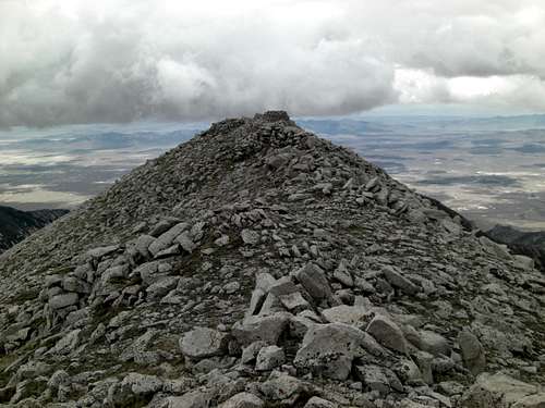
![Ibapah Crest]() Cresting Ibapah Peak, my first view of the Summit Shelter Cairn.
Cresting Ibapah Peak, my first view of the Summit Shelter Cairn.
![Ibapah Summit West]() Looking back toward the West edge of the Ibapah Summit Block.
Looking back toward the West edge of the Ibapah Summit Block.
![Ibapah Bricks]() Red/orange bricks strewn about on Ibapah Peak. Looks like they may have built small fireplace or maybe mailbox for the Summit Register. But either weather or someone destroyed it. The more important question is, who hauled all those bricks and mortar up this gauntlet of a mountain?
Red/orange bricks strewn about on Ibapah Peak. Looks like they may have built small fireplace or maybe mailbox for the Summit Register. But either weather or someone destroyed it. The more important question is, who hauled all those bricks and mortar up this gauntlet of a mountain?
![Ibapah Summit Cairn]() Approaching Ibapah Peak.
Approaching Ibapah Peak.
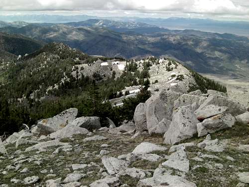
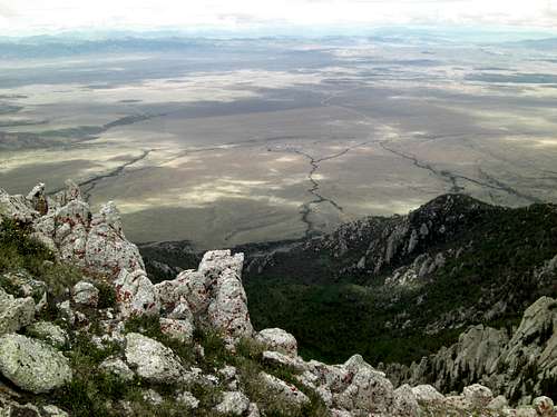
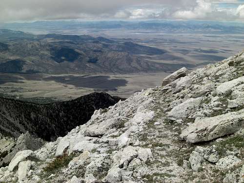
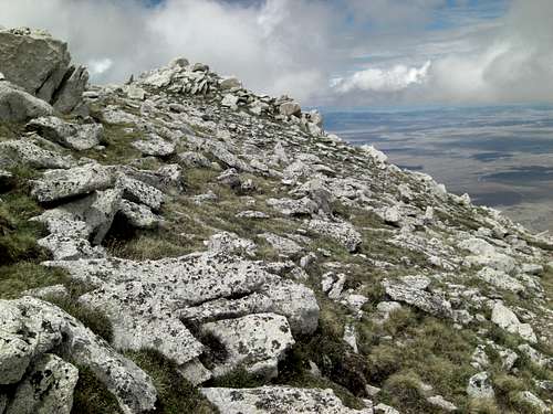
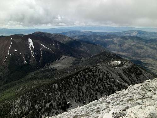
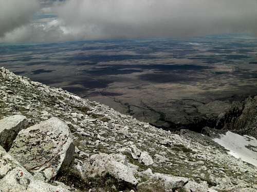
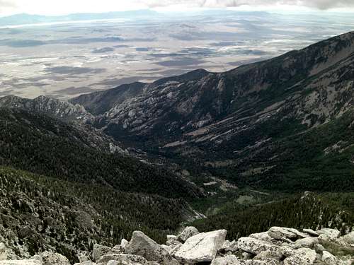
![Ibapah Panoramic Series 1]() Panoramic series start. Looking South from the Ibapah Summit Block. The valley you hike through just to get to the High Meadow. The Trailhead is just below the Granite formations near the bottom.
Panoramic series start. Looking South from the Ibapah Summit Block. The valley you hike through just to get to the High Meadow. The Trailhead is just below the Granite formations near the bottom.
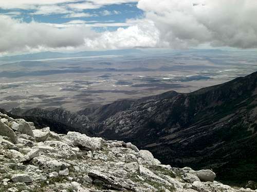
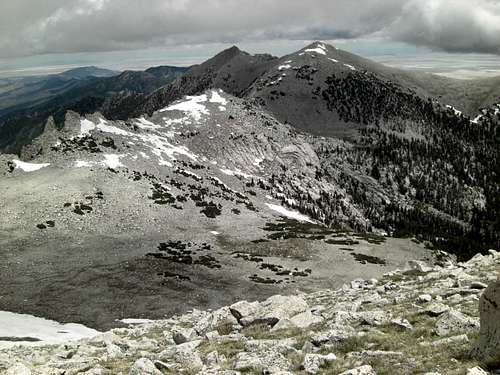
![Ibapah Panoramic 2]() Looking South-West from Ibapah Peak toward Red Mountain (11,600 ft.)
Looking South-West from Ibapah Peak toward Red Mountain (11,600 ft.)
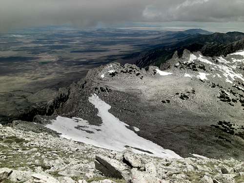
![Ibapah Panoramic 3]() Looking South-West from Ibapah Peak toward the High Meadow (10,200 ft.)
Looking South-West from Ibapah Peak toward the High Meadow (10,200 ft.)
![Ibapah Panoramic 4]() The West edge of Ibapah Summit showing the steep angle.
The West edge of Ibapah Summit showing the steep angle.
![Ibapah Panoramic 5]() The West edge of Ibapah Summit.
The West edge of Ibapah Summit.
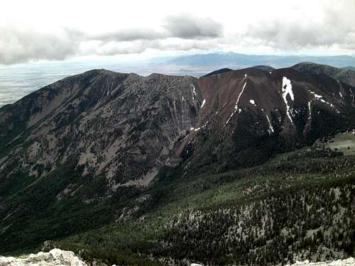
![Ibapah Panoramic 6]() Looking North-West from Ibapah Summit.
Looking North-West from Ibapah Summit.
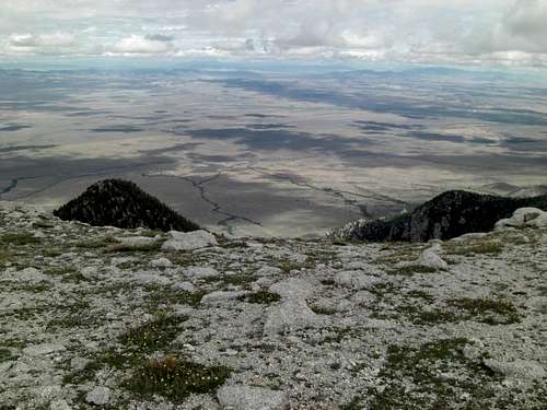
![Panoramic 7]() Looking North from Ibapah Summit.
Looking North from Ibapah Summit.
![Ibapah Panoramic 8]() Looking North from Ibapah Summit.
Looking North from Ibapah Summit.
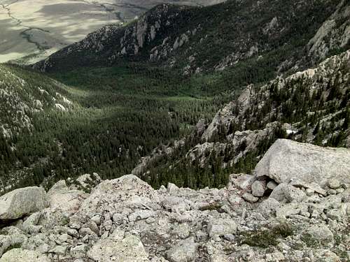
![Ibapah Panoramic 9]() Looking East from Ibapah Summit.
Looking East from Ibapah Summit.
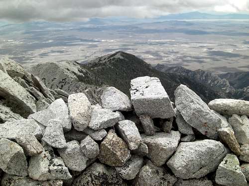
![Ibapah Panoramic 10]() Looking East toward the other Shelter Cairn on Ibapah Summit.
Looking East toward the other Shelter Cairn on Ibapah Summit.
![Ibapah 11]() Looking East from Ibapah Summit.
Looking East from Ibapah Summit.
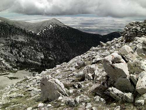
![Ibapah Panoramic 12]() Wider view looking South from Ibapah Peak.
Wider view looking South from Ibapah Peak.
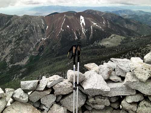
![Ibapah Panoramic 13]() My trekkers with Red Mountain and the High Meadow beyond.
My trekkers with Red Mountain and the High Meadow beyond.
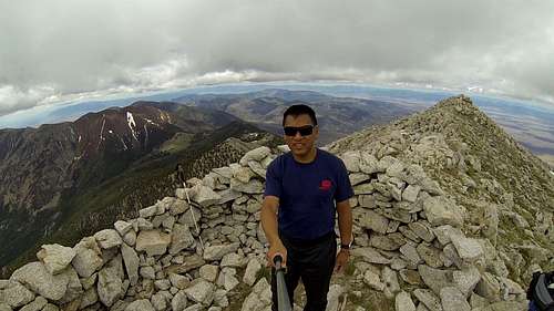
![Ibapah Peak V]() Me on Ibapah Peak at 12,087 ft. MSL. It's the Highpoint for Juab County in the Deep Creek Mountains and one of the "57 Ultra Peaks" in the lower 48 States. 2014-06-27.
Me on Ibapah Peak at 12,087 ft. MSL. It's the Highpoint for Juab County in the Deep Creek Mountains and one of the "57 Ultra Peaks" in the lower 48 States. 2014-06-27.
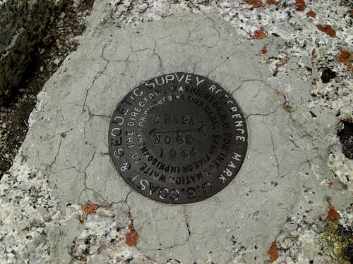
![Ibapah Peak Geodetic Reference Six]() Ibapah Reference Geodetic Spike. 1944! I think that's the earliest spike I've seen so far.
Ibapah Reference Geodetic Spike. 1944! I think that's the earliest spike I've seen so far. ![Ibapah Peak Reference Pointing to Summit Cairn]() Ibapah Reference Geodetic Spike pointing to the Summit Shelter Cairn beyond.
Ibapah Reference Geodetic Spike pointing to the Summit Shelter Cairn beyond.
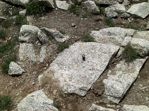
![Ibapah Spike]() This nail is what's remaining of the Ibapah Geodetic Spike in the center of the Shelter Cairn.
This nail is what's remaining of the Ibapah Geodetic Spike in the center of the Shelter Cairn.
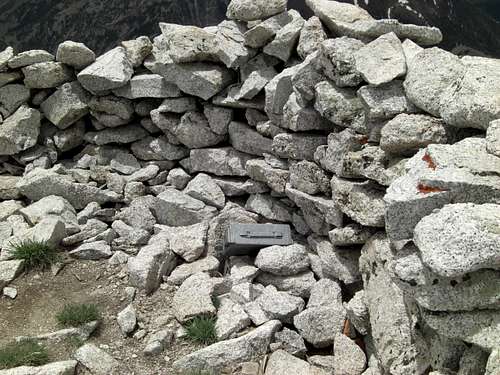
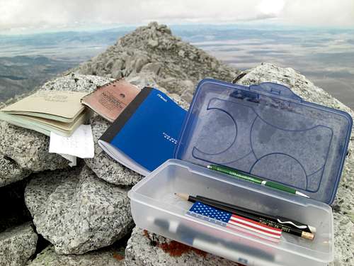
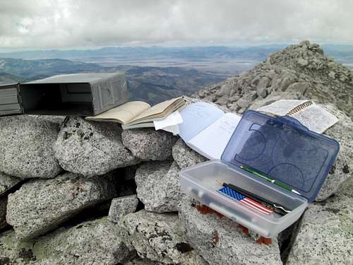
![Ibapah Register Case]() The Ammo-case housing the Ibapah Summit Register hidden in the wall of the Shelter Cairn.
The Ammo-case housing the Ibapah Summit Register hidden in the wall of the Shelter Cairn.
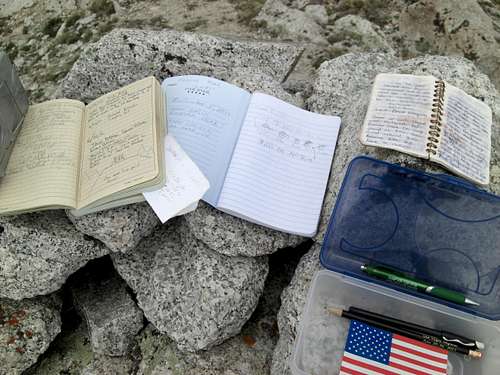
![Ibapah Register Logs]() Contents of the Ibapah Summit Register.
Contents of the Ibapah Summit Register.
![Ibapah Logs 2]() Contents of the Ibapah Summit Register.
Contents of the Ibapah Summit Register.
![Ibapah Register 3]() Reading through some of the Ibapah Summit Register logs, the prevalent theme was "What an incredibly grueling and awesome hike this was". Some, more poetic than others, using rhyme and lyric.
Reading through some of the Ibapah Summit Register logs, the prevalent theme was "What an incredibly grueling and awesome hike this was". Some, more poetic than others, using rhyme and lyric.
![Ibapah East Summit]() From the West-end of the Summit Block, looking East toward Ibapah Peak, revealing the shape and steep angles of the Summit Cone.
From the West-end of the Summit Block, looking East toward Ibapah Peak, revealing the shape and steep angles of the Summit Cone.
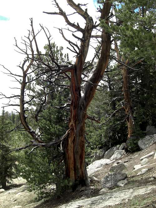
![Ibapah Peak Tree 1]() This hike had beauty abound, but the colors painting this tree on the way down were especially vibrant. Or maybe I was just both tired and elated! Bright Burnt-Sienna striations. The photo doesn't do it justice. You have to go see it. Thanks for viewing.
This hike had beauty abound, but the colors painting this tree on the way down were especially vibrant. Or maybe I was just both tired and elated! Bright Burnt-Sienna striations. The photo doesn't do it justice. You have to go see it. Thanks for viewing.


Comments
Post a Comment