Intro/Stats
Jacque Peak (13205’)- CO Rank 481
Tucker Mtn (12421’)- unranked
7 miles RT, 3280’ gain
Participants: Tom Hankiewicz, John and Renata Collard, Kevin Baker
Renata's Pics
Back on New Year’s Day this year Rob Stiner, Layne Bracy, and myself made an attempt at Jacque and were thwarted by a relentless steep snowshoe in deep sugar up the east slopes of Tucker. Upon reaching the ridge, we were spent and also were discouraged by the looks of the slopes leading up to Jacque’s n.e. ridge. It wasn't a good start to the year! I had a score to settle with Jacque, so I signed up for my friend John Collard’s CMC trip.
We all met at the same spot I started from last time, an unmarked road leading to the Climax mine on Hwy 91 north of Fremont Pass. This road is posted, so we decided to duck into the woods right off the bat and not follow the road. John and Renata started calling me Mr. Bluebird because it seems like every time I hike with them the weather is perfect. Looking back at my records, I have hiked with John and Renata 13 times and 10 of those hikes I would classify as bluebird days! Today would be no different as we started out at 7:42 to crystal clear skies and a temp of 32. I was worried about a monster posthole fest coming down though with temps this warm.
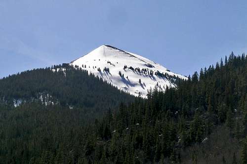
![Jacque Peak]() Jacque's sweeping s.e. ridge taken from Hwy 91.
Jacque's sweeping s.e. ridge taken from Hwy 91.Redemption on Jacque
Initially we were able to stay on top of the snow as we contoured above the road, but it didn’t take long before we were punching through. We strapped on the snowshoes and left them on all the way to the summit. We contoured s.w. to the south side of Tucker Gulch with a little willow bashing and some snowshoe tree belaying thrown in for good measure. I was having problems with my camera and after switching out the batteries numerous times I discovered that I forgot the memory card. Thanks to Renata for taking some pics.
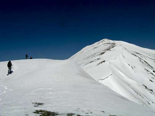
The s.e. ridge was much gentler than the more direct route I took up the east slopes of Tucker last time. We were able to stay on firm snow for the most part by staying in the shadows of the trees despite the skyrocketing temps. It was so warm I was able to hike in one layer most of the day. Upon reaching treeline at 11600’, we were surprised at just how bullet proof the snow was. It appeared that the most recent upslope storm was not very potent on the west side of the divide. There were some intimidating cornices on the ridge ahead as it bended to the north, so we hoped the west side would be blasted clean for safe passage.
![Impressive cornice on Jacque]() The impressive cornices on Jacque's s.e. ridge.
The impressive cornices on Jacque's s.e. ridge.
Ascending this sweeping ridge was beautiful as the views all around were amazing. Pacific to the east looked very striking, looking like a mini-Matterhorn cloaked in white. Tom led the way up the minor ups and downs along the ridge. He is training for Denali and was moving well. The cornices were very impressive, but there was plenty of room to avoid them. We topped out just a little after noon. The summit was very pleasant with a temp of 41 degrees. To compare this to my first attempt, it took us 4.5 hrs just to get to nearby Tucker Mtn, so the going was much easier.
![Jacque east face]() Cornices and a recent avy path on Jacque's east face.
Cornices and a recent avy path on Jacque's east face.Traverse to Tucker and Descent
John wanted to make this a loop hike so we could go over Tucker and it looked like the slope below the n.e. ridge had plenty of bare spots in case the snow was unstable. We left at 12:48 and got in a short glissade off the summit. The cornices were plentiful on this ridge too, so we stayed on the ridge until the slope mellowed out. This slope looks very steep from Tucker, but it wasn’t as steep as it looks. We took a break at the Tucker saddle and enjoyed the view back to the ridge we ascended.
![Crystal Peak from the west]() Crystal Pk dominates the eastern skyline on Tucker.
Crystal Pk dominates the eastern skyline on Tucker.
The gentle climb up Tucker went quick and we continued on to the false summit of Tucker where some of the extreme ski runs start. This route is not advised during the ski season or the ski patrol will bust you. I’m not sure how they could prosecute though, because this is national forest. We glissaded straight off the false summit of Tucker and plunge stepped down to treeline. I got a serious case of butt frost because I wasn’t wearing my waterproof pants today! We could see our glissade tracks on this slope all the way from the road.
![Glissade track on Tucker]() Our glissade tracks off the false summit of Tucker.
Our glissade tracks off the false summit of Tucker.
Descending the steep east slopes of Tucker in the trees wasn’t as bad as I expected. We ended up getting sucked into the Copper Creek drainage where things got a little annoying with the deadfall, but nothing too bad. We popped out at the beaver ponds at the gate. Tom and I forded the hidden ponds by crossing some beaver dams. We arrived back at the cars at 3:45, stoked to have enjoyed such a nice day with excellent snow to boot! This was a fine introduction to the Gore range for Tom, John, and I.


Comments
Post a Comment