Toggle navigation
Mountains
Routes
Images
Trip Reports
Forum
What's New
People
Areas & Ranges
Articles
Trailheads
Canyons
Huts & Campgrounds
Albums
Logistical Centers
Fact Sheets
Lists
Custom Objects
Gear
Plans & Partners
WELCOME TO SUMMITPOST
SIGN IN
REGISTER
Keller Mountain
Additional Parents
Image
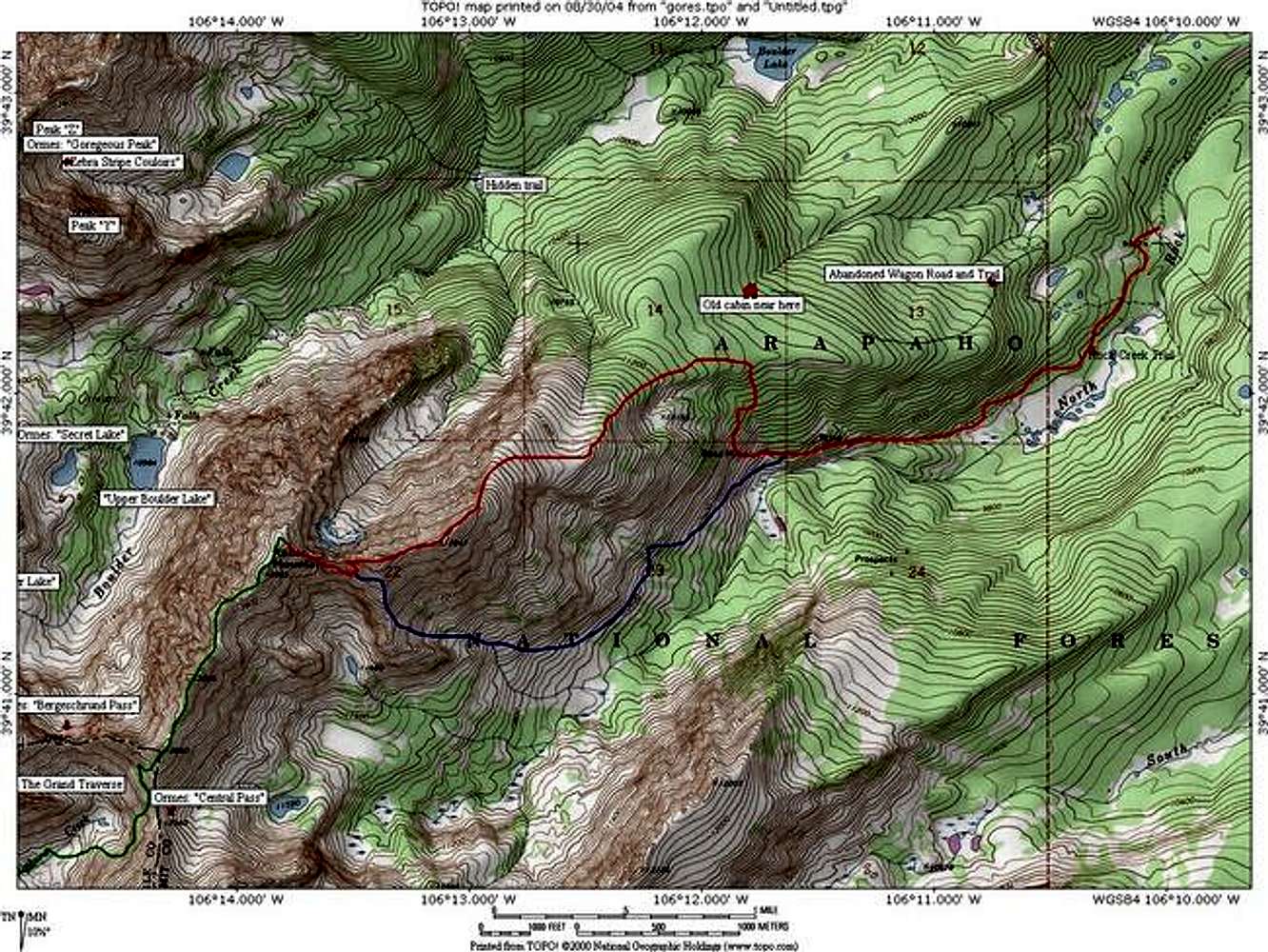
Keller Mountain Topo Map....
View High-Resolution Image
Keller Mountain Topo Map....
Keller Mountain
Topo Map. The red route is the 3rd class
East Ridge
, the blue is the 2+
Southwest Face
, and the green route is th
Bighorn Creek Traverse
. Software by National Geographic, Notations by Jon Bradford.
« PREV
NEXT »
JonBradford
on
Aug 31, 2004 12:49 am
Comments & voting
Other parents
Lat/Lon:
39.69000°N / 106.231°W
Image ID:
67538
3238 Hits
72.08
% Score
2
Votes
Log in to vote
Comments
No comments posted yet.
to post!
Don't have an account?
Keller Mountain
(Mountain/Rock)
« PREV
Viewing
#46 of 63
GALLERY
NEXT »
JonBradford's Image Gallery
« PREV
Viewing
#1268 of 1444
GALLERY
NEXT »
×
You need to login in order to vote!
User Name
Password
Remember me
Forgot your password?
Log me out when I close my browser.
Keep me logged in all the time.
sign in as a user
Don't have an account?
Register now for FREE
Rating available
Suggested routes for you
People who climb the same things as you
Comments Available
Create Albums
Register Here


