-
 1803 Hits
-
 72.08% Score
-
 2 Votes
|
|
Trip Report |
|---|---|
|
|
40.77675°N / 110.3728°W |
|
|
Download GPX » View Route on Map |
|
|
Jul 3, 2018 |
|
|
Hiking |
|
|
Summer |
Overview
This report will review a loop from the Swift Creek trail head, taking Kings Peak to Trail Rider Peak in the Uintas. Amazing panoramic views. Check. Wildlife. Check. Wicked wind and unstable rock on the ridge. CHECK. For years, I had wanted to climb Kings Peak, the tallest peak in Utah. In July, I found my chance during a time when my kids had a summer camp in Utah. I had two days to do it before I had to get back to July 4 activities with family and friends. For most people, Kings in two days would be no problem. It can be done in one solid day. However, I like to make things epic, and in this case, I decided to attempt the entire Kings to Emmons ridge in two days.
Day 1 (Jul 2): Drive to Swift Creek Trail Head
From Salt Lake City, the drive to the trail head is about three hours. For directions, Google your route to the Swift Creek Campground (map link
From SLC, take I-80 East. At Heber City, take I-40 East. At Duchesne, go north on UT-87. The paved road will wind north winding through farming country. There is not great signage to the Swift Creek Campground. You will take 20780W, and then take a right hand turn onto graded dirt roads via FR119 and FR124 to FR 125.
Day 1 (Jul 2): Hike to Base of Kings Peak
Late morning, I started my trek up the Swift Creek trail toward the base of Kings Peak on the west side. Taking the trail over Bluebell Pass to Milk Lake, I then went cross country about 4.5 miles to camp for the night at around 11,290’. The day total was almost 16 miles.
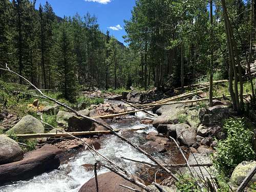
There is plenty of water throughout for you to filter water at stops and keep your pack light. I usually did not carry any water and took no more than a liter over the dry areas across ridges and the saddle at Bluebell pass. I use a 1 liter Smart Water bottle with a sport top and a Sawyer Squeeze. I carried collapsible water containers to fill up later for the Kings to Emmons ridge line the next day. All creeks on topos appeared to have running water.
From the trailhead, you will climb about 2,000’ to Deer Lake. The trail follows the ridgeline above Swift Creek and then drops down to the side of it. After Deer Lake, you will pass a number of other lakes on the route to Bluebell Pass, which is at about 11.6k’. I swam in one of the lakes - very chilly but refreshing!
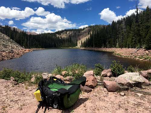
After crossing the pass and taking the trail to Milk Lake, which had a great looking emerald color, you will go cross country. In general, if you go too high in elevation, you will be in rocks. However, staying just above the tree line and below the rocks, you will be walking mostly grass. You will hear water run off everywhere coming from beneath the rocks along the slope. There may be some muddy areas to navigate but in general you can walk on dry ground or on the tundra.
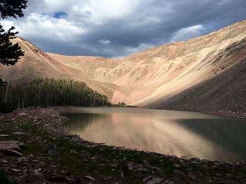
There is not a trail but you will find cairns in several places. They may be comforting to some, but do not fully depend on them. There are not enough to pick out a path the entire way. Many are huge and over 3-5’ tall.
If you want solitude, you are going to get it here. I did not see a single person the entire day. Be prepared and know your terrain. People do get lost. Several years ago, I helped out on two SAR searches in the Uintas: one adult was found, but for the second instance, the kid never was, unfortunately. (God bless, Garrett Bardsley)
Though this was my first time backpacking in the Uintas, I came prepared with prior study of the terrain, Gaia on my iPhone, plus a small backup charger, maps and compass. (I am a huge fan of Gaia. Put your phone on airplane mode and shut off notifications, etc. and you can go 2-4 days on one charge.)
During the last two miles, I walked on elk trails. Sure enough, I saw a herd of elk. The bull had the largest rack I have ever seen.
I went expecting a massive amount of mosquitos but hardly saw any the entire day or evening. My head net remained in a pocket the entire day.
Day 2 (Jul 3): Kings to Emmons Attempt
Up before sunrise, I found the Highline trail and took it to Anderson Pass. I saw a moose on the slope by the pass. From this point, the rocky scramble up Kings Peak began. I finally met a few people on the trip. All had started from the north at Henry’s Fork TH.
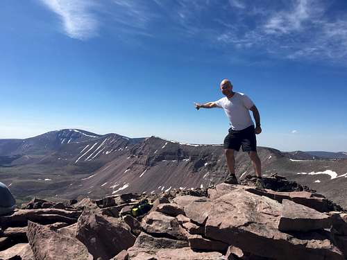
Kings Peak (13,528’) had an excellent 360 view. It also was the last time I saw anyone for 24 hours. I snapped a few photos and continued onward south along the ridge. I wanted to keep moving to be done with the ridge before the afternoon to decrease the risk of lightning strikes.
There was little snow but no trail. From then onwards on the ridge, I walked on rocks of all shapes and sizes. Many would move underfoot. There was some smaller sized scree, but most were 2’ and larger.
About 45 minutes after Kings Peak, which was very breezy, I finish scrambling up South Kings Peak (13,512’), which had steady wind. I continued to the “bump/peak” of Second Gemini (13,306’). By this time, the wind was blowing hard enough to push me down a couple of times and threw me against rock as I danced on the moving boulders underfoot.
Many people in trip reports I read said that they loved jumping on the spine of rock pillars in the pathway to Painters Peak (13,387’). These pillars were separated by cracks which varied from about 1-4’. I really was looking forward to this. However, with the wind, I did not dare because those columns were only about 3-4 feet wide and bordered a cliff on the east face. I did not have a death wish to be a human kite!
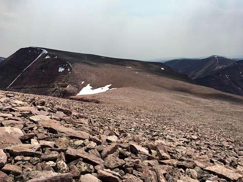
I stopped for a break in the saddle to Trail Rider peak (13,247’). The wind was really blowing here. Not sure how much, but holding a trekking pole by the strap, my pole was held just below horizontal (maybe 5-10 degrees) with gusts bringing it to horizontal. I also poured water around waist level into the air and the ground was wet about 10 large paces out. When I got out, I found out that gusts outside the below the Uintas reached 53 mph!
By this time, the adventure “lost its fun” for me. I think that the altitude was affecting me too (I live in San Diego). I had no headaches; I just felt really tired and was moving slower. I really wanted Emmons, but it was about 3pm. I figured that my path to Emmons was still going to be filled with rocky boulders, and at the rate I was going on those rocks and in the wind and in my condition, I would be picking my way in the dark up Emmons in the dark. I am comfortable hiking in the dark. (I did a lot of it two years ago when I did the L2H – Low to High, Badwater to Whitney.) But I was done mentally here!
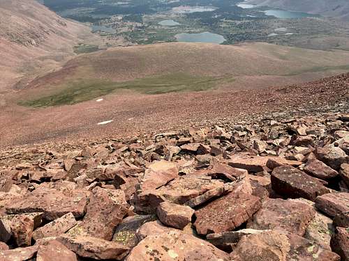
I managed to scale Trail Rider Peak and then had the “joy” of descending 2,000’ in a rock field. The thought crossed my mind that I better still keep my balance, because if something happens, who is going to find me? (I did not take a Spot on this trip though I did leave info on routes where I might bail out, of which this was one.) Trekking poles really did help here. Once I descended a bit, I also felt a lot better too from the effects of the altitude and started to regain energy.
I descended into the Timothy Lake basin, which was absolutely beautiful, and continued onwards. By 8pm, I decided to call it a day. Many deer were out in the meadow that evening.
Day 3 (Jul 4): Hike Out to Swift Creek Trail Head
Waking up before sunrise, I hiked the remaining 6 miles or so out. I was refreshed and felt great. There was ash everywhere on the trail from a nearby forest fire - in some places ash about every square inch.
Just before I got to the trail head, I met some locals on horseback – the first people I saw in 24 hours. They were going fishing, but with their gear on each of their horses and a spare pack horse for each rider, they were “packed for bear,” not like my meager kit.
In all, I hiked just short of 35 miles in less than 48 hours with 8,100’ elevation gain/loss. I saw some amazingly beautiful country with lakes and mountains and wildlife. I did not reach my goal, but darn it, I hiked several 13,000’ peaks! The highest in Utah!
Reflection
In reflection, this was really tough, but I am glad I did it. I was happy with my gear. I likely would carry a Spot with me if I did something like this again solo. It may have been better to set up a base camp by the lakes, and daypack the ridge loop in order to move faster and have a lower profile in the wind.
Climb on, - Mike Beames

