
-
 5489 Hits
-
 74.01% Score
-
 4 Votes
|
|
Mountain/Rock |
|---|---|
|
|
50.09859°N / 126.13958°W |
|
|
Hiking |
|
|
Spring, Summer, Fall |
|
|
5299 ft / 1615 m |
|
|
Overview
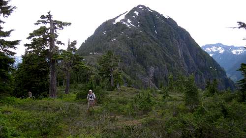
Kokummi Mountain E Aspect
Really little more than an alpine knoll, logging reaches far up the southern aspect of the mountain thereby ensuring convenient access to those seeking those views. The 2 km long east ridge is the most rewarding way to reach the summit even though the latter can be accessed more or less directly from the roads below. This means a little more bush and deadfall but is ultimately more enjoyable than what otherwise would be mostly a forest hike.
Getting There
Vancouver Island can be reached by air from eg Toronto, Vancouver, Seattle, Calgary or San Francisco to Victoria, Nanaimo, Comox or Campbell River and by ferry from Port Angeles to Victoria on The Coho and on BC Ferries from Vancouver to Victoria or Nanaimo. Public transport on the Island is notoriously poor and anyone arriving by air would be advised to rent a car.Although the initial approaches to Kokummi are on good gravel main line, you won’t be able to get up those convenient high roads without a high clearance vehicle with 4WD.
Approaches
Approach the mountain from the south on the Inland Island Highway 19 from Victoria or Nanaimo.Drive Highway 19 north of Campbell River to Sayward Junction. At the junction turn left to access the White River mainline. This can be a little confusing. After turning off the Island Highway keep straight and cross the White River. At the now-closed gas station turn right again and after a further 400m right again. In 150m turn left uphill onto White River Main.
Drive the wide, well surfaced gravel – watching out for logging trucks – about 28 km and find Moakwa Main on the right. Drive up Moakwa Main for about 3 km to spur MC12 on the left. Many of the MC designated spurs off the main line have been deactivated and blocked. MC 12 is the first or second of the driveable roads you come to.
Switch to 4WD and drive up MC 12 as it winds its way across the foot of the south ridge and across the south face of the mountain. We explored the road right to the end before settling on a camp/start point at 9 U 706498 5553260 right by a patch of new second growth with the south ridge only 90 vertical metres above. This spot also offered superb views of Victoria and Warden to the south.
Alternatively, drive 10 km past Sayward Junction and, just after Keta Lake, find Adam South Main on the left. Turn here and in 200-300m keep left. Drive the road ~32 km along the Adam River, through Schoen Lake Park and into the Moakwa Creek valley where, by this point, the road is designated “Gerald Main”. This leads directly to Moakwa Main. Drive up MC12 according to the directions above. This is a longer but more scenic approach.
Route
From the start point thrash up through the new growth to the low point on the ridge above. Unfortunately the saddle is choked with deadfall and quite a bit of over and under is required as you head west towards the old growth. Once there a steep bushy section awaits you. Make your best route up this – we favoured the right hand side – and emerge on the wonderful open east ridge with the summit in full view.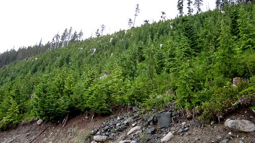 Kokummi Mountain Start Point | 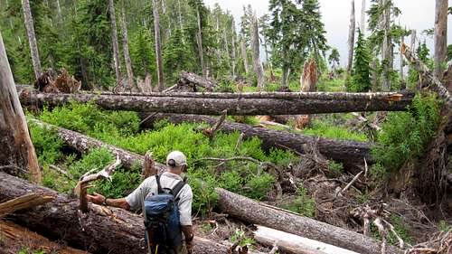 Kokummi Lower East Ridge | 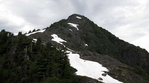 Kokummi Upper East Ridge | 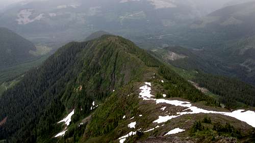 Kokummi Mountain E Ridge |
Route numbers:
Distance: 5.5 km return
Elevation: 520 metres net, 600 total
Time: ~3.5 hours up, ~2.5 hours down
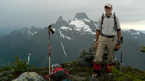 Kokummi Summit View S | 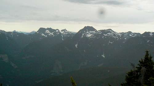 Kokummi Summit View W |
Red Tape/Safety Considerations
None.As always, make sure that you have left a detailed trip plan with someone responsible. The RCMP and the appropriate SAR agency will respond in an emergency but it is up to you to have the mechanism in place that will initiate the call-out process if it becomes necessary.
There is limited cellphone coverage once on the open east ridge.
Camping
Excellent car camping on MN12 right at the start point with great views of Victoria and Warden. There is no water available so haul a barrel in with you.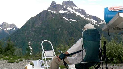 Movie Night on Kokummi Mountain |
Useful Links
For route information refer to Island Alpine – A Guide to The Mountains of Strathcona Park and Vancouver Island, Philip Stone, Wild Isle Publications, 2003, ISBN 0-9680766-5-3For precise directions get hold of a copy of Backroad Mapbook. Volume 7: Vancouver Island