
-
 4088 Hits
-
 72.08% Score
-
 2 Votes
|
|
Route |
|---|---|
|
|
46.85062°N / 10.59050°E |
|
|
Hiking |
|
|
Spring, Summer, Fall, Winter |
|
|
Most of a day |
|
|
Hike and Scramble |
|
|
Overview
 The final ascent along the west ridge and face The final ascent along the west ridge and face |
This certainly is not the direct route to the summit of Wölfeleskopf. Neither is it the complete panoramic hiking trail "Langtauferer Höhenweg". However, it might be considered the finest route to climb one of the easier summits of the Nauderer Berge Subgroup of the Ötztal Alps. In the end you can exchange Mataunkopf or Großer Schafskopf for Wölfeleskopf and you'll get basically the same route description.
Langtauferer Höhenweg runs along the south slopes of the Nauderer Berge subgroup, starting at Graun / Curon Venosta, where Laungtauferer Tal ends and ending at Weißseejoch at the very end of the valley. Usually hikers start at Melag, the last of the villages in the valley, quickly climb towards the high route through Melager Tal and then hike out keeping an elevation of between 2500m and 2700m. But make no mistake: the relief of the terrain is mixed - you have to ascend and descend quite a lot.
The part of the trail covered here, describes about two thirds of the overall trail, which can be hiked in 9 - 11h. We took about 6h to reach Wölfeleskopf without making too many or too long breaks.
Getting There
 Nauderer Henessiegelspitze
 See the main page for the directions to Langtauferer Tal. Melag is at the very end of the valley and has a big parking lot.
Route Description
 Wölfeleskopf from south-west
- Start altitude: 1898m
- Summit altitude: 2894m
- Prevailing exposure: S
- Type: Hike and Scramble
- Protection: None
Follow the road to the very end of the parking lot. Here, on the right hand side a path leads back up between two fences until you reach a small (beginners) ski lift. Here a route from Wies joins, both routes now turning north-eastward and heading fror Melagtal, the valley of Melagbach, after which the village has been named. For 1 1/2h a path leads along the creek towards the end of the valley gradually turning more and more eastward. At the end of these 90min you find yourself at the beginning (or end) of Langtauferer Höhenweg. The trail is marked with a big 7. (As an alternative you can hike the trail in easterly direction until you reach Weißseejoch. However,, the route into this saddle is very steep and covered by huge amounts of scree.)
Turn left (west) onto the panoramic trail. Heading up and down but basically keeping the elevation it follows the terrain, often circumnavigating spurs and ridges, which come down from the mountains. The first part is set back a little and stays away from Langtauferer Tal. Instead it navigates underneath the peaks collectively called Hennesiegelspitzen, the most impressive of which is Glockhäuser. A ridge, consisting of Melager Schwarzwand and Schwarzer Schragen, bars the way and needs to be passed on the outside. At the apex you first encounter views of the Weißkugelkamm Ridge, which won't leave you for the rest of the day.
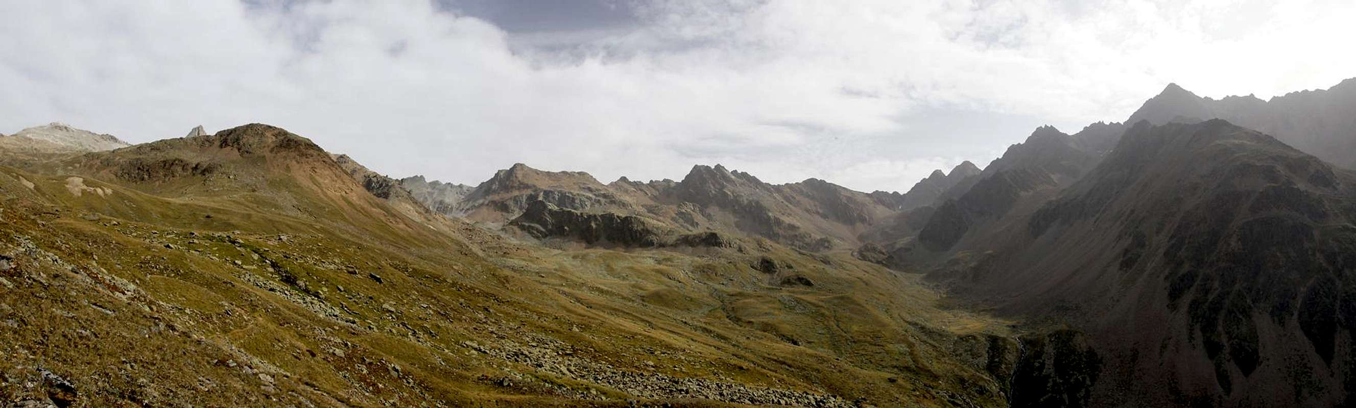  |
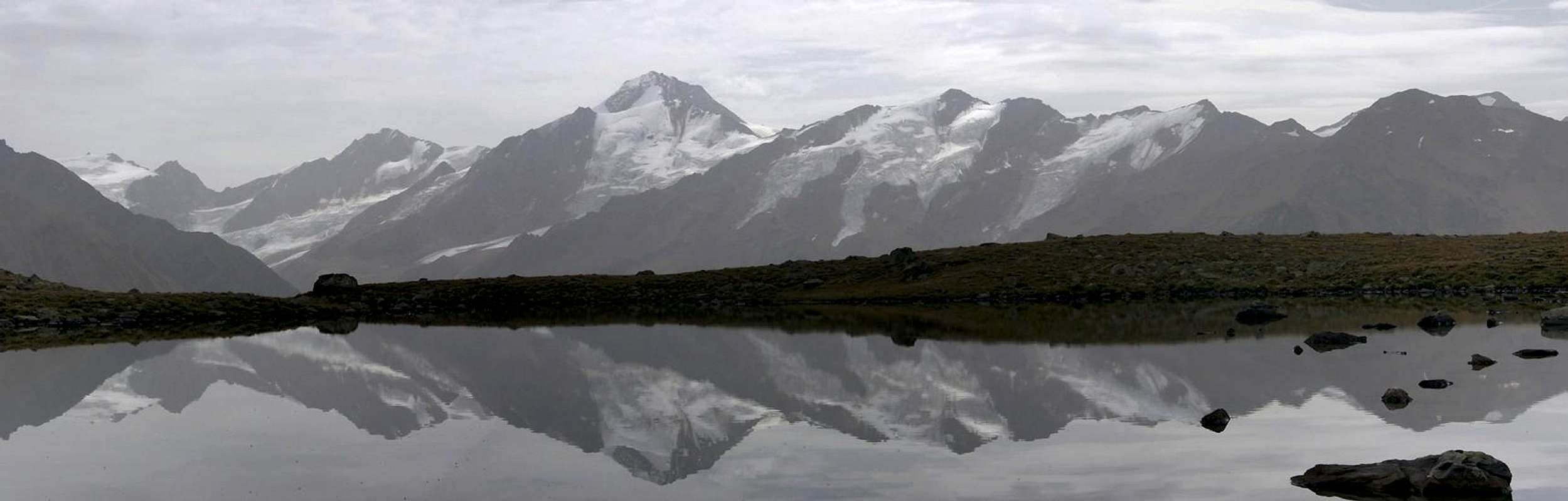
The next stage ends at Äußere Schafbergalm, a mountain farm, set a little below the hiking trail. Here you have the first opportunity to leave the panoramic trail and descend towards Wies. The following stage climbs to roughly 2800m, crossing another ridge through a little pronounced saddle. After passing another barrier you head down into Matscher Winkel, a bowl shaped meadow, in the centre of which you find the Schwemmsee Lakes, which in calm weather offer good mirrors for the observation of Weißkugelkamm.
 |
Right behind the lakes a path turns northward for Tscheier Schartl, the first of the passes through the Nauderer Berge Main Ridge. Head onwards and after some 30 minutes you''ll reach an old military barracks, which has been reused as stable but which has fallen into ruin meanwhile. Here another descent route heads down from the panoramic trail and heads for Geschwell.
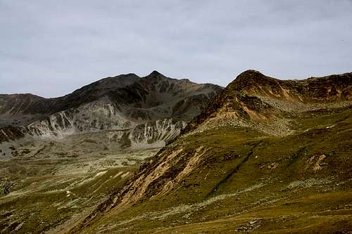
 Glockhauser Glockhauser | 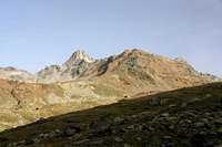 Hennessiegelspitzen Hennessiegelspitzen | 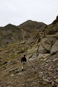 Wölfeleskopf Wölfeleskopf |
Another half hour takes you to the path to Wölfelesjoch, a saddle from which both Großer Schafkopf and Wölfeleskopf can be climbed. If yoou head on, another ridge needs to be climbed, finally leading to the path to Saletzjoch, which serves as base for the climbs of Wölfeleskopf and Mataunkopf. The path is cobbled at first but once it gets steeper it is pretty worn. Marmots have dug their holes right between the switchbacks so that climbing the path actually requires some concentration. Finally you head out into Saletzjoch to admire the views towards the north.
The final stage now leads eastward in direction of Wölfeleskopf. Head for a spot a little south of the west ridge of the mountain. Here a path heads onto the ridge, follows it for some 50m, before traversing out into the west face of the mountain. Another 50m higher the path turns back, now heading almost directly for the summit. A few turns and you are on top.
Essential Gear
Hiking gear and due to the length of the route, ample amount of food and drink. The main ridge is one of Europe's main weather divides and thanks to the low Reschenpass / Passo di Resia, you can encounter quickly changing conditions. Be sure to bring full high altitude mountaineering equipment.We were chased down the mountain by a fierce thunderstorm, which had been forecasted so we were prepared.