
|
|
Route |
|---|---|
|
|
38.76210°N / 78.2739°W |
|
|
Hike/Scramble |
|
|
Half a day |
|
|
Walk-up |
|
|
Overview
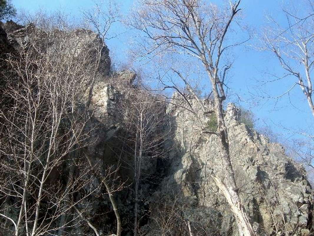
Little Devils Staircase is one of the most fun hikes in the entire Shenandoah National Park, with about twenty stream crossings and over thirty waterfalls. The steep section of the hike climbs 1,000 feet in less than a mile and Hogback Mountain itself rises over 2,100 feet from the trailhead. At the top of Little Devils Staircase, there are several options for hiking to the summit of Hogback Mountain, the shortest being about 7.5 miles round trip.
Approach
Use the same approach as on the main page, except get off Route 211 about 3 miles East of Sperryville. Take a right on to SR 622. Follow SR 622 about 2 miles to a left turn on SR 614, which is also called Keyser Run Road. Follow SR 614 for about 3 miles and you will come to a small parking area that is clearly marked as Shenandoah National Park property, and there are several parking spaces. The Little Devils Staircase trail begins on the right side of the parking lot next to a trailhead sign.
Route Description - Ascent
The trail meanders around for ½ mile until the real climbing starts. Follow the blue blazes up rocks, stream crossings, and waterfalls. After about 40 minutes, the trail will leave the rock climbing and level off a little bit. Several minutes later you will hit a fire road, and an intersection called Fourway at 2680’(this is about two miles from the start of the trail).
To reach Hogback from Fourway, you have a couple of options:
Option 1: Take a right, and go up the fire road for 1 mile. You will come to Skyline Drive. Go straight towards the Appalachian Trail, and take a left. Head up the trail for about 1.3 miles until you reach the summit of Hogback Mountain. Total distance to summit from the trailhead: 3.5 miles
Option 2: Go straight and follow the blue blazes. You will now be on the Pole Bridge Link Trail. About ¾ mile up the trail, take a right on the Hogback Trail (also known as the Sugarloaf Trail), and take it about 1 mile up to the Appalachian Trail. Take a right (North) on the AT, and you will cross Skyline Drive. In about another ¼ mile you will reach the summit of Hogback Mountain (unfortunately marked by a small building near an energy tower). You can walk around the building to take a photo and get a small view. Total distance to summit from the trailhead: 4 miles
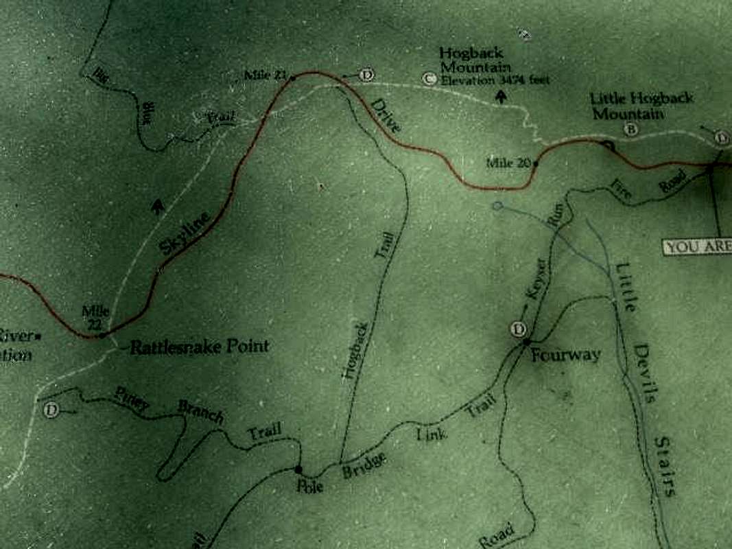
FOURWAY is to the right on the map, Hogback Mountain at the top-center (C)
 |  |  |
Route Description - Descent
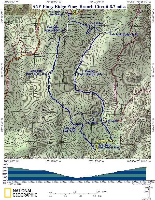
There are multiple trails in this area, and a trail map will enable you to do a variety of hikes. However, for hikers who wish to do no more than 8-10 miles here are the two descent options that will give you under 10 miles round trip:
Option 1: Head back down the Hogback Trail and take the Pole Bridge Link Trail back to Fourway. This is especially a good way to go if you have taken the fire road up, because you will be making a loop out of the top part of the hike. Take Little Devils Staircase back down, but be careful with your footing because the route down can be steep and slippery. Also be aware that at the top portion of the descent down Little Devils Staircase the blue blazes are less frequent than one might desire, so be aware of the trail so you don’t get lost. Total round trip hiking distance 7.5-8 miles
Option 2 Head back down the Hogback Trail, and take the Pole Bridge Link Trail back to Fourway. Instead of taking Little Devils Staircase, head down the fire road for 3.7 miles back to the trailhead. This is a safer way to go if the Little Devils Staircase is slippery, or it is raining. Total round trip hiking distance 9-9.5 miles
Longer Hike Option
This is one of the long options, and will likely exceed 12 miles. Take the Hogback Trail back down to the Pole Bridge Link Trail, but instead of taking a left back to Fourway, take a right on Pole Bridge Link, and hike for about ½ mile to the Piney Branch Trail. Take a left on Piney Branch and head down for about 4 miles until you reach a road - (benchmark 1417 on topo maps). Take a left up the road, and continue back to the trailhead. On the way will be some uphill hiking, and you will pass a cemetary. I would bring a topo map, or an area trail map to hike this option. There are plenty of trails around here, and a map is needed to explore this area effectively.
Essential Gear
Hiking shoes and lots of water. It is better to hike this in the early spring before the trail gets overgrown. Winter is also a good time to hike, but only if temperatures are mild, and there isn't too much snow on the trail.
Thanks!
Thanks to Adventurer and Buz Groshong for their help with these directions.