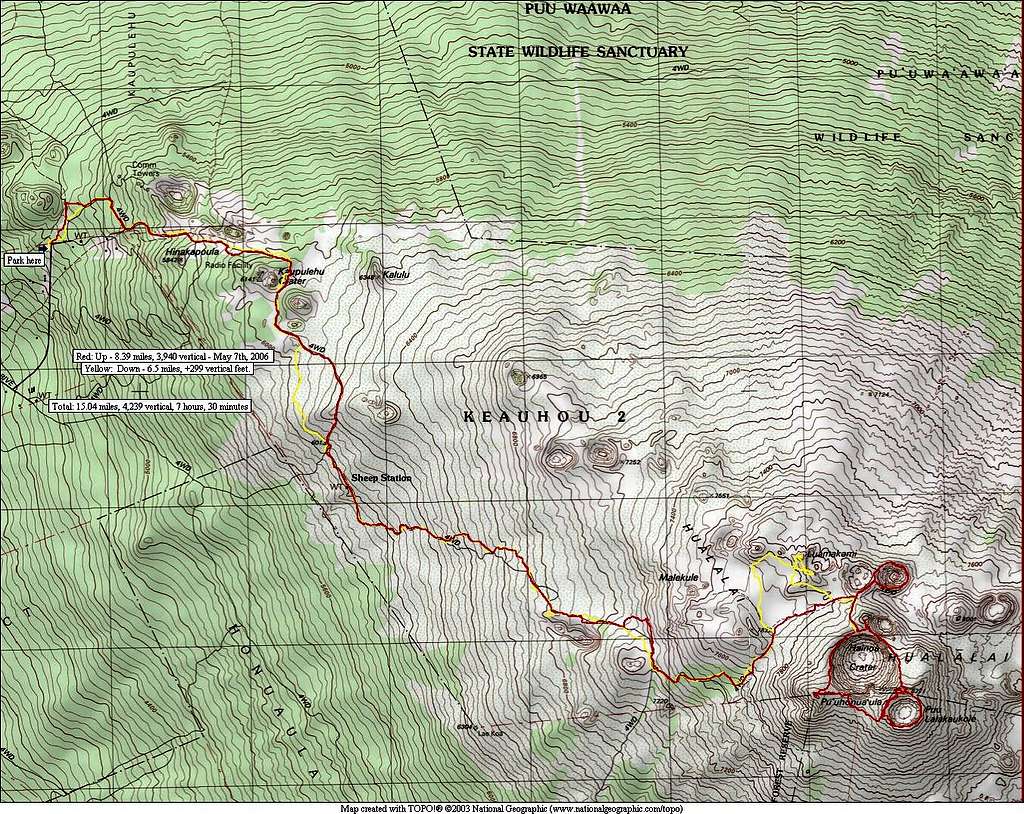
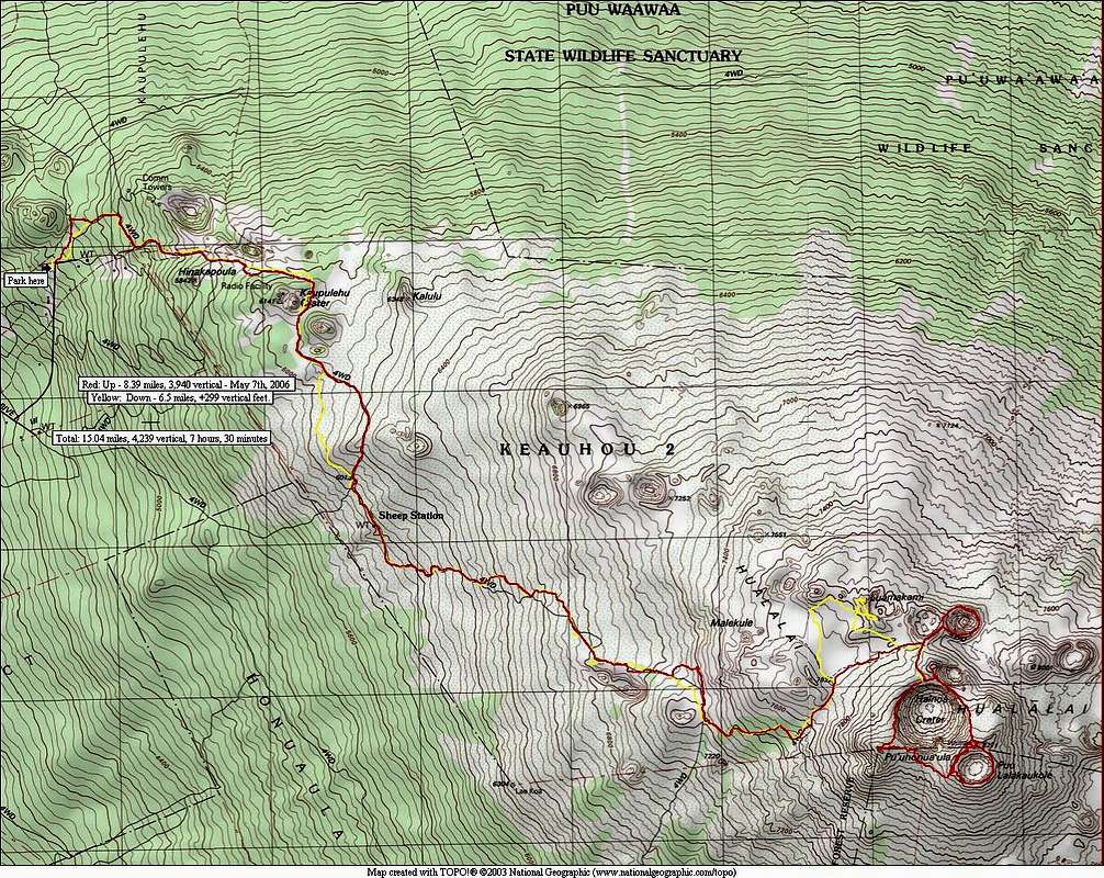
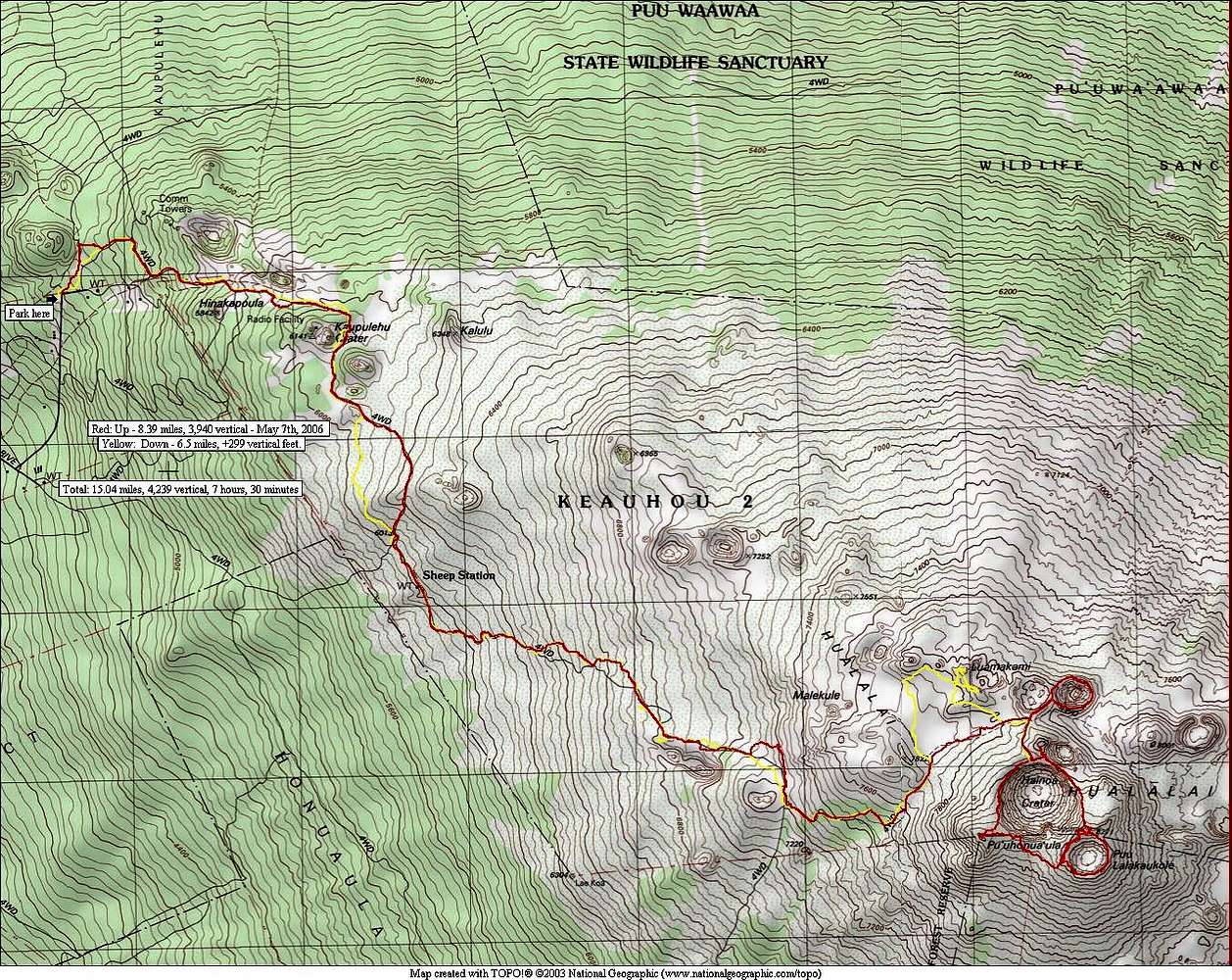
Map of a route to the summit.
GPS derived map of my trip in May '05. A GPS is a good idea in this terrain as disorienting and very dense fog and clouds occur almost every day on the upper slopes of the peak. It's a tropical thing! Red on the map is my route up and yellow is my route down. The summit terrain is mostly unencumbered by vegetation so one can wander at will.


