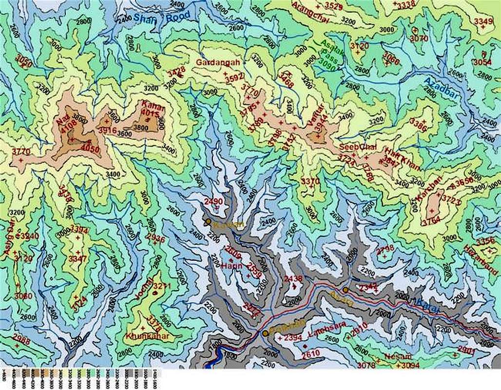
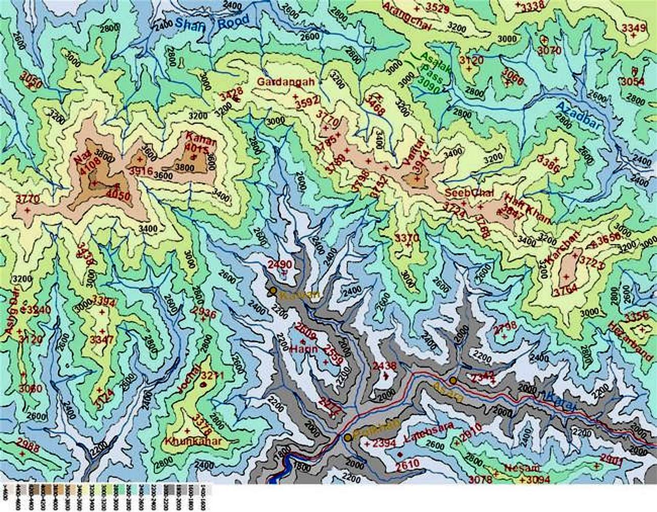
Map of Naz/Kahar area peaks created by me based on the 1:50 000 maps and colorized by
Nomad. This map is to scale and covers an area 26 Km (E-W) by 19 Km (N-S).
Zoom out to Map of Central Alborz. The tail end of the lake behind Karaj (Amir Kabir) Dam seen at the bottom of the map.


