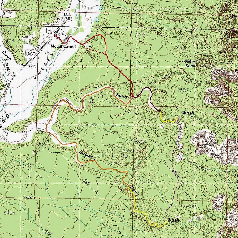
- The Dark orange is the access walk from the highway to Sand Wash, with a dashed line shown for an alternate variation
- The burgundy color is the approach to the Upper Cave along Sand Wash
- The lighter orange is the approach to the Lower Cave along Sand Wash and then Lower Sand Wash.
- The Dashed lighter orange is the bypass of the steep drops within Lower Red Cave
- The Yellow is represents the slot canyons. The Lower Canyon is not a continuous deep slot this entire length.
- The Dashed Purple is a route that can be used to make a loop of a bit over 7 miles to both canyons.


