

|
|
Mountain/Rock |
|---|---|
|
|
46.85115°N / 9.72365°E |
|
|
Hiking |
|
|
Summer |
|
|
8071 ft / 2460 m |
|
|
Overview
The Mattjisch Horn is a typicall mountain to do if you wake-up late after a night out and still want to do something nice.It's perfect for daytrips in summer and also makes a very nice skitouring mountain in winter. Because it is easy approachable it's very popular in summer and winter, never really crowded though.
Getting There
The Mattjisch Horn is located in the narrow "Schanfigg Valley" east of Chur, the capital of canton Grisons.You can reach the starting village "Langwies" either by car or the Grisons Railways. (the red trains)
If you want to get there by car you have to get to Chur first. Drive to the city center and follow the blue signs "AROSA". These will lead you into the Schanfigg Valley, where Langwies is located. The road to Langwies is very picturesque with lots of switchbacks. It will take you about 30-40 minutes by car from Chur. Watch out in winter, the road is often icy and slippery when it has snowed. You can park your car at the local trainstation in Langwies where it has some parking lots. Make sure you pay the parking fee. As always in Switzerland, you will be ticketed if you don't do so.
Going to Langwies by train is also a very good option. Take the red RhB (Raetian Railways) train leaving from the trainstation ich Chur, direction Arosa. Make sure it stops in Langwies since there are some direct trains to Arosa. The trainride will take about 45 minutes.
The trail to the Mattjisch Horn starts right at the trainstation
The Mattjisch Horn
Hiking Option:Follow the street behind the trainstation to the church. Pass the church to the left and then you will see the yellow trail signs which give you dirctions to the Mattjisch Horn. Follow the mountainroad (only access for locals and farmers) until a "Höhrüfi" (elevation 1673 meters) where a gravel road leads to the left. Follow this gravel road in the woods. You will do some switchbacks. You in the upper sections of this road you will see some wooden avalanche protectors.
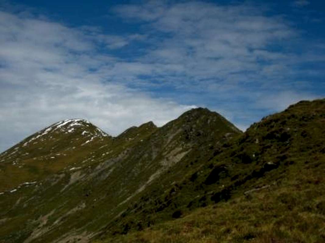
After the switchbacks you will get out of the woods and continue only on grasshills. Follow now the white-red-white trail markers which will lead N up to the "Blackter Fuerggli". There is a pile of stones which mark this little summit (elevation 2212 meters). From here you have a clear view to the "Blackter Flue" ridge which leads to the Mattjisch Horn, where also the highest point of this ridge is.
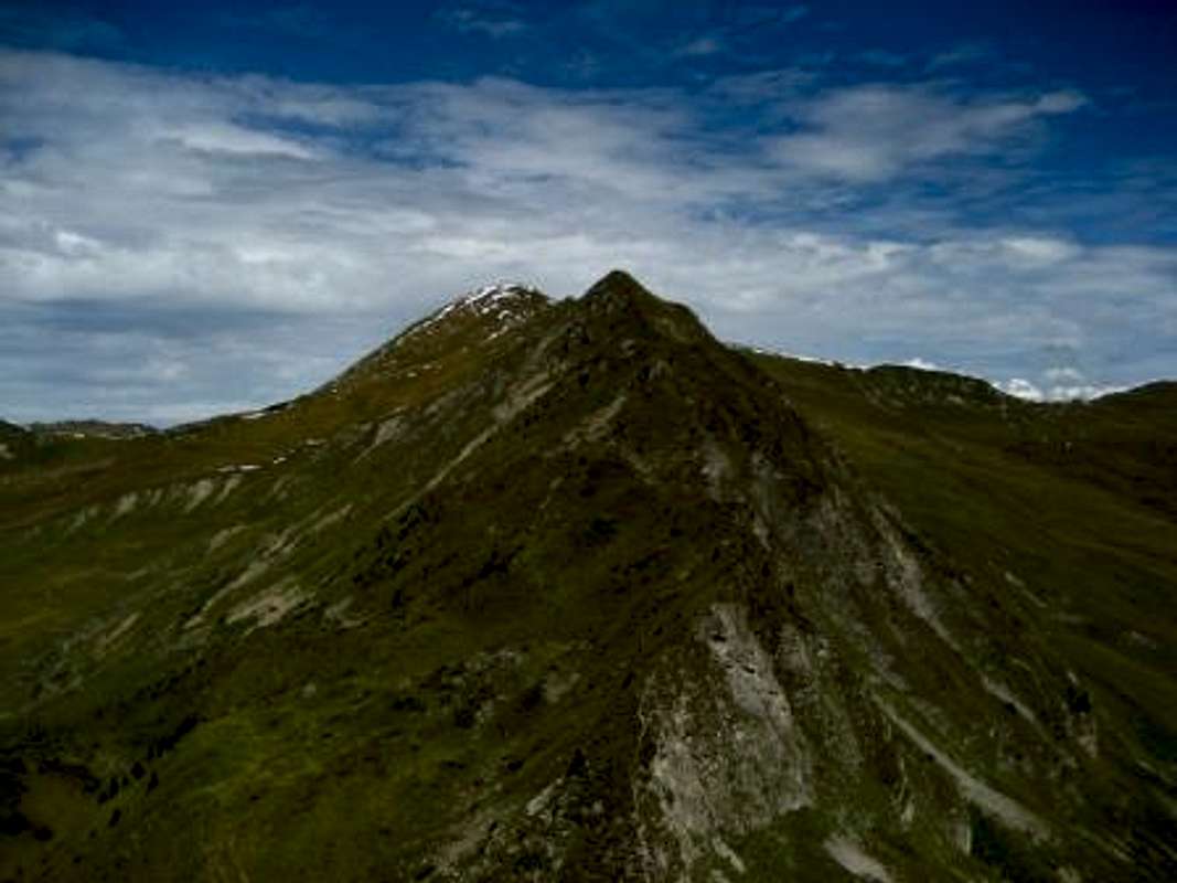
From the Blackter Fuerggli, descend hundred meters down to the north where you get to a little nameless pass (elevation: 2141 meters)a. Continue the trail to the north all the way up the ridge over Blackter Flue and Wit Furgga to the Mattjisch Horn.
You can either descend through the ascent route or descent the Mattjisch Horn to the NW until point 2277 meters. Turn SW until the trail goes S all the way down to a Ski hut called "Pirigen" (elevation 1773 meters). Follow then again the white-red-white trail markers trough the forest. At the end of the forest you will get to a paved mountain road which you follow to the E. Shortly after you see Langwies, the village where you started.
You can also do the tour the other way around, no problem at all.
This tour is very nice during summer since you have a great view over the whole Schanfigg valley. The tour is not very hard but requires good condition. The roundtour will take about 4-6 hours.
Skiing Option
The best skitouring route follows pretty much the same as the hiking route. To be precise, for the ski tour you follow the descent route but all the way up. The skiing ascent will take about 3 hours. (one way)
Sking down you can either do by taking the ascent route or trough the E face of the Mattjisch Horn. Pass the Ski hut "Casana" all the way down SE until you reach the mountainroad which leads back to Langwies. You could also ascent the summit trough this route, critics say it is a little bit boring since there is no big variation on the trail.
On the summit you will see the Praettigau Valley to the N, the Merderger Flue to the S and the Montalin Group the the W.
Useful information and links
Maps:Swiss Topo Maps 1:25'000 Number 1196 "Arosa" and
the Skitouring Map Number 248 S "Praettigau".
Public Transportation:
Transport
also in English (for trains and busses)
Raetia Railways:
RhB
also in English
Weather:
Meteo
also in English
Avalanche Report:
Avalanche
Mountain Rescue:
Telephone Nr: 1414 (free number diable from every phone and cellphone)
Red Tape
Camping is not forbidden in the area but makes no real sense, since the routes are well doable in a day.Parking is available in Langwies, do not drive the forestry road since it's only for forestry service and locals. You will get a fine if your park along the road.
Permit for the mountain is not required.