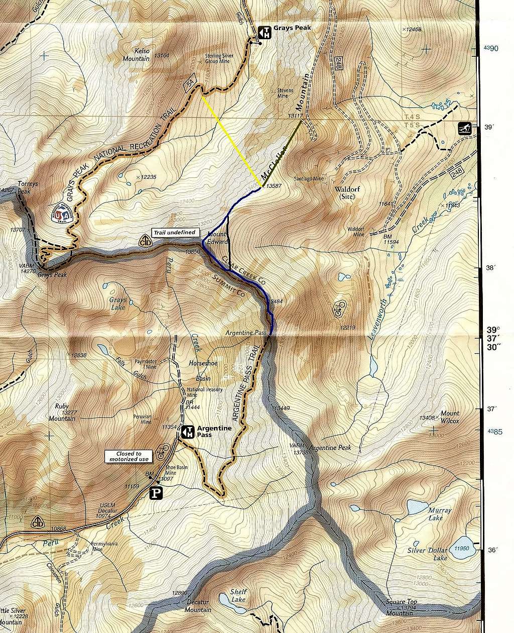
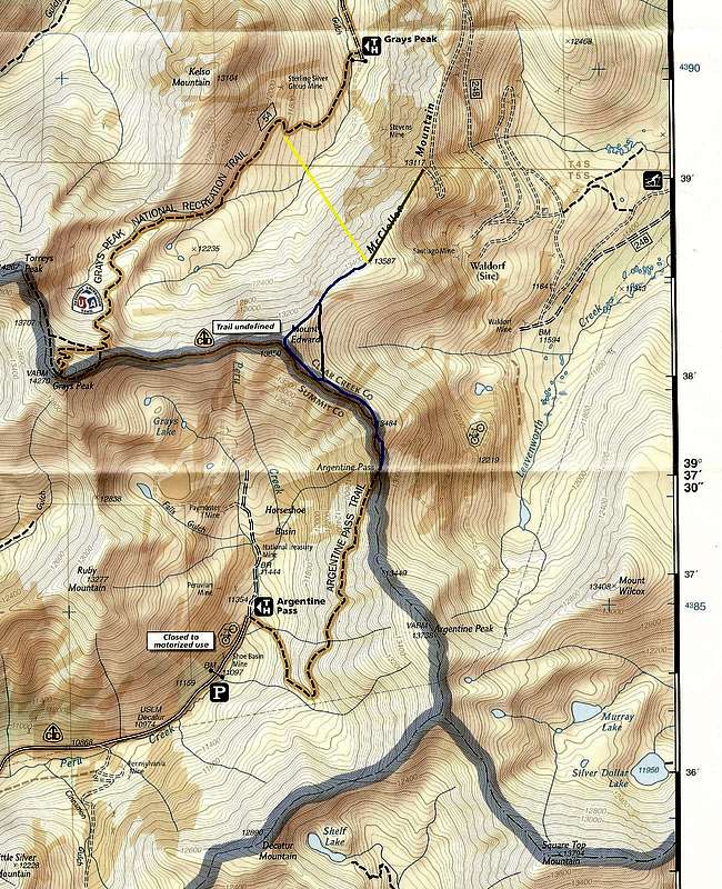
McClellan Mountain-- Routes
Please enlarge (click twice) for better detail.
Yellow-- scrambling route from Stevens Gulch (at least Class 3 on very loose rock). This diagram only approximates direction and location; the actual route will depend upon conditions and the climber.
Red-- from end of McClellan Mountain 4WD road (Class 2).
Blue-- from Argentine Pass via Mount Edwards (Class 2). The BLACK variation is shorter and more direct but has awkward, though not difficult, footing due to sidehilling.
This is a scan of part of the Trails Illustrated map for Idaho Springs, Georgetown, and Loveland Pass.


