-
 1456 Hits
-
 75.81% Score
-
 6 Votes
|
|
Mountain/Rock |
|---|---|
|
|
49.23363°N / 20.98955°E |
|
|
Hiking, Mountaineering |
|
|
Spring, Summer, Fall, Winter |
|
|
3796 ft / 1157 m |
|
|
Overview
The highest peak of the Čergov (Góry Czerchowskie) in eastern Slovakia. It rises in the north-west of this mountain group. The top is covered with a vast clearing. The Topľi spring rises on the eastern slopes of the mountain. At the top there is a reinforced concrete obelisk, erected in the first half of the 1930s as one of the seventeen main points of the Czechoslovakian triangulation network. The commemorative plaque commemorates the 26th rally of Slovak tourists in 1979.
The peak itself and a large part of the ridges in its immediate vicinity include the Čergovský Minčol nature reserve.
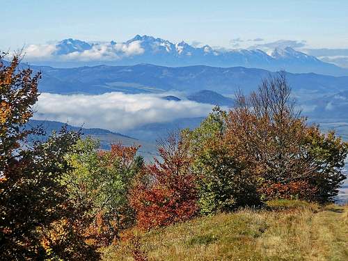
There is a wide panoramic view from Minčol and its ridge to the top of Łazy. The widest views are from an unnamed peak with a cross between Minčol and Lazy.

Getting There
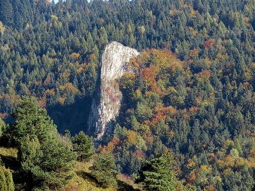
There are many trails leading to the summit. Each of the is easy hike, I think the most interestina ia a trail from Kamenica - by the way you cas visit also ruins of Kamenica Castle and picturesque Rock - Sokolova Skala.

Route
- the shortest trail - From Livovska Huta - yellow label - about 1,5 h
- from Kyjov - blue label - about 2 h
- from Kamenica - green label - abo 2,5 h
Long hikes - 3-4 hours
- from Šarišské Jastrabie - yellow label
- from Čirč - green and yellow label
- from Ruska Vola - blue and red label
I recommend using map applications because the trails are not very precisely marked.
Red Tape
No special restriction here
When to Climb
All year long
Camping
The best way to stay overnight is in a tent.
Small chalet under Minčol - you need to contact the local tourist company.
You can rent accommodation in the surrounding villages.
External Links
http://naszczytach.cba.pl/geografia-linki/

