
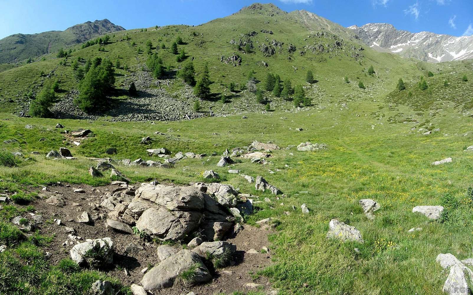
Missing signs at an important junction
Only the base of a signpost is still visible in the rocks, but that's all. One clear trail leads up to this point from the south. It's right at the tree line, just above 2200m.
Without signs, it would be easy to go wrong here.
At first turning only slightly to the right here, trail 10A continues to go up, into the valley on the right side of the grassy ridge in the center. Gently at first, steeper later on. It leads to the Kirchbachkreuz (2951m), a minor summit on the Gfallwand south ridge. The ridge in fact splits in two branches there, to the south and to the southwest respectively. A trail follows the south branch back down to the valley.
Trail 9 makes a sharp turn to the left at this junction, but starts turning right soon. It heads up the valley on the left side of the grassy ridge in the center and leads to the Ginggljoch saddle (2936m). On the other side is the Lafaistal valley, and if you desend that way, you eventually get to the Lodner Hütte (2259m).
The problem with the missing signs is that, at the junction, trail 10A is clearly visible, but trail 9 is not. So, if you don't notice that this is the junction, you could easily continue on trail 10A, and it could take a long time before you realize your mistake.
16 July 2013.


