
|
|
Route |
|---|---|
|
|
45.98792°N / 10.89715°E |
|
|
Hiking |
|
|
Spring, Summer, Fall |
|
|
Half a day |
|
|
EE |
|
|
Overview
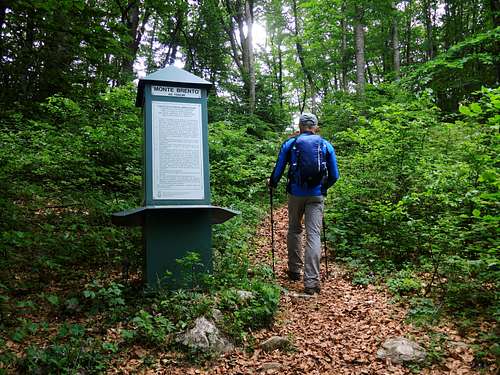
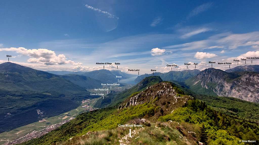
Monte Brento loop from Marcarie
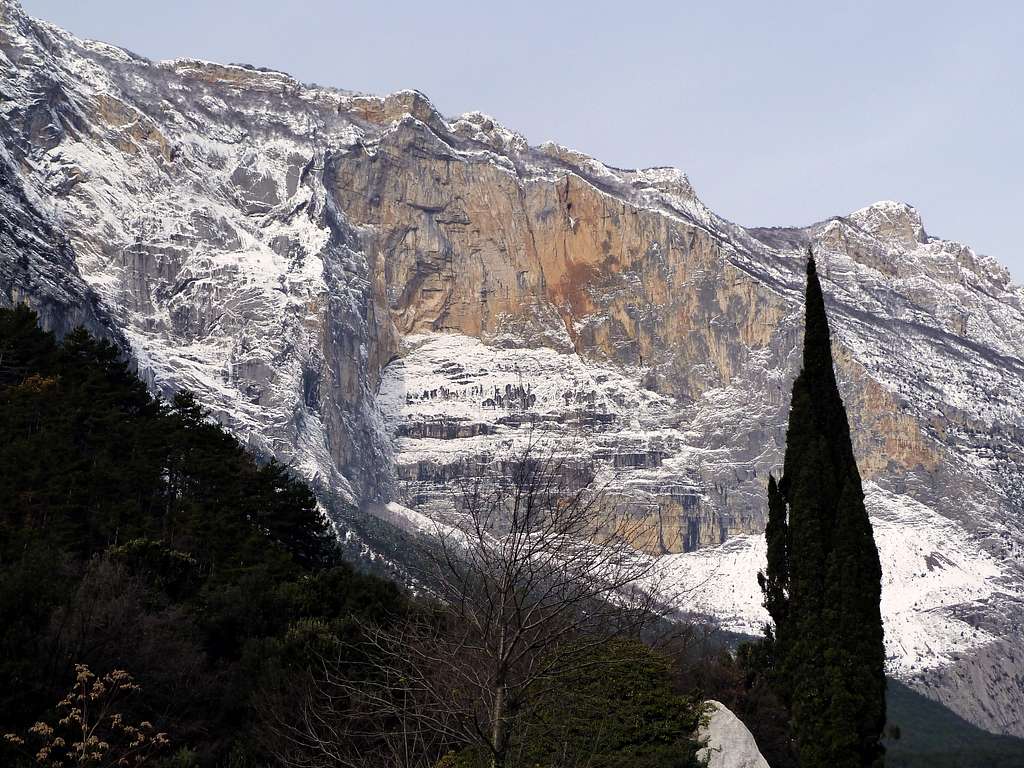
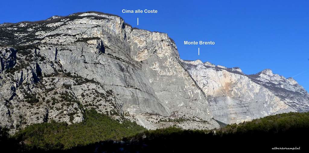
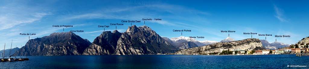
Monte Brento 1545 m is an extraordinary mountain with a double face. It is located in the Casale chain, between the Giudicarie Valleys and the Sarca Valley. On the East side it falls overlooking the Sarca Valley with a very high and spectacular wall at times overhanging. Numerous multipitches over 1000 meters long have been climbed on this wall. Due to this conformation, the Becco dell'Aquila, a rocky protrusion on the summit ridge of the mountain, has become famous all over the world because it is very popular with the Base jumpers, who from here launch for over 1000 meters landing in the Sarca valley.
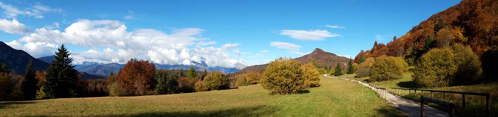
On the opposite side the Brento looks like another mountain! In fact this side is wooded and grassy and this conformation allows a rather simple and not demanding itinerary to reach the spectacular and panoramic summit. Rocky and prohibitive when viewed from the Sarca Valley, Monte Brento is quite wooded and easy when approached from its long wooded shoulder that looks towards the Giudicarie Valleys.
Getting There
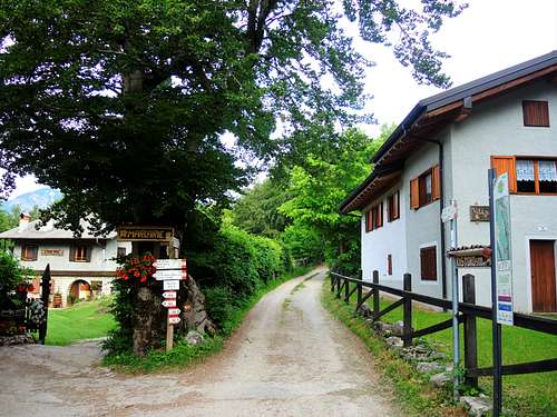
The reference point to start the road approach is Varignano, a hamlet of Arco.
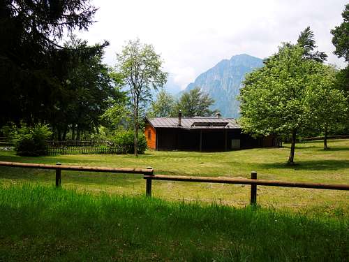
Coming from Verona Arco can be reached driving on the Autobrennero A22 motorway (exit Rovereto Sud/Lago di garda Nord), then along the SS 240 state road. Coming from Trento along the SS 45/bis. Coming from the Southern/Lake Garda along the SS 249 (Eastern Gardesana) or along the SS45bis (Western Gardesana). Once in Varignano take the road to San Giovanni al Monte. Pass the hamlet of Padaro and the Refuge San Giovanni and follow the road up to a small parking lot at the entrance if the hamlet of Marcarie.
Route Description
Monte Brento loop from Marcarie
Summit quote: 1545 m
Difficulty: E
Difference in level: 440 m from Marcarie
Starting point: Marcarie
An easy and panoramic ascent at first through meadows and wood, then on a panoramic ridgeline.
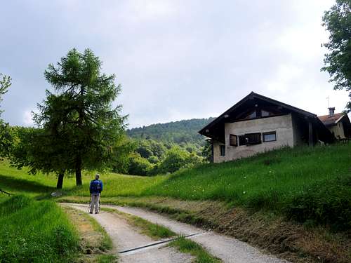
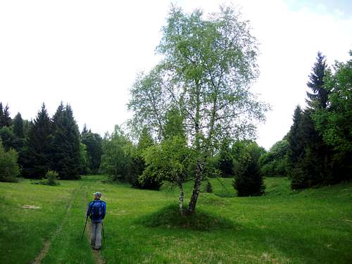
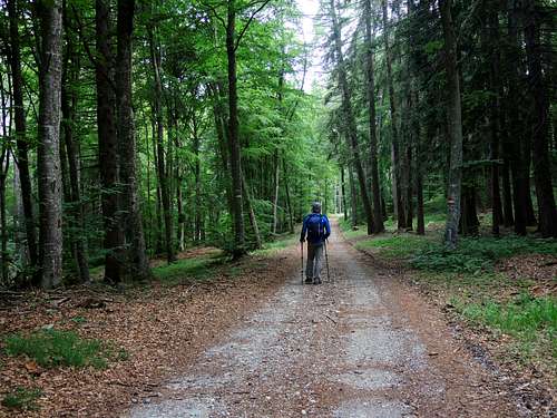
From the small car park at the beginning of the hamlet of Marcarie 1104 m., take a forest road marked with the signpost SAT 408. The forest road skirts some houses, then reach the Malga di Vigo 1087 m. and continues in the forest. At a crossroad ignore the left branch (Sentiero Frassati) and follow the right direction (signpost Monte Casale, Monte Brento) getting the Malga Valbona 1265 m. At a new crossroad ignore the left path to Monte Casale (SAT 408) and take the right path (signpost SAT 408b).
The trail crosses the wide clearing of Pra di Muci 1389 m. Shortly after the clearing, you will reach a signaling stone near Becco dell'Aquila, the launching point for the base jumpers. At this point the path reaches the long summit ridge, which begins to travel after a sharp turn to the right. In this section the path is quite exposed and offers a truly spectacular view of the Sarca Valley and the lakes.
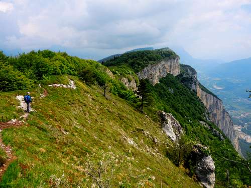
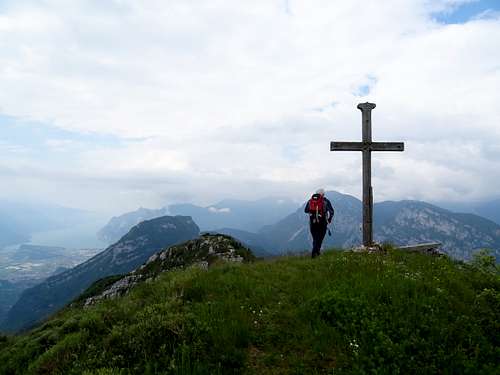
The path continues to climb between easy rocks, always towards the south, staying on the ridge and reaching the summit cross. Here a wonderful balcony opens on the lakes of Garda, Santa Massenza and Toblino, on the Sarca and Giudicarie valleys, on the mountains of the Brenta Dolomites and on Monte Stivo right in front.
Descent
The descent can be done along the same ascent route or (shorter) continuing on the summit ridge in the opposite direction to those one of the ascent along the path 408b. In a short distance, after a stretch on the ridge, the path begins to descend steeply in the dense wood, going to intercept a forest road that at a crossroads descends to the right and after passing near the Baita Cargoni descends to the road just downstream of the Marcarie car park.
Essential Gear
Normal hiking gear.
Red Tape
No fees no permits required
Hiking and scrambling scale
T - Turistico (Tourist): Itineraries on wide, clear and well worn paths, sometimes on mule tracks or gravel roads. The routes are never exposed, don't give any orientation problems and don't exceed 2500 meters of altitude. Suitable also for children
E - Escursionisti (Hikers): Itineraries on marked trails, even narrow and with possible steep and impervious sections. They are never exposed and don't give any orientation problems. They can tread different kinds of ground, such as forests, gravel, meadows, pastures, easy rocks, etc.). They form the majority of the trails that wind up in the mountains and require a certain habit to walk; you need equipment suitable for the altitude and resistant footwear with soles suitable for rough terrain
EE - Escursionisti Esperti (Experienced Hikers): Itineraries for hikers with experience and good knowledge of the mountain. Some of these paths may have exposed sections, however brief, which require firm foot and no dizziness. They require the ability to adapt to particular terrain, such as steep grassy slopes or stretches of rocks with difficulties that can reach the 1st degree of the UIAA scale. They can also reach high altitudes (3000 m or more). Sometimes they may include unmarked sections, requiring a good sense of orientation. Snow slopes are possible, however which can be overcome without specific mountaineering gear (rope, harness, crampons, ice-axe)
EEA - Escursionisti Esperti con Attrezzatura (Experienced Hikers with equipment - The same as EE, in addition these routes require the use of via ferrata equipment (lanyards, harness, carabiners, heat sink, helmet). This kind of itineraries range from the trails with short easy and not much exposed sections, previously equipped with fixed ropes and iron pegs, to the true and more difficult Via Ferratas climbing on rocky walls or on aerial ridges and ledges, previously equipped with long stretches of iron ropes, iron steps, ladders without which proceeding would constitute a real climbing. It is necessary to know how to use the technical equipment and have a certain habit of exposure and mountaineering terrains.
Accomodation
Several possibilities of accomodation in Arco and surroundings.
When to climb
The best period comes from April to November
Bibliography
Maps:
KOMPASS sheeet 071 – Alpi di Ledro Valli Giudicarie 1:50.000
LAGIRALPINA sheet 016 - Alpi di Ledro - Tremalzo