
|
|
Mountain/Rock |
|---|---|
|
|
39.65506°N / 15.91262°E |
|
|
Cosenza |
|
|
Hiking, Mountaineering, Scrambling |
|
|
Spring, Summer, Fall, Winter |
|
|
5722 ft / 1744 m |
|
|
Monte La Caccia
Monte La Caccia is a major elevation of the Montea Group, a subgroup of the Pellegrino massif, also known as the "Orsomarso Mountains" (ita. Monti di Orsomarso). The Pellegrino massif is the southermost extension of the Lucanian Apennines. From the Calabrian Apennines it is divided by the mountain pass "Passo dello Scalone".
Monte La Caccia rises abruptly only a few kilometers from the coast of the Tyrrhenian Sea, in vicinity of the calabrian town of Belvedere Marittimo. Its rugged summit ridge runs from west to east and comprises the true summit (1,744 m) and two false summits (1,708 m and 1,680 m). The south face of the mountain presents a steep wall of rock that, from the feet of the mountain to its crest line, rises up for about 700 m.
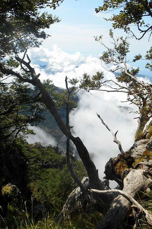
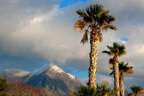
Because of its proximity to the Mediterranean and the associated temperature fluctuations the whole mountain range receives a good share of condensed water. In winter copious snowfalls are rather frequent. The spectacular view from the summit stretches from the mountains of the Sila (south) to the Lucanian Apeninnes (north). To the south-east one can see the Ionian Sea and the Gulf of Corigliano, to the west and the north-west the azure waters and the coastline of the Tyrrhenian Sea up the Gulf of Salerno. On clear days it is possible to spot Stromboli and the Aeolian Islands, as well as Sicily and Mount Etna.
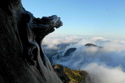
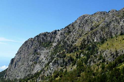 Monte La Caccia (South face) | 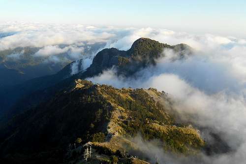 View from the south-east ridge | 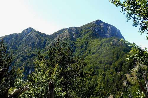 Monte La Caccia (from the North-east) |
Routes
1. South-east ridge - hiking/scrambling
The Chappel (Serra della Croce)
View from the summit ridge
Note: Make sure that you memorize this spot. During the descent, especially with suddenly incoming fog or low clouds, serious problems with orientation may arise, as it is very easy to miss this small indentation and, subsequently, mistake one of rocky extensions of the summit cliff for the south-east ridge.
Turn left and follow the summit ridge in a western direction. You may either stick to the rocky spine of the ridge itself and scramble your way up to the true summit or enter the forest to your right and pick up the footpath that circumnavigates the steepest parts.
Right beneath the summit the ridge is broken up by a deep and brushy recess. The easiest way to cross it and avoid the thick vegetation is by traversing the huge trunk of a dead beech tree which may serve as a natural bridge.
*The mountain hut itself can be reached on a sporadically signposted hiking trail that starts at the base of the south-west wall, in vicinity of a location called Trifari, where the asphalt road ends.
2. South-west ridge - scrabling/hiking
Also this route starts at the location Trifari (730 m) and partially uses the main hiking path that leads up to Serra della Croce and the mountain hut "Rifugio Belvedere". Where the path flattens look to your left for a crag descending from the mountain and a stone cross. Leave the path, scale the crag and follow it up to a point where it joins an extension of the actual south-west ridge (alt. 1,237 m). Now turn right and look for a narrow footpath which descends a few meters and traverses a small couloir before ascending again, always in an eastern direction.
Once reached at a steep grassy slope, continue the ascend keeping slightly left until you come upon the south-west ridge. Keep following the ridge until you come upon another narrow but steep couloir which will take you right to the summit.
3. North route - hiking
Footpath to "Sella La Caccia"
Towards the nameless elevation
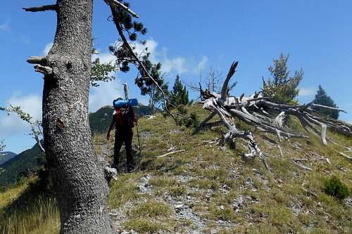
Recommendable detour: Heading straight instead, where the forest opens the ridge of a narrow and nameless elevation offers some fine views on almost all the major summits of the Montea Group: La Montea (1,825 m), Monte Faghitello (1,432 m), Serra della Croce (1,420 m), Monte Petricelle (1,758 m) and Monte Cannitello (1,464 m). Do not descend the steep slopes! Any of them will eventually lead to very hideous and almost vertical terrain. Turn around, go back to the divarication and continue on the hiking path that enters the forest, now on your right.
After several gentle bends you should notice to your left a breach in the vegetation and the onset of a narrow and steep footpath. (Look for a red dot on a large boulder and a small cairn right at the edge of the forest.) This path leads up to a col called "Sella La Caccia" (alt. 1,591 m) which connects the north shoulder of Monte La Caccia with the south shoulder of Monte Petricelle.
Once on the col, turn south (left) and find your way through the beech forest to the summit ridge. Follow the summit ridge or the narrow footpath in a western direction (right) until you reach the true summit, marked only by a heap of rocks.
4. South-west coloir ("Direttissima") - hiking/scrambling
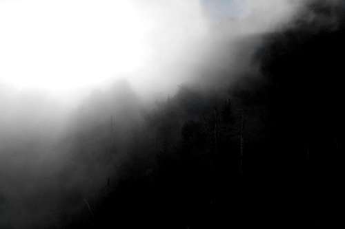
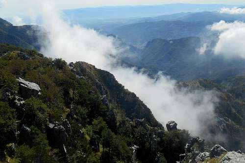
Typical visibility conditions (late afternoon)
At the location Trifari keep following the asphalt road for 1,5 km and, at a crossroad where three roads meet, take the dirt road to the right. After about 100 metres take another dirt road to the right and head for the steep slopes beneath the south face of the mountain.

Monte La Caccia (seen from Trifari)*
Exit the couloir and scale the ridge. Follow it in an eastern direction (right) up to the summit. For a somewhat less steeper descent route you may choose between the south-west ridge (2.) and the south-east ridge (1.).
Note: All indications for this route are approximative and an approach should be avoided in case of adverse weather conditions (fog, imminent rain etc.) or dubious weather forecast.
*image source: Marcovaldo
A Few Landmarks and Impressions
 Monte Cannitello (from the summit ridge) | 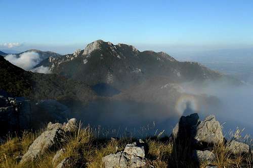 La Montea (from the summit) | 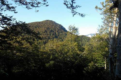 Monte Petricelle (from Monte La Caccia) |
 False summit and south-east ridge | 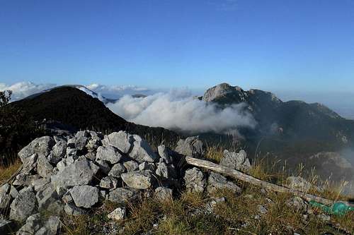 The summit | 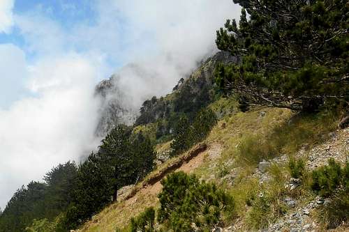 Approaching the south-east ridge |
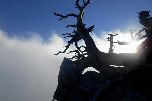 Dead Bosnian Pine (summit ridge) | 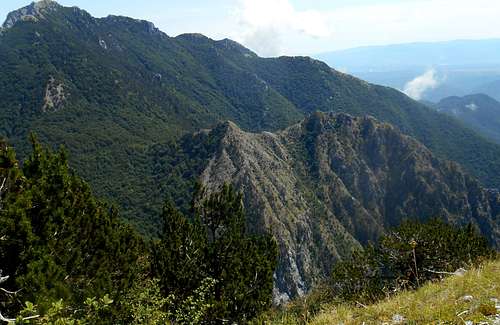 Monte Faghitello & La Montea | 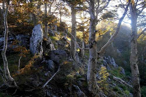 Beech forest |
Getting There
The nearest town center is Belvedere Marittimo. From Naples it is a 3 hours ride (about 250 km) on the highway A3 Napoli-Reggio Calabria. Take the Exit "Lagonegro Nord" and follow the state road SS585 south, in direction Maratea / Praia a Mare. At Castrocucco take the state road SS18, again in a southern direction (Scalea). Keep following indications for Belvedere Marittimo.Red Tape
The Pellegrino massif, and hence Monte La Caccia, is an integral part of the 'Pollino National Park'. With a total area of 1,960 square kilometres it is the most extensive national park in Italy. The park was officially founded in 1993. The same rules and regulations apply as for any other national park in Italy.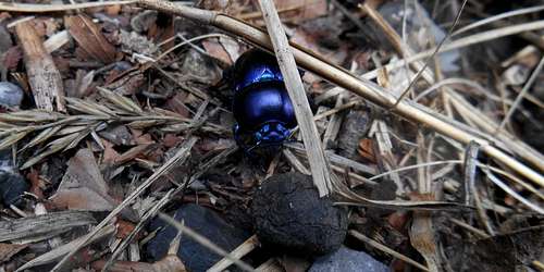
Anoplotrupes stercorosus
Free camping is generally not encouraged (in other terms: it is not allowed). However, it might be tolerated from dusk until dawn and as emergency bivouac. No open fire etc. will be tolerated, though. There are no fees or permits required.
When to Climb
Monte La Caccia can be climbed all year round. During the winter months it might be a good idea to bring ice axe and crampons. The ridges, escarpments and steep ravines enclosing the mountain from all sides can pose serious difficulties with orientation. Trails are signposted insufficiently, and low clouds are rather frequent. Especially on the main ridges the trails are not signposted at all and can become incognizable. Expect lush vegetation and lots of loose terrain. The overall rock quality is moderate to pretty bad. Daytime temperatures in the summer months can be taxing.
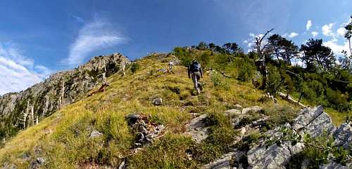
On the south-east ridge - photo: G. Cosmo
Accommodation, mountain huts etc.
Accommodation can be found easily at Belvedere Marittimo. A small camping site is situated about 600 metres from the town center, too. There are countless accommodation options to be found in the small towns along the coastal road.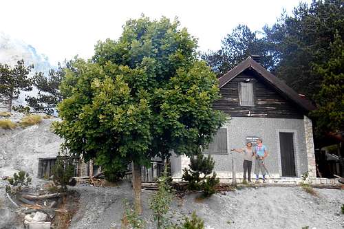
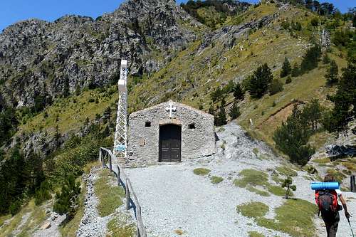
Rifugio Belvedere
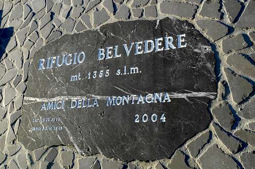
Rifugio Belvedere (1,355 m)
The spacious mountain hut has a fire place, a lavatory and an outside toilet. Non-potable water for cooking is available from a rainwater cistern. Drinkable water can be found at a wellspring on the trail to Trifari, descending for about 20 minutes from the hut. The attic is equipped with quite comfortable campbeds and has room for ten guests.
The mountain hut is unguarded. There is no service and you may find the hut locked or occupied. Should you be planing on staying at the hut it might be necessary to contact the association Amici della Montagna beforehand in order to pick up the key. - (Tel. 338 2527985)
Maps
As already pointed out before, the Orsomarso mountain range is still a pretty wild spot. Signposting is insufficient, or absent, hiking trails are often discontinued or hard to decipher. A good sense of direction is required in order to avoid getting lost or into trouble. Leaving or loosing the trail means almost certainly negotiating very steep and almost impassable slopes on loose terrain. Unfortunately, to this very day there is no official hiking map available. 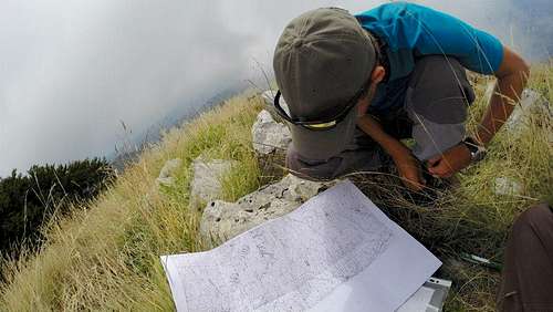
Orsomarso range with IGMI - photo: G. Cosmo
The whole region has been mapped in the 1950s and 60s by the "Istituto Geografico Militare Italiano". These maps, called "tavolette" (1:25,000), provide all information about geographic features, elevations, major trails etc. They are still indispensable for anyone frequenting these mountains or any other range of the Southern Apennines. A new edition is still in the making. Both original and new edition can be ordered here.
Other useful publications:
- Sui sentieri dell'Orsomarso. Guida naturalistica ed escursionistica al settore occidentale del parco nazionale del Pollino, author: Francesco Bevilacqua, Il Coscile 1995. - 41 itineraries, includes a small removable map and contains also a lot of useful and interesting information about the Orsomarso range.
- Guida dei Monti d'Italia. Appennino Meridionale - Campania, Basilicata, Calabria, author: Luigi Ferranti, Touring Editore 2010.