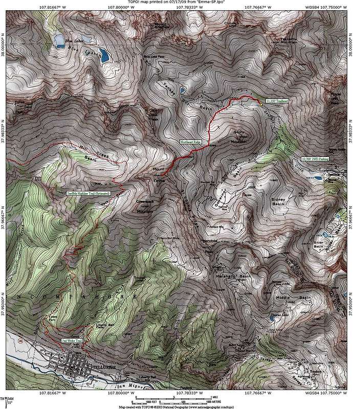
This is a map showing the NE Ridge Route from Yankee Boy Basin in solid red and potential access from the Telluride side in dashed red if you are up for some exploring. The Sneffels Highline Trail was not on my USGS quad in TOPO!, so the route is estimated from Trails Illustrated #141.


