
|
|
Mountain/Rock |
|---|---|
|
|
48.41964°N / 123.65897°W |
|
|
Hiking |
|
|
Spring, Summer, Fall, Winter |
|
|
1791 ft / 546 m |
|
|
Overview
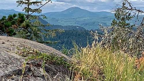 Looking north toward Empress Mountain
Mount Manuel Quimper is the most popular of all of the Sooke Hills in the Greater Victoria Area. It is located in the Sea to Sea Regional Park near Sooke, BC. The top of Mount Manuel Quimper is home to one of the few lookout towers in the southern part of Vancouver Island. It should be noted that the exact summit is located 50 feet from the lookout tower, and it does have a great view. This hike up is mostly a lighter (for experienced hikers) to moderate hike (less experienced hikers) with various route ranging from 5.5 to 7 miles roundtrip and an elevation gain starting at 1500 feet depending on where you start from. Depending on skill level a hike roundtrip on this mountain can range from two to five hours. Be aware that mountain biking is allowed to the summit.
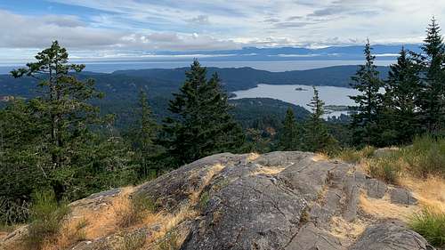
The view from the summit of this mountain is nothing short of breathtaking. One can look to the north and see some of the other Sooke Hills. To the south lies the Strait of Juan de Fuca, the city of Sooke and the distant Olympics. If one really looks around, they can see a fine view of downtown Victoria. Because of the fine view this summit can be popular to other popular mountains in the region so expect some company especially on weekends on this mountain. This summit can be combined with other summits in the region with Mount Brule being the most popular to combine it with.
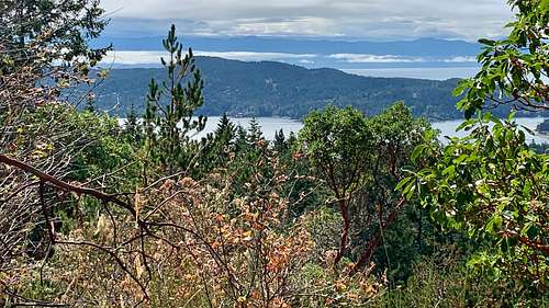
 Looking south from near the summit of Mount Manuel Quimper
Getting There
FROM LANGFORD: head southwest on BC-14 for 2.2 or 1.4 miles and turn right onto the BC-14 (Sooke Road). Stay on the road for 17.3 km or 10.7 miles. Make a right on Harbourview Road and in a half mile you will arrive at the parking area.
Route
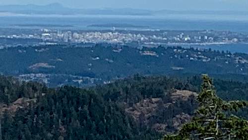 View of Victoria
There are many different routes up this mountain so it can get really confusing when are heading up. I would recommend a GPS either from using the AllTrails app on your phone or Garmin GPS. Take the Mount Manuel Quimper trail from the trailhead. This trail will intersect many other trails on the way but most intersections the trail will be in a big blue pole. The final section of this trail is steeper but easily doable as a normal hike. This page has good topo link of the surrounding area. It also features an alternative route to the summit.
Red Tape
The gate to the trailhead closes at sundown but is free of charge. There is no other red tape.
When to Climb
 First view on the way up!
This mountain can be climbed at any time. Weekends are the most crowded. It does snow up high in winter though it is rare. You may need microspikes in winter if there some recent snow activity, but snow does not stay on this mountain for long.
Camping
There is no camping allowed in the area. The gate to the parking area is closed dusk to dawn.
External Links
Here are good links to Mount Manuel Quimper.
Trailpeak Mount Manuel Quimper Page.
Mount Manuel Quimper AllTrails Page
Mount Manuel Quimper Outbound Page