
|
|
Route |
|---|---|
|
|
44.00080°N / 71.536°W |
|
|
Hike |
|
|
Half a day |
|
|
Class 1 |
|
|
Approach
MT. OSCEOLA TRAILHEAD VIA TRIPOLI ROAD: (2280') This road is usually closed from November to April to snowmobile traffic. From I-93, get off on Exit 31 (Tripoli Road) and head east on Tripoli Road to past the trailhead on the Mount Tecumseh Trail. Mt. Osceola is 7 miles on your left (WMNF Mandatory Fee).From Waterville Valley, head to the Waterville Ski Area. When you reach Tripoli Road make a right. When you come to a fork in the road, make another right. Head Past the Livermore Park Ranger Station and campground and all the way up Tripoli Road past the height of land. Mt. Osceola will be on your right just past the height of land.
Route Description
FROM TRIPOLI ROAD TRAILHEAD: (2280')
This section of the Mt. Osceola trail is very easy in comparision to the the other side which can be very difficult. It ascends Mt. Osceola in very easy and moderate grades to the top of Mt. Osceola and can be typical be done in four hours. The trail though is exceptionally rocky in areas, especially towrad the beginning. The summit of Mt. Osceola has terrific views with forty one 4000 footers of the White Mountains and Mt. Mansfield in Vermont in site.
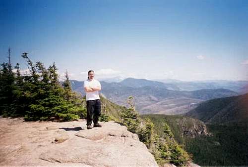
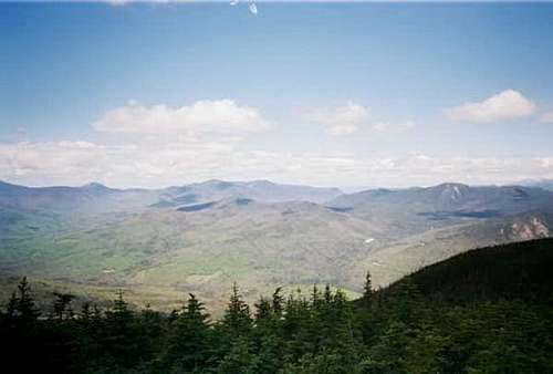 Taken from Mount Osceola looking north | 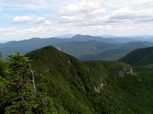 View from the summit of Mount Osceola |
From the Tripoli Road trailhead take the Mt. Osceola Trail up moderate but rocky terrain. Use care on the rocks due to this section being especially rocky. It begins to climb switchbacks about a mile and half into the trail. Beyond the small brook crossing their is a small overlook with good views of Mt. Tecumseh. The trail continue over a number of switchbacks alternating from easy grades to steeper pitches until it hit the first of two fire towers at 3.2 miles. A side trail (almost overgrown) to the left will lead to excellent views of Franconia Ridge, The Bonds and Twins, and of Mt. Washington. Then head back to the main trail to the summit ledge with an even better view of Mt. Washington, Mt. Carrigain, Mt. Trypyramids and many of the other White Mountains.
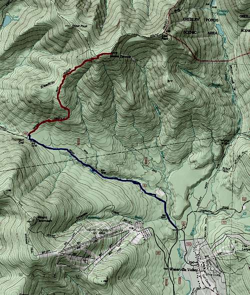
This is the map of the route up Mount Osceola. The red represents the summer route while the blue represents the winter variation.
Essential Gear
Cotton t-shirt not usually a good idea! :)
In summer all that is required is a essential hiking gear and good sturdy hiking boots. Tennis shoes would be a nightmare on this trail due to the rocky nature of it, especially on the lower sections. Remember to bring bug repellent especially during black fly season in June, because if you don't you will have many scratchy memories.
In winter this trail should be traversed in deep snow due to the number of rocks on it. When deep snow has accumulated, this trail can be traversed in snowshoes, though the hike dramatically increases in mileage. Crampons are advisable to bring during winter as a safety measure.