

-
 15360 Hits
-
 83.69% Score
-
 17 Votes
|
|
Mountain/Rock |
|---|---|
|
|
51.22463°N / 116.10987°W |
|
|
Mountaineering, Scrambling |
|
|
9333 ft / 2845 m |
|
|
 From the highway (south)
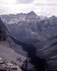 From the south
Overview
 From the highway
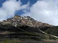
Mount Whymper is located immediately north of Vermilion Pass in Kootenay National Park, British Columbia. It is a beautiful peak, but does not have any established technical climbing routes. Because there is virtually no approach and its routes are moderate scrambles, it is a good summit to keep in mind for less than perfect conditions.
The mountain was originally named Mount Lefroy in 1858, but was renamed for famous mountaineer Edward Whymper during his visit to the area in 1901.
The first ascent was in 1901 by Edward Whymper with guides: J. Bossoney, C. Kaufmann, C. Klucker, J. Pollinger.
Getting There
 View down to highway
Kootenay National Park is about 900 km east of Vancouver and 170 km west of Calgary.
Kootenay National Park Access Information
Vermilion Pass is on Highway 93 South (AKA Kootenay Parkway) between Castle Junction and Radium Hot Springs within the Park
Mount Whymper rises directly above the pass on the north side.
Routes
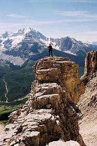
The mountain is most often ascended from Vermilion Pass via the east and south slopes to the west ridge then to the summit. Climbing is not difficult and many variations are possible.Trip Report with photos. (Better conditions than shown in my photos below).
The Southeast Route. a steeper, more direct, and less certain route goes directly up the large gully / avalanche chute on the southeast side of the mountain.
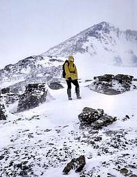
Scrambling on Mount Whymper
 |
 |
 |
 |
Red Tape
Kootenay National Park has a Voluntary Safety Registration program.A Wilderness Pass is required for back country camping within the Park.
Camping & Accommodations
Camping & AccommodationsMountain Conditions
Current WeatherAvalanche Bulletin (Seasonal)
Park Warden Contact Info