
-
 6543 Hits
-
 86.85% Score
-
 23 Votes
|
|
Mountain/Rock |
|---|---|
|
|
46.87733°N / 11.31386°E |
|
|
Hiking |
|
|
Spring, Summer, Fall |
|
|
7192 ft / 2192 m |
|
|
Overview
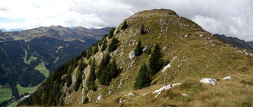
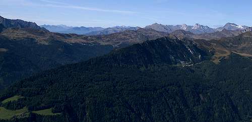 Mareiter Stein / Sasso di Mareta in front of the Ötztal Alps main ridge Mareiter Stein / Sasso di Mareta in front of the Ötztal Alps main ridge |
Located at the south-eastern end of the Stubai Alps, Mareiter Stein / Sasso di Mareta is the last outpost of the whole range. Granted - another ridge separates it from the Sarntal Alps in the south but together with Roßkopf / Monte Cavallo it is the easternmost summit of the range. Also like Roßkopf, it is heavily developed - not with ski runs but rather with marble quarries. You find them both on the north and on the south of the mountain, which itself is made up from marble alltogether.
Given that Mareiter Stein doesn't reach the lofty elevations of its neighbours it is still a great lookout post. It is located above the basin around the town of Sterzing / Vipiteno, where several ridges of both the Stubai and the Zillertal Alps end. When seen from Sterzing, Mareiter Stein towers above both the Ratschings / Racines and Ridnaun / Ridnana Valleys. Both its north and south faces are very steep though the east-west ridge rather looks like a rounded back. Its slopes are covered with firs and pines almost up to the summit and only the topmost part is open and free for viewing the mountains around.
So why would one climb Mareiter Stein instead of heading up one of the higher summits nearby? The reason is time - it takes but 2 1/2 hours climb the 1000m to the top and Mareiter Stein is the perfect location in insecure weather conditions. When we climbed it the forecast called for afternoon rain all over the region. We reached the summit before 11 a.m. and were already back in the valley when it actually did start to rain. Moreover, you will be quite alone on Mareiter Stein as the usual hiker traffic is directed to other summits in the area like Roßkopf and Telfer Weißen for instance.
|


The Summit Views
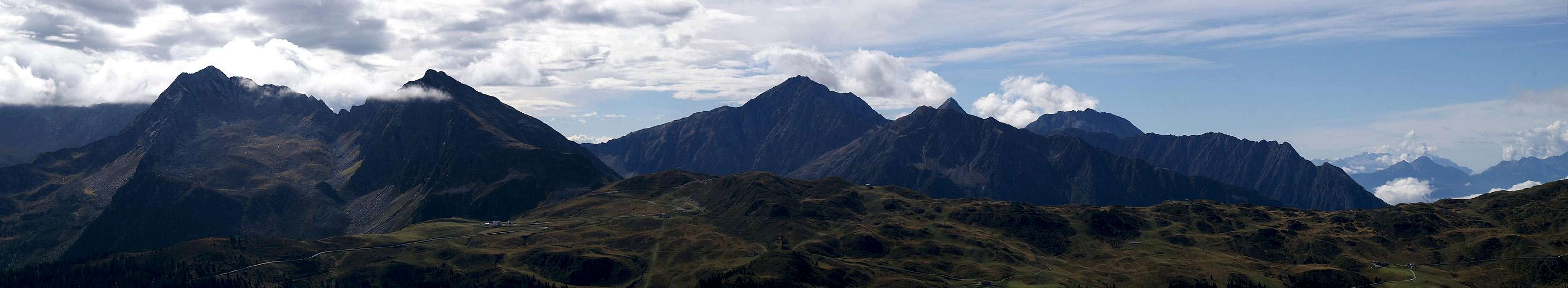  |
Though by far perfect we still had some good views from the summit of Mareiter Stein. Especially the Sarntal Alps in the south lie at your fingertips.
|


Getting There
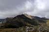
 Mareiter Stein seen from Telfer Weißen
The mountain can be easily reached from the Brenner Motorway A22. Take the exit Sterzing / Vipiteno and follow the signs for SS44 in direction Jaufenpass / Passo Giovo. After about 2km you'll reach a roundabout at Gasteig / Casateia where you have to turn right onto SP36 into Ridnaun / Ridnana Valley.
At Stange / Stanga turn onto SP38 into Ratschings Valley / Val Racines. After 1km you get to an intersection where you have to leave onto a side road to Pordaun / Pratone, where the trail to Mareiter Stein starts.
Red Tape
 The summit of Mareiter Stein above Ratschingstal
There is no red tape here. Take care on the road from Podaun / Pratone up the mountain because it is used by the trucks which carry the loads from the marble quarries on the north side of the mountain.
Accommodation
Rooms and Apartments
The closest accomodation to be found are in Sterzing, Gossensass, Pfitsch and Ridnaun. You can find accommodation info for all four locations on the following link:
Camping
There is a campground at Gasteig / Casateia in Ratschingstal / Valle di Racines to the south of the mountain. The campground is called "Gilfenklamm" and is located on SS44 to Jaufenpass / Passo del Giovo.