
-
 10693 Hits
-
 79.67% Score
-
 11 Votes
|
|
Area/Range |
|---|---|
|
|
46.88366°N / 11.25755°E |
|
|
Hiking, Mountaineering, Mixed, Scrambling, Skiing |
|
|
Spring, Summer, Fall, Winter |
|
|
10663 ft / 3250 m |
|
|
1 - Overview
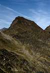
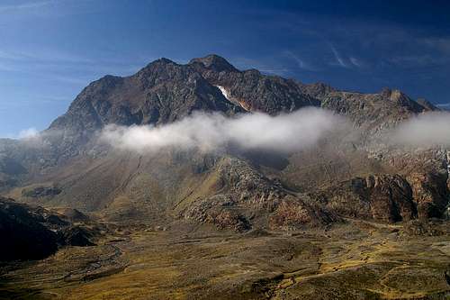 Hochgewänd and Botzer Hochgewänd and Botzer |
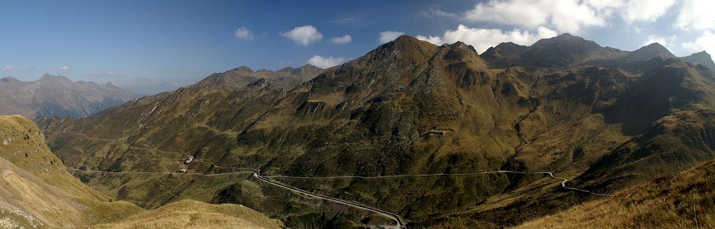
The Botzer Group – named after the highest mountain in its midst – is the southernmost subgroup of the Stubai Alps. It also is one of the best accessible groups since two high mountain passes, Timmelsjoch / Passo del Rombo and Jaufenpass / Passo di Monte Giovo bound the group to the west and south. Moreover the South Tyrolean valleys Passeiertal / Val Passira, Ridnauntal / Val Ridnana and Ratschingstal / Val Racines lead directly into the centre of the group. Thus the group is easily one of the most popular ones of the whole Stubai Alps.
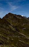
The base of its mountains is made up from reddish looking brittle gneiss. Especially Botzer and the surrounding Hochgewänd and Nock show that distinctive colour which relates them to the highest summits of the Stubai Alps main Ridge. Underneath their summits veins of metal ore have been found early on so that from both the eastern and western sides of the group deep mines have been dug. Mining activities subsided in the early 20th century and now only some mines are kept open to show the mining history to visiting tourists. Indeed, on such a tour, you can cross the Botzer Group main ridge roughly 2000m beneath its tops.
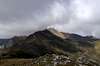
Here and there – strewn all over the group – the red gneiss makes way for bright limestone. Especially in the south-westernmost part you can find quite a number of these mountains like Hochwart or Hohe Kreuzspitze. Then there are the marble mountains – Schneeberger Weißen, Moarer Weißen, Mareiter Stein, which give the area a strange looking aspect. In some places quarries have been established to dig for the marble but only the one at Mareiter Stein remains operative.
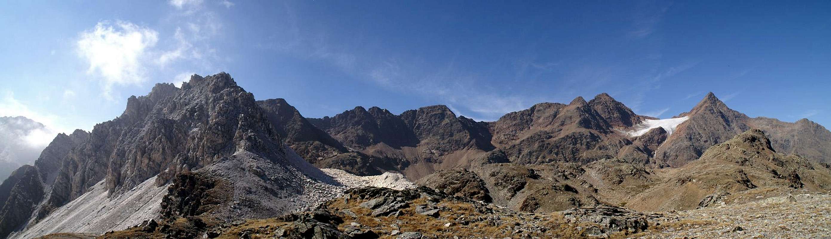
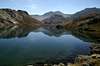
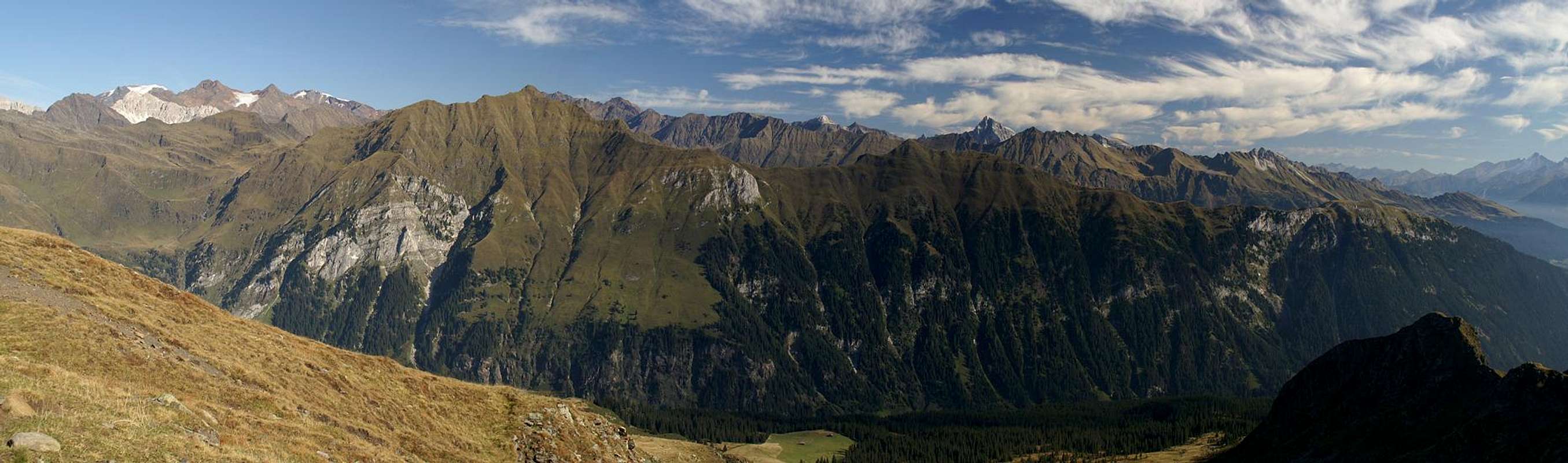
The highest mountain of the group is Botzer. At 3250m it is almost as high as the summits on the Stubai Alps Main Ridge, from which it is separated by the big Übertalferner and Ebenferner Glaciers. There is a popular summer route to its summit from Timmelsalm near Timmelsjoch but most ascents run across this route in winter as the mountain is a polpular ski tour destination. The central mountain of the group, however, is Hohe Ferse / Monte Tallone Grande, a sharp peaked mountain, which rises out of the ridge between Ridnauntal and Ratschingstal. It is probably the best lookout summit of the whole area, offering views towards Zillertal- Sarntal- and Ötztal Alps.
2 - The Botzer Group on SP
  |
3 - The Summits
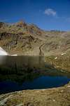
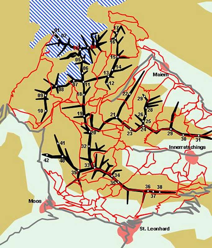 Schematic Map of the Botzer Group
- Hofmannspitze (3112m)
- Königshofspitze / Monte Reale (3128m, 3138m)
- Botzer / Il Capro (3250m)
![]()
- Hochgwänd / Parete Alta (3192m)
![]()
- Nock (3185m)
![]()
- Timmelsspitze (3033m)
![]()
- Schwarzseespitze / Cima del Lago Nero (2988m)
![]()
3.2 - Weissen Group
- Schneeberger Weißen / Le Rocce Bianchedi Monte Nevoso (2968m)
- Gürtelspitze / Croda della Cintola (2861m)
- Schönnerkofel (2656m)
- Moarer Weißen / Rocce Bianche del Massaro (2967m)
![]()
- Egetspitze (2724m)
![]()
- Moarer Spitze / Punta del Massaro (2804m)
![]()
- Hoher Schlug (2776m)
![]()
- Krapfenkarspitze / Quaira Tonda (2703m)
![]()
- Gschlantenspitze / Cima Lago Torbo (2477m)
- Ippeleskogel (2337m)
3.3 - Hohe Ferse Group
- Sprinzenwand / Croda Sperone (2899m)
- Rinnerspitze / Monte Rinna (2824m)
- Weißen / La Bianca (2822m)
![]()
- Gleckspitze / Monte Campana (2620m)
- Geigenspitze / Cima Giga (2254m)
- Schönauer Berg (2480m)
- Hohe Ferse / Monte Tallone Grande (2669m)
![]()
- Auchgrübl (2617m)
- Rudererberg (2486m)
- Zunderspitze / Cima di Incendio (2445m)
- Saukofel (1951m)
- Hochspitze / Punta Alta (2424m)
- Wurzer Alpenspitze (2229m)
![]()
- Mareiter Stein / Sasso di Mareta (2192m)
![]()
3.4 - Jaufenkamm
- Zermaidspitze / Cima Zermedo (2798m)
![]()
- Hohe Kreuzspitze / Monte Alta Croce (2743m)
![]()
- Kleine Kreuzspitze / Piccola Punta di Monte Croce (2518m)
![]()
- Glaitner Hochjoch / Monte Fumaiolo (2389m)
![]()
- Saxner / Sassi (2358m)
- Fleckner (2373m)
- Fastnachter / Fosnochter (2268m)
- Hochwart / Guardialta (2608m)
![]()
- Ganderberg / Monte Ganda (2330m)
- Hütterberg / Monte delle Capanne (2422m)
- Istelspitze / Punta Casabella (2078m)
3.1 - Main Ridge


4 - Getting There
 |
The Botzer Group is one of the most accessibile subgroups of the Stubai Alps. The roads across Timmelsjoch / Passo del Rombo and Jaufenpass / Passo di Monte Giove offer easy access from the west and south while from the east two valleys – Ridnaun and Ratschings cut deep into the group. The closest airports are Innsbruck Kranebitten in the north and Bozen / Bolzano in the south.
Access from Innsbruck
- East
- Take Brenner Motorway E45 from Innsbruck.
- At Sterzing / Vipento turn off and decide between the Ridnaun- , and Ratchings-Valleys or the Jaufenpass road.
- Take Brenner Motorway E45 from Innsbruck.
- West
- Take motorway A12 in direction Bregenz.
- Turn off onto B186 through Ötztal Valley.
- Take the toll road across Timmelsjoch / Passo del Rombo to reach SS44b and SS44 in the west and south of the Botzer Group.
- Take motorway A12 in direction Bregenz.
Access from Bozen / Bolzano
- East
- Take Brenner Motorway E45 / A22 from Bozen.
- At Sterzing / Vipento turn off and decide between the Ridnaun- , and Ratchings-Valleys or the Jaufenpass road.
- Take Brenner Motorway E45 / A22 from Bozen.
- West
- Take highway SS38 to Meran / Merano.
- Switch to SS 44 in direction Timmelsjoch / Passo del Rombo and Jaufenpass / Passo di Monte Giove
- At St Leonard decide between SS44b and SS44 for the west and south of the Botzer Group.
- Take highway SS38 to Meran / Merano.
5 - Accommodation
 |
On both sides of the border you have the choice among a lot of hotel rooms and apartments. Here is a selection of links:
- Ötztal accommodation
- Sterzing / Vipiteno accommodation
- Ratschings / Racines accommodation
- Moos / Moso accommodation
- St. Leonard / San Leonardo accommodation
- St. Martin / San Martino accommodation
As for mountain huts, you can find the complete list on the Stubai Alps main page
6 - Red Tape
There are no fees or regulations. As for travel, both Timmelsjoch / Passo di Rombo and Jaufenpass / Passo di Monte Giove can be closed at all times of the year due to snowfall. Moreover the road across Timmelsjoch is a toll road which is closed after 8 p.m. Keep that in mind when crossing over to the other side of the border.7 - Weather Conditions
8 - Maps & Books
8.1 - Maps
Kompass has some very good overview maps, scaled 1:50000 which show all the necessary trails but don't go into too much detail:
- Sterzing / Vipiteno
Kompass Map WK44
1:50000
ISBN: 3-85491-050-9
More detailed maps scaled 1:25000 cn be obtained from Tabacco:
- 38: Vipiteno-Alpi Brenoie / Sterzing – Stubaier Alpen
- 39: Val Passiria / Passeier Tal
Maps Online
8.2 - Books
- Stubaier Alpen
W. Klier
Alpenvereinsführer
Rother Verlag
ISBN: 3-7633-1271-4
- Rund um Sterzing
Henriette Klier / Walter Klier
Rother Verlag
ISBN: 3-7633-4167-6