
-
 19053 Hits
-
 90.81% Score
-
 33 Votes
|
|
Mountain/Rock |
|---|---|
|
|
34.76280°N / 120.0417°W |
|
|
Santa Barbara |
|
|
Hiking |
|
|
Spring, Summer, Fall, Winter |
|
|
3685 ft / 1123 m |
|
|
Overview

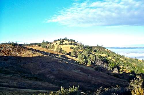
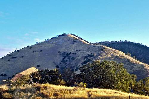
Zaca Peak seen from the summit

Looking south from the top
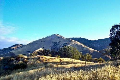
Grass Mountain is flanked by Biradent Canyon from the south and Zaca Ridge from the north. It is located to the northwest of Figueroa Mountain and to the southwest of Zaca Peak. This entire area is known as Santa Lucia Ranger District and is a part of Los Padres National Forest, California.
Grass Mountain, at an elevation of 3685 feet, is not by any means the highest peak in this area, but by all means, it is the most prominent of all the surrounding mountains. It has a pyramidal shape that draws attention from miles away. During the spring time the huge southern slopes of this mountain are covered by green grass making it pleasing to the eye. The unique shape of this mountain, however, is the factor that makes this mountain special. During the summer months the entire mountain side turns into a golden color that shimmers in the light of the morning sun.
The Hike


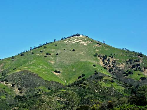
The hike up Grass Mountain takes you past beautiful pastures and hillsides. The view of the summit of this mountain dominates the entire hike. The actual summit is wide and covered by trees that provide the all-welcome shade from an extremely rigorous hike. The views from the summit are spectacular. Looking south, there are the rolling hills of Santa Ynez Valley and the Pacific Ocean in the far distance. To the northwest, you get a great view of Figueroa Mountain and Zaca Peak. The summit register is an inch and a half steel pipe with many personal notes and poems left by hikers. One of the notes reads "Who made your trail, Grass? A lunatic, a sadist, or someone being chased?" All this is an indication of how unrelentingly steep this trail is. But, it is important to remember that the rewards are great. Since the summit is quite wide, please leave the register in an obvious location to be found by future summiters.
Amenities
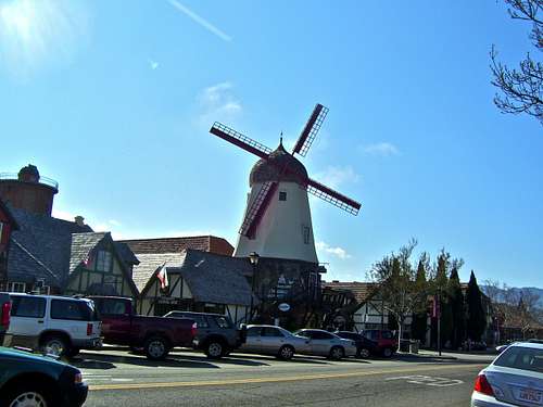
The Danish town of Solvang is located off Highway 154 just south of the junction with Figueroa Mountain Road. This town offers the best of Danish and Scandinavian foods and pastries. People are friendly and the architecture is interesting. The town of Los Olivos is located at the junction of Highway 154 and Figueroa Mountain Road. This town is known for its exclusive boutiques and nurseries. Michael Jackson's Neverland Ranch is located about six miles up Figueroa Mountain Road.
 |
 |
 |
Red Tape and Getting There

From the city of Santa Barbara on the southern California coastline, take Highway 154 and drive for seven miles to San Marcos Pass. Drop down the back side and drive 14.6 miles to the junction with Figueroa Mountain Road at the town of Los Olivos. Take a right here and drive five miles to Midland School.
Grass Mountain trail is located within the Midland School property. You need to get a permit to enter the area.
Drive into the school and find the box marked "Hiking permits." You need to fill out a permit form, leave a copy in the box and carry one with yourself. Get back onto Figueroa Mountain Road again and drive another two miles up the road. The road makes a sharp turn to the right and crosses a cattle guard. Shortly after the cattle guard there is a gate. You can park here, but not too close to the gate. The trailhead is right across from the gate. There is also a large pullout just before the sharp turn on the road and the cattle guard.
Camping
There are a number of campgrounds along Figueroa Mountain Drive in the Happy Valley area. Figueroa Campground is located a few miles before reaching the Figueroa Lookout.
There is also one very large and well developed campground at Cachuma Lake, and a few less developed ones along Paradise Road off Highway 154. There are also a few campgrounds along Highway 101 at El Capitan State Park and Refugio State Park.
El Capitan Beach Camping
Refugio State Beach Camping
Cachuma Lake
hgrapid - Sep 9, 2010 6:21 pm - Hasn't voted
Route information?I hate to quibble since you are such a prolific and excellent submitter to the SP site. However, seems like you didn't mention a few items. Such as: How many miles to the summit? Does it start at 1,000' elevation, 2,000'? How long will it take to climb? I am sure it is a minor oversight, and you probably hadn't added it yet. But just a note in case. Otherwise, an excellent addition to SP
Marcsoltan - Sep 9, 2010 6:54 pm - Hasn't voted
Re: Route information?I am going to include all the hiking information in the upcoming "route" page for this mountain. I will make sure to include the important coordinates, as well as the elevations and distances.
hgrapid - Sep 9, 2010 11:17 pm - Hasn't voted
SweetLooks like it will be a great page when this is complete. Surprised nobody posted this before?