
-
 5579 Hits
-
 89.77% Score
-
 30 Votes
|
|
Route |
|---|---|
|
|
34.74170°N / 120.0621°W |
|
|
Hiking |
|
|
Spring, Summer, Fall, Winter |
|
|
Half a day |
|
|
Class 1 |
|
|
Overview
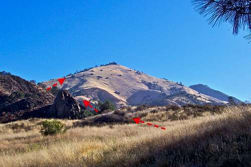

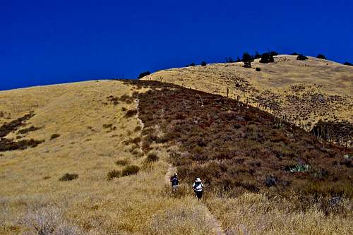
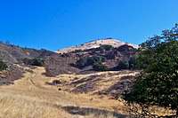
Looking at Grass Mountain in Los Padres National Forest from a distance, the west Ridge looks quite tame. But when you actually hike the trail, your endurance and resolve are thoroughly tested. There are no rocky sections, nor are there any switch backs. In short, West Ridge of Grass Mountain is no walk in the park. After the initial three quarters of a mile, the steepness of the trail becomes unrelenting. You gain over 2000 feet in only 1.2 miles. Since most of this mountain is covered by chaparral, your choice of routes are limited. The West Ridge, oddly enough stays free of chaparral and is the most reasonable route to the summit. Be prepared for a difficult hike with great views. During the summer months the creeks are bone dry and the area is quite hot. Carry three quarts of water. The return can be confusing. So, carry a compass or a GPS and make notes on the way up.
Getting there, The Trailhead, Red Tape


Grass Mountain trail is located within the Midland School property. You need to get a permit to enter the area.
Drive into the school and find the box marked "Hiking permits." You need to fill out a permit form, leave a copy in the box and carry one with yourself. Get back onto Figueroa Mountain Road again and drive another two miles up the road. The road makes a sharp turn to the right and crosses a cattle guard. Shortly after the cattle guard there is a gate. You can park here, but not too close to the gate. The trailhead is right across from the gate. There is also a large pullout just before the sharp turn on the road and the cattle guard.
Route Description
 unmarked trailhead unmarked trailhead | 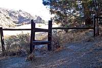 First gate First gate |  Second Gate Second Gate |
 Descending what we nick named "Hillary Step"
1- Start your hike at this unnamed trailhead at an elevation of 1329 feet. GPS reading, 34.74171 -120.062089
2- Heading northwest and keeping the creek to your left will bring you to the first gate. Climb over the gate and continue on the trail keeping the creek to your left.
3- After hiking through a meadow climb over a second gate. 34.7444 -120.0588
4- You will come to a three-way fork on the trail. Take the left one. 34.7459 -120.0568
5- Cross the creek over medium size boulders. 34.7465 -120.0560
6- Another fork on the trail is reached. Take the right one. 34.7472 -120.0555
7- Cross another creek and bear left. Hike up a meadow to the base of the lower ridge. 34.7551 -120.0525
8- Follow the trail that continues on the south side of the west ridge. After a short gravel covered hillside reach a dead tree near the broad summit of Grass Mountain. A clump of trees will provide a welcome shade.
34.76248 -120.041857
Summit elevation, 3685 feet. Total elevation gain 2356 feet. Total one way distance 2.25 miles.
Essential Gear

A good map, and a compass or GPS.
Trekking poles help coming down.
Lots of water.