
Viewing: 1-2 of 2

brendon - May 15, 2005 2:37 am - Hasn't voted
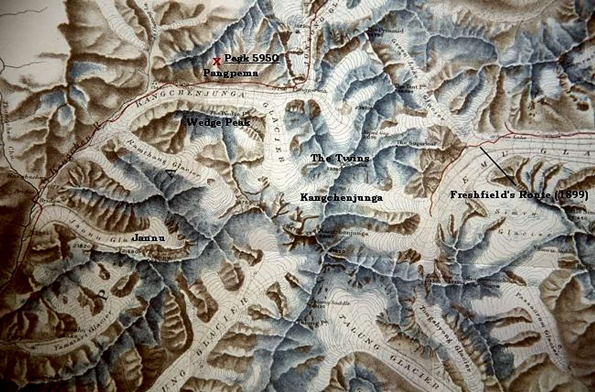
Old-time cartographersThey were pretty good at what they did. It's amazing how maps of the coast are similar to satellite images today.
Artist renditions of mountains, however, always seem to have exaggerated relief. Have you noticed that?

Nelson - May 15, 2005 6:13 am - Hasn't voted
Re: Old-time cartographersYes, when you compare this map with the satellite photo it is pretty amazing.
I can't say that I have in general noticed artistic exaggerated relief. In this case the satellite seems exaggerated, them's big mountains! But it would make sense that an artist would be tempted to exaggerate for effect.
Viewing: 1-2 of 2


Comments
Post a Comment