
Viewing: 1-3 of 3

Bor - Sep 15, 2004 9:30 am - Voted 8/10
question!Hm Vid are you doing this maps alone or are you copying from somewhere?
Bor ;)

Vid Pogachnik - Sep 15, 2004 10:41 am - Hasn't voted
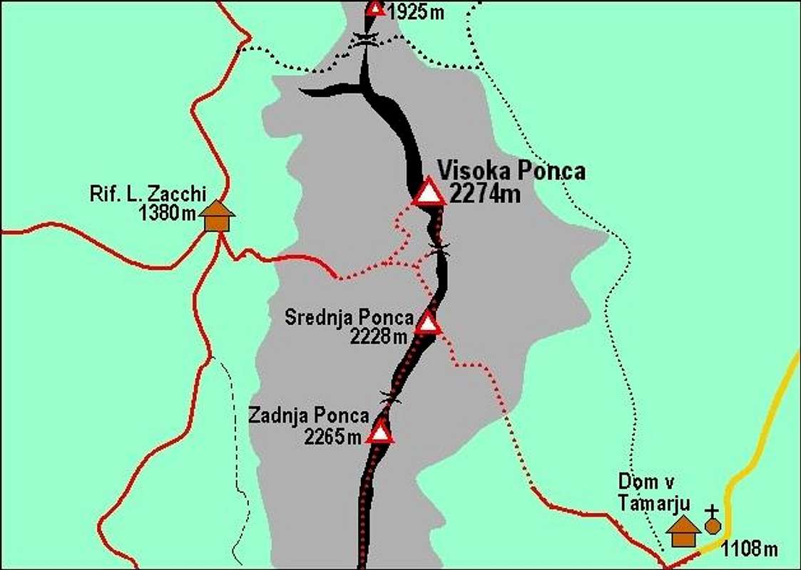
Re: question!First I copy the original map from Atlas Slovenije or from Austrian Map etc. Then I put the picture (jpg) in Powerpoint. There I start drawing over it what you see on this map - crests, summits, routes, add text. Finally I delete the original picture. The only problem I have is - what to be the grey area - rocky part (as here) or the mountain area above certain altitude (like on Boese Weibele page). But it's just a simple hand draw :-)
Bor - Sep 15, 2004 11:25 am - Voted 8/10
Re: question!Wow respect!!! Nice, nice!!
Viewing: 1-3 of 3


Comments
Post a Comment