
-
 23075 Hits
-
 83.69% Score
-
 17 Votes
|
|
Route |
|---|---|
|
|
34.22499°N / 118.06364°W |
|
|
Hiking |
|
|
Spring, Summer, Fall, Winter |
|
|
Most of a day |
|
|
Class 1 |
|
|
Overview: A Venerated History
The Mt. Wilson Trail is a former Gabrielino Indian trail that snaked through breath-taking Little Santa Anita Canyon to the top of Mt. Wilson. White settlers in the area used the trail in the mid to late 19th century for access to the harvesting of pine and spruce higher on the slope of the canyon. Those were the days when California grizzlies were common in the San Gabriels.This trail is the site of an annual 8.6 mile race from the downtown plaza of Sierra Madre to Orchard Camp and back. This race was first run in 1908 all the way to Mt. Wilson. Its modern incarnation, begun in 1967, is of course much shorter.
Apart from a route from Chantry Flat through Big Santa Anita Canyon , the Mt. Wilson Trail is the most popular route to the top of Mt. Wilson.
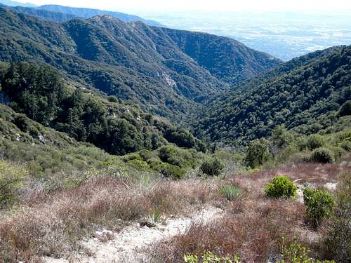
Little Santa Anita Canyon
Getting There
The Mt. Wilson Trail trailhead is located within the city limits of Sierra Madre. From the 210 Freeway, exit Baldwin Ave. and go north. When you come to a traffic light where you have to go either right or left, go left to the next light and that is Baldwin Ave. Take a right and continue up Baldwin Ave. through the downtown area of Sierra Madre. Approximately ¾’s of a mile from the downtown plaza, take a right on Mira Monte. Go down about ½ mile and you will come to a small park on your left. Park anywhere in this area long Mira Monte. (Note: it seems that Sierra Madre police are serious about curbing your vehicle’s wheels). To get to the trail, walk up the paved road that heads north off of Mira Monte next to the park. About ¼ of a mile up the paved road, you will come to the signed start of the trail.Route Description: First Water, Orchard Camp, Manzanita Ridge, Summit
The trailhead is at 970 feet elevation.The Mt. Wilson Trail ascends the western slope of Little Santa Anita Canyon. Be advised that this trail is one of the steeper ones in the San Gabriel mountains. About ½ mile from the start, you will come to a noticeable point where the trail crosses a ridge. The ridge on your right side runs down to the creek. To your left, there is a very faint use trail that travels an extremely steep, brushy mile to the summit of Jones Peak. Do not ascend unless you are ready for a real demanding, dirty, brush-clogged climb.
At 1.2 miles, you will reach First Water Junction, where you go left up the trail. Taking the fork to the right will drop you into the creek. But you may want to make this little detour. For canyoneers, this is the drop-in point to canyoneer Little Santa Anita Canyon.
At 2.7 miles, you will reach the turn-off for a steep connector trail that takes you to the ridge north of Jones Peak. The turn-off, which goes left up a streambed initially, is intermittently marked by a small wooden sign. Right past the junction with the connector trail, there is a heliport site about 50 yards off the trail to your right.
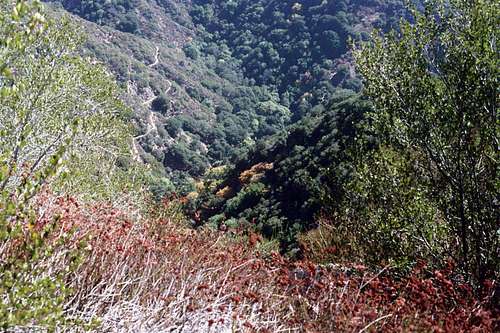
Little Santa Anita Canyon and the Mt. Wilson Trail (CL)
At about 2.75 miles from the start, you will reach Decker Springs where you will quickly drop into the creek and just as quickly ascend. From here, it is about 1/3 of a mile to Orchard Camp, a nice shady rest spot if you’re so inclined.
From Orchard, it is 1.9 miles to Manzanita Ridge where you will connect with the Winter Creek Trail coming from Chantry Flat. Go left (northwest) and continue to a major junction where the trail meets the Mt. Wilson Toll Road coming up from Altadena through Eaton Canyon. Here, the southeast ridge of Mt. Harvard (currently officially off-limits to hikers) meets the road and Mt. Harvard is to your left.
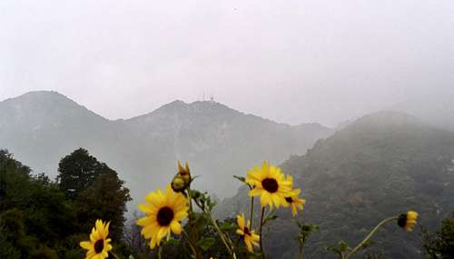
Mt. Harvard (C) seen from the helipad by the Mt. Wilson Trail
At the trail/toll road junction, turn right and proceed up the toll road. When you come to a structure (known as Martin’s Cabin) on the left side of the road, look immediately to your right and you will encounter the resumption of the Mt. Wilson Trail. This point is about a mile distance from the Manzanita Ridge. Proceed up the trail, now single track again, .75 miles to the parking lot summit of Mt. Wilson.
Alternatively, you can by-pass the resumption of the Mt. Wilson Trail and continue up the toll road to the summit. Keep in mind that doing this will be a much more round-about way to reach the summit and will also take you to a different entry point than the trail.
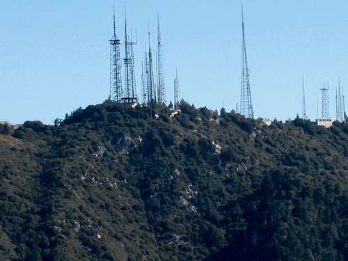
Summit of Mt. Wilson
This route is about 15 miles roundtrip with about 4800 feet of gain.
Essential Gear
Except for winter, trail runners are perfectly adequate for this route. In the winter, with snow cover, equip yourself appropriately.Red Tape
No permits are needed for hiking this trail to Mt. Wilson. Neither is an Adventure Pass required to park at the trailhead because it is not located within the Angeles National Forest.Other Information
It is best to carry all the water you need. While it is possible to get water out of the creek both at First Water and at Decker Springs, the required treatment would be more bother than simply carrying what you need.USGS Topos: Mt. Wilson
External Links
Angeles National ForestAdventure Pass information
California Dept. of Transportation