An epic bushwhack of idiocy.
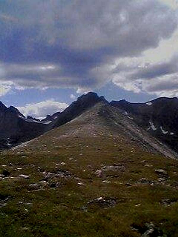
I'd started my hike out right on the assend of the road around Brainard Lake. The place was absolutely packed. I just figured I'd start out on the trail anyways. I got right towards the end of Long Lake before I realized I'd missed the Niwot Ridge trail. I was also sick of running into person after person along the trail. So, at one point, the trail crossed a creek. I walked along the creek for a ways before being presented with only one option. Going STRAIGHT up Niwot Ridge. This route is Colorado mount bushwhacking at it's finest. A reasonable class 3 jaunt up talus and decently steep streches of hill. And swamp walking. And barging through a decent stretch of forest.
![Niwot Ridge from Long Lake]() Going up Niwot Ridge.
Going up Niwot Ridge. ![Halfway up Niwot Ridge from Long Lake]() Halfway up Niwot Ridge looking down.
Halfway up Niwot Ridge looking down. ![Looking down towards Long Lake]() Long Lake
Long LakeWalking along the flat tundra ridge.
I'd reached the top in about 20 minutes. I sat and ate a few crackers before continuing across the ridge for a little ways. I was suprised to finally see the trail. I walked west on the trail for a tad until I reached the last of the research outposts up there. The views from high up on this ridge are stunning. For my opinion, some of the best in Colorado. All the landmarks of the Front Range cities are on perfect display. I continued the walk past the weather station, enjoying the brief respite from tedious steep trudging and talus hopping. A nice gentle class 1 walk with great scenery. This all ended quickly.
![Niwot Ridge looking towards the plains.]() Niwot Ridge
Niwot Ridge![Looking west on Niwot Ridge]() Niwot Ridge
Niwot RidgeThe ridge summit.
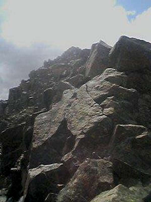
I'd planned on trying to reach Navajo Peak, but due to my late start, I thought I'd just scramble on some of the gnarly formations that form the crest of the ridge. The talus hopping in the beginning is rather tedious, but nothing too bad. You can see where the rock starts to change after a while. It loses the gray hue and starts turning a dark red color. This is also where things get hairy. The whole ridge just becomes a massive pyramid of precariously placed rock that drops drastically on all sides. Much of it requiresclass 4 scrambling over some formations that may or may not leave you with a creepy sense of vertigo. The apex of the crest is marked with a nice tabletop formation. You get a perfect view of the Navajo and Apache massif, the Albion and Isabelle drainages, and an area that offered pretty much perfect solitude. Once I left the trail, I had the whole ridge to myself. I think the whole ridge tops out a little above 13,000 feet.
I didn't dilly dally around the top. I stayed to take a few valleys of the massive panorama to the east of me, and started the precarious descent down. I basically just repeated my line of ascent for the descent. Seems a lot steeper on the way down, for sure.
Anyone interested in some of the most breathtaking scrambling the Front Range has to offer should definitely check out the crest of Niwot Ridge. If your experience with the mountains is limited, you'd probably be best to stay away. As far as aretes go, it's decently impressive. Much of the route isn't technically difficult, but requires a lot of committed approaches on some decently exposed terrain. Unless you happen to know what you're doing, I'd stay on the flat tundra part of the ridge. The views are just as grand.
![The terminus of Niwot Ridge]() Niwot Ridge
Niwot Ridge![Blocky upper flanks.]() Niwot Ridge
Niwot Ridge![Looking across from Niwot Ridge]() North of Niwot Ridge.
North of Niwot Ridge.![The false crest of Niwot Ridge.]() The apex of the ridge.
The apex of the ridge.
Comments
No comments posted yet.