
-
 7409 Hits
-
 83.1% Score
-
 16 Votes
|
|
Route |
|---|---|
|
|
37.83940°N / 108.0047°W |
|
|
Scrambling |
|
|
Summer |
|
|
Most of a day |
|
|
Class 4 |
|
|
II |
|
|
Overview
Elevation gain: 3,100 feet from Navajo Lake / 5,000 feet from trailhead
Proposed by 14ers.com member jwproulx, the North Buttress is a good alternative to the standard North Slopes route on El Diente because it contains more solid rock, and is more likely to be snow-free.
The route begins with class 2 boulder hopping and becomes steadily more difficult and exposed as it climbs the mountain. Almost all of the route is class 2-3, with one class 4 move on the final pitch near the summit. The buttress can easily be divided into six sections which are separated by natural benches in the terrain:
The Boulder Field (approach, class 2)
The Slabs (mostly class 2)
The Jumble (inclined boulder field making up the buttress, class 2-3)
The Hump (upper boulder field making up the buttress, mostly class 2)
The "V" (pitch marked by "V"-shaped snow patch, class 3, more exposure)
The Summit Pitch (class 3, plus class 4 crux chimney to gain West Ridge to summit)
Approach
Begin at the Navajo Lake Trailhead. Above Navajo Lake, the trail contours with the talus slopes well above the creek, until eventually moving back toward the water at a grassy shoulder around 11,800 feet. Leave the trail here, angling right (south) toward the North Buttress. There is some mining debris to the left (east) of the buttress, and the bottom of the buttress ends in gray rock above the boulder field on the shoulder.The Boulder Field
After leaving the trail at 11,800 feet, hike through the boulders to the base of the buttress (class 2). Angle up onto the ridge above the steepest of the gray rock at the base of the ridge.  |
The Slabs
Cross the crest of the ridge and hike up solid gray rock slabs to the right of the ridge crest, until progress is blocked by an obvious boulder. Turn left here and scramble up over some boulders and onto the first wide bench.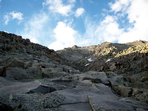 |
The Jumble
From the first saddle, a large inclined boulder field makes up part of the buttress. This section requires some route-finding and a few 3rd class moves over boulders. When in doubt, easy passage around obstacles is most often found to the right (west), but not always. This section ends at the second bench. |
The Hump
From the second bench, The Hump above is seen as a steeper section of the boulder-strewn buttress, but it is surprisingly easy to overcome. Simply hike upward on class 2 ledges along the highest point or just to the left (east) of the highest point along the buttress. Arriving at a third, narrower bench, the "V" shaped snow field will be visible immediately ahead.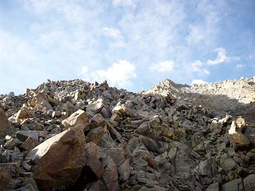 |
The "V"
Here the route begins to get interesting. From the third bench, follow an obvious ledge straight ahead, then to the right toward more difficult terrain. Look left and find a 3rd class passage up solid rock which involves just two or three quick moves. After this, the climber is next to the base of the "V" snow-field, on its left (east) side. |
Hike left (east) and uphill over talus to regain the ridge crest. Continue straight up the spine of the ridge (class 3), which quickly narrows to nearly a knife edge or more of an inclined catwalk, with increasing exposure.
Eventually this inclined catwalk ends at the summit of a tower. Before reaching the summit, look left (east) to find a ledge leading around the tower, which allows easy passage to the 4th bench (more of a saddle here).
 |
The Summit Pitch
From the saddle, hike straight ahead over gravelly ledges, then scramble up across narrower ledges on gray slabs (class 3). There are cliffs to the right (west) and a drop-off toward a steep couloir on the left (east). Straight above, there may or may not be a small patch of snow depending on the season. There are several steep 10-foot high chimneys leading to the base of this snow patch. All of these options involve one or two class 4 moves, though these chimneys consist of mostly solid rock. |
Above the crux, angle steeply uphill and to the right (west) for 50 feet over gravel, mud and looser rock (class 3). This is the loosest section of the climb, but it is short-lived. The climber arrives abruptly atop the West Ridge, less than 80 yards from the summit. From here it is an easy scramble along solid blocks on the West Ridge to reach the highest point of El Diente.