Introduction
After finishing the North Country Trail (NCT) segment from M-34 to Lake Baw Beese, I decided that (since I was in the area) I would check out the (new) north section of the Baw Beese Trail (BBT). All I knew was that it had now been designated as the route for the NCT once it had been finished, and where the northern end was located.
The temperature remained nice (low 70s F) and I missed a rain shower that went through. Starting from the parking area off M-99 (W Carleton Road) at the southern end of the Hill-Jo Bicycle Park, I went across the railroad tracks to the northern terminus of the officially marked BBT (north section). From there, I hiked to the southern end, which was a very short hike, and returned.
The NCT is not blazed in this segment, but the route is very easy to follow. All of the route is paved.
The NCT deviates from current version of map MI-01 in that it not longer follows the road connector. Instead, from the end of W Montgomery Street the NCT follows the BBT and then a paved bicycle path until it meets up with the marked route somewhere in Hillsdale.
Trail Connector and Baw Beese Trail (north section)
The trailhead on M-99 (W Carleton Road) is on the east side of the highway, right next to the Republic Waste Services recycling center. The parking area is right near the yellow post on the paved path (to keep vehicles out). From there, I started in the New York direction.
The path proceeds downhill and across railroad tracks. There are fences (but with an open path) around the tracks on both sides to keep bicycle riders from speeding across the tracks. After the tracks, the NCT crosses the St. Joseph River on a small bridge, and then the NCT arrives at the end of W Montgomery Street in Hillsdale.
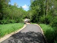
![20100522 1636]() The NCT proceeds across this bridge to the BBT
The NCT proceeds across this bridge to the BBT
Instead of continuing east to start a road connector (as map MI-01 indicates), I turned right to head south on the (new) north section of the BBT. This is a nice paved section, but short - maybe only 0.3 miles. I reached the southern marked end in a few minutes on W Galloway Drive.
From there, a paved bicycle path continues south along the St. Joseph River. I checked it out for a few minutes but decided to tackle it another time.
I turned around to return in the North Dakota direction. There was nothing different to report.
Picture info
See the attached album. Time and travel order are the same, though note that I attached a picture from a previous trip to start the NY direction since it completed the set well.
-->ND: 20100522 1653, 1655, 1658, 1701, 1704
-->NY: 20100417 1450, 20100522 1634, 1635, 1636, 1637, 1640, 1644
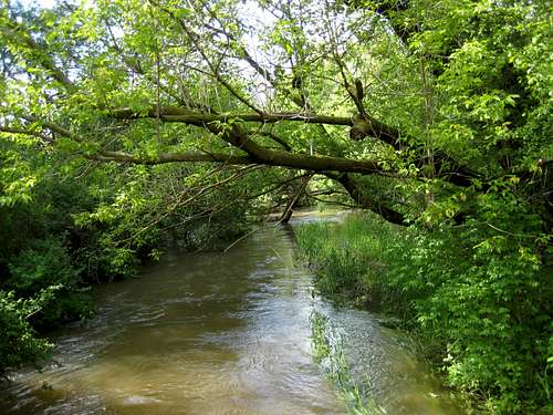
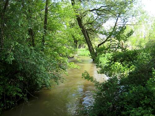
There are a few scenery pictures of the St. Joseph River, which was running very full!
- 20100522 1701a river (St. Joseph River)
- 20100522 1702 river (St. Joseph River)
![20100522 1701a river]() 1701a | Looking down the St. Joseph River from the bridge
1701a | Looking down the St. Joseph River from the bridge![20100522 1702 river]() 1702 | Looking up the St. Joseph River from the bridge
1702 | Looking up the St. Joseph River from the bridgeConnector info to next NCT segments
In the ND direction, the NCT continues northwest on the Hill-Jo Bicycle Path along M-99 (W Carleton Road).
In the NY direction, the NCT continues along the bicycle path through Hillsdale to the BBT (south section).
Comments
No comments posted yet.