
-
 5568 Hits
-
 76.66% Score
-
 7 Votes
|
|
Route |
|---|---|
|
|
48.01589°N / 121.50263°W |
|
|
Hiking, Mountaineering |
|
|
Spring, Summer, Fall, Winter |
|
|
Class 2 |
|
|
Northwest Ridge Route (Ridge Saddle Between Vesper And Sperry)
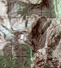 Ridge Route Topo
Sunrise Mine Trailhead (2,100')
In the summer this is a easy to follow trail. The South Fork of The Stillaguamish River can be interesting to cross with lots of snow melt. The trail starts off meandering through woods with lots of roots and small creek crossings. It will go in and out of a couple avalanche gullies with loose rock.
Wirtz Basin
Eventually you will exit from the woods into the Wirtz Basin. From here follow the trail through lots of Talus until you are at the base of Headlee Pass. In the Wirtz Basin you will see Sperry Peak to your right as you ascend up.
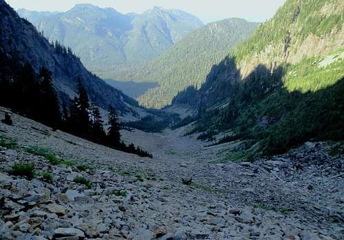 Looking Down Wirtz Basin In The Summer
 Looking Up Wirtz Basin In The Winter
Headlee Pass (4,600')
From the base of Headlee Pass, it is switchbacks up the steep gully until it tops out at (4,600ft). Drop down the westside following the trail and traversing the loose talus until you are at the creek outlet of Vesper Lake. Follow the creek up until you are at the south shore of Vesper Lake.
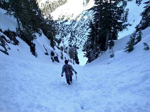 Going Down Headlee Pass To The Wirtz Basin In Winter
 Traverse Between Headlee Pass and Vesper Lake in Summer
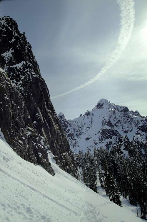 Traverse Between Headlee Pass and Vesper Lake in Winter
Vesper Lake
From here you can go to the left (West) or right (East) around the lake to its north shore. I have gone left (West) and its pretty simple. You will be to the base of a headwall that seperates Vesper Peak on the left and Sperry Peak on the right. At the top of the headwall is the connecting ridge's saddle. Getting to the saddle is a serious of switchbacks and route finding on good rock. There is some loose talus and scree, but you can pick and choose your route.
 Route From Vesper Lake
 Vesper Lake In The Winter
Ridge Saddle (5,300')
From the saddle (5,300') you head east along the faint trail through heather. It is very easy to loose the trail, so it is important to watch where you are going. If you are bushwhwacking and finding class 3 exposure, you are off route. Go back to your last spot and review your options. The trail comes out into a talus field. Sometimes you can find cairns which will help the way, but do not rely on finding them. From this point you will want to pick the first gully above the talus field. If you start to traverse to far to the south, it will become more technical.
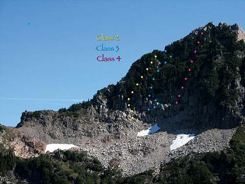 Photo from Magellan showing the options at the final summit block
There are class 3 and 4 routes that will take you to the summit. Stay to the north and find solid rock and class 2 up the first gully. There are two summits, you will see which one is higher (North Summit).
 Looking Down At Vesper Lake From The Summit Of Sperry
Review photos for easier route finding. In the winter this climb is very steep and has many avalanches on its west face above Vesper Lake.
gimpilator - Sep 26, 2010 5:52 pm - Voted 10/10
Nice job!You've done great work putting this page together. I might have one correction for it though. I believe the lake in question is known as Lake Elan and not Vesper Lake. If I'm right, you might want to change the image captions and whatnot.