Toggle navigation
Mountains
Routes
Images
Trip Reports
Forum
What's New
People
Areas & Ranges
Articles
Trailheads
Canyons
Huts & Campgrounds
Albums
Logistical Centers
Fact Sheets
Lists
Custom Objects
Gear
Plans & Partners
WELCOME TO SUMMITPOST
SIGN IN
REGISTER
Wasatch Range (Central)
Additional Parents
Pfeifferhorn
North Thunder Mountain
Obelisk (Hogum Divide)
Upwop Peak, UT.
South Thunder Mountain
White Baldy
Red Baldy
Image
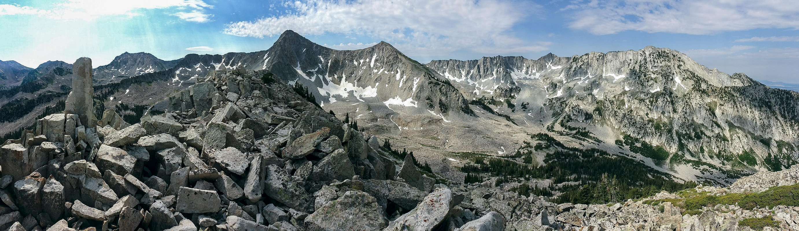
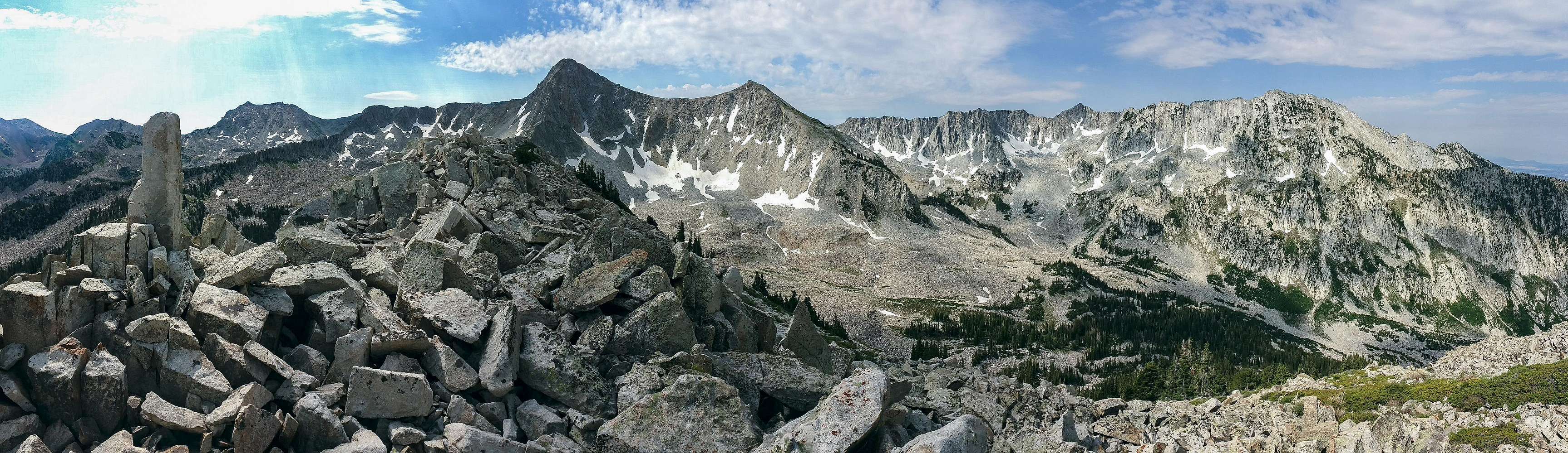
Obelisk Summit View
View High-Resolution Image
Obelisk Summit View
From left to right: Red Baldy, the rock that gives Obelisk its name, White Baldy, Pfeifferhorn, Upwop, Lightning Ridge, South Thunder, North Thunder (photo taken July 4, 2016)
« PREV
NEXT »
yorbaram
on
Jul 8, 2016 1:35 am
Comments & voting
Other parents
Lat/Lon:
40.54107°N / 111.70297°W
Image ID:
976322
3607 Hits
74.01
% Score
4
Votes
Log in to vote
Comments
No comments posted yet.
to post!
Don't have an account?
Wasatch Range (Central)
(Area/Range)
« PREV
Viewing
#243 of 381
GALLERY
NEXT »
yorbaram's Image Gallery
« PREV
Viewing
#233 of 406
GALLERY
NEXT »
Pfeifferhorn
(Mountain/Rock)
Loading....
White Baldy
(Mountain/Rock)
Loading....
Red Baldy
(Mountain/Rock)
Loading....
South Thunder Mountain
(Mountain/Rock)
Loading....
North Thunder Mountain
(Mountain/Rock)
Loading....
Upwop Peak, UT.
(Mountain/Rock)
Loading....
Obelisk (Hogum Divide)
(Mountain/Rock)
Loading....
×
You need to login in order to vote!
User Name
Password
Remember me
Forgot your password?
Log me out when I close my browser.
Keep me logged in all the time.
sign in as a user
Don't have an account?
Register now for FREE
Rating available
Suggested routes for you
People who climb the same things as you
Comments Available
Create Albums
Register Here


